

CHC Navigation’s aerial survey cameras are lightweight and compact units that can be easily integrated into a variety of fixed-wing and multirotor drone platforms, including the company’s BB4 Mini and P330 Pro drones as well as the DJI M300 RTK.
The range of cameras includes:
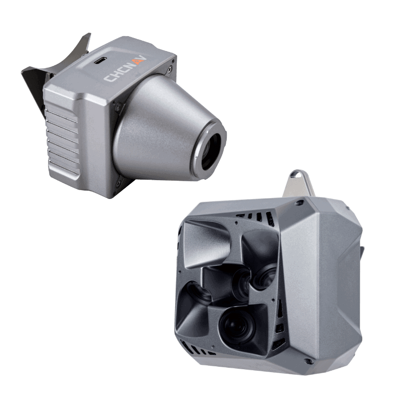
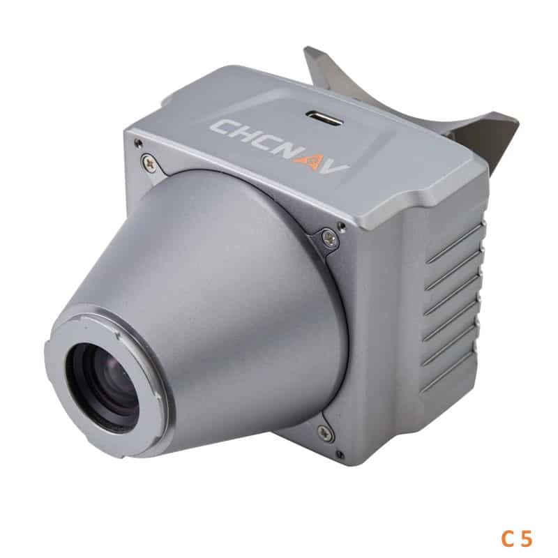
- The C5 – orthographic full-frame, fixed-focus camera system with a larger sensor for more detailed and accurate orthophotos
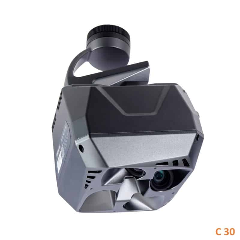
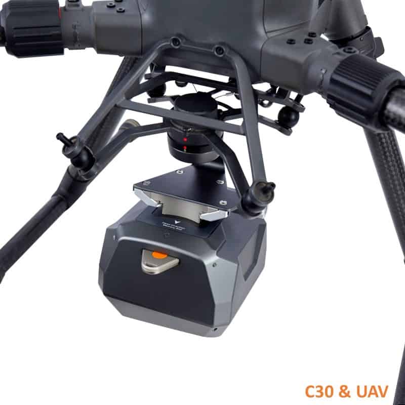
- The C30 – high-performance oblique photogrammetry system
Both systems feature industrial-grade cameras that deliver low lens distortion and optimized image sharpness, resulting in high-quality and high-accuracy survey results.
CHCNAV’s Alphaport quick-release interface enables both cameras to be easily connected without the need for additional tools, and includes easy interfacing with the DJI Skyport connector as well as power and data connections for reduced wiring and complexity.
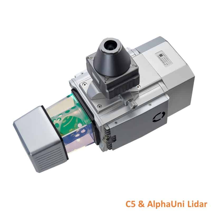
The C5 and C30 can be used independently on RTK-enabled drones for high-resolution photogrammetry, or connected to CHCNAV’s AlphaUni LiDAR systems to enable colorized point cloud data.
Specifications:
| C30 | C5 | |
| Dimensions (L x W x H) | 110 x 108 x 85 mm (4.33" x 4.25" x 3.35") | 75 x 63.5 x 102.5 mm (2.95" x 2.50" x 4.04") |
| Weight | 605 g (21.34 oz) | 290 g ± 5 g (10.23 oz ±0.18 oz) |
| Power | 12 – 27V, 25W | 12 – 27V, 10W |
| Sensor Size | 23.5 x 15.7 mm | 36 x 24 mm |
| Pixel Size | 3.76μ | 4.4μ |
| Image Size | 6252 x 4168 px (3:2) | 8184 x 5460 px (3:2) |
| Focal Length | 25mm / 35mm | 35mm |
| Angle of Lens / FOV | 45° / 90° | 54.3 x 37.8° |
| Shutter Speed | 1/50 - 1/20000 | 1/50 - 1/20000 |
| Aperture | F5.6 | F5.6 |
| ISO | 100 - 3200 | 100 - 3200 |


