


Marine and Bathymetric LiDAR
Discover cutting-edge solutions from leading global suppliers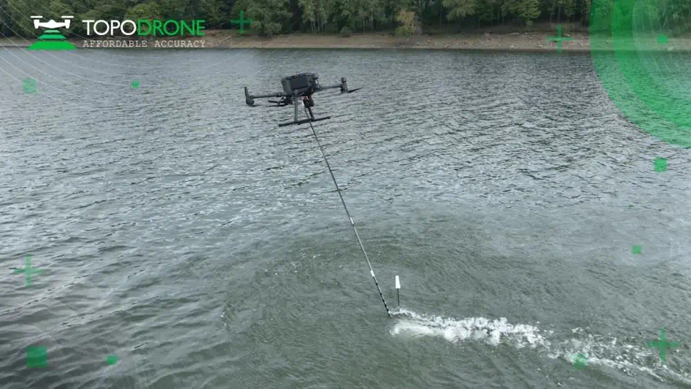
TOPODRONE, a Swiss based designer and manufacturer of LiDAR equipment for installation on drones, vehicles and backpacks, has launched AQUAMAPPER, a UAV-based solution for bathymetric surveying and marine construction.
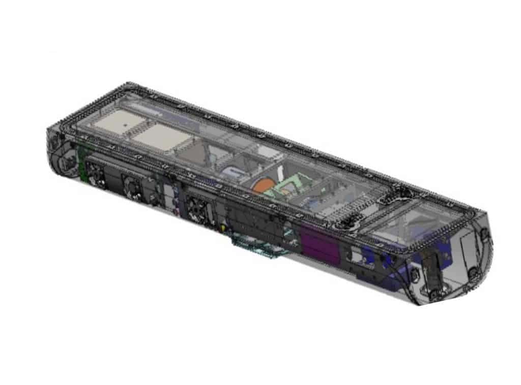
Launched at INTERGEO 2022, AQUAMAPPER is a new hardware developed in-house by TOPODRONE and contributes to a complete set of photogrammetry, LiDAR and bathymetry surveying solutions. This new product mounted on a UAV provides a combination of high speed efficiency (up to 14 km/h) and accuracy. It is a PPK ready solution, compatible with DJI Matrice 300 RTK. The application areas include but are not limited to an open sea bathymetric survey up to 100m depth, quantity survey and calculation of sediments, and periodic maintenance survey of storage pools.
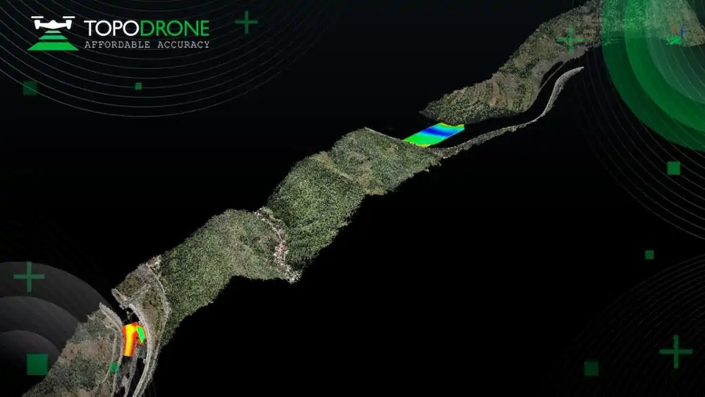
The new multitasking data collecting device and TOPODRONE LiDAR ULTRA equipment have been successfully used together for airborne surveying at a highway construction project in Romania to deliver a full digital twin of a studied area.
TOPODRONE AQUAMAPPER and LIDAR ULTRA have also been used for airborne surveying at ‘Autostrada Sibiu – Pitești, Secțiunea 2: Boița – Cornetu’, a European road construction project that aims to build a highway in one of the toughest terrains in Romania and includes seven tunnels, 24 bridges and 18 viaducts.
The drone LiDAR corridor and bathymetric survey was performed by Romanian company GRAPHEIN TOPO SA to provide accurate maps and up-to-date information about terrain level, buildings, roads, power line networks, cadastral boundaries, and rivers. TOPODRONE LIDAR ULTRA on board a DJI M300 drone was used to capture laser scanning data from 100-120 meters altitude over rugged terrain forest area to cover a corridor with a length of 32km and a width of 400m within 14 flights while AQUAMAPPER connected to the same DJI M300 drone performed bathymetry surveys over six river crossings.
“The key advantage of the new bathymetric equipment from TOPODRONE is the ability to capture a riverbed with centimeters level accuracy with high speed in fully automatic mode and without using any boat,” said Andrei Sueran, GRAPHEIN TOPO SA. “It allows us to work in hard to access and shallow water areas. The same drone carrier can be used for both LiDAR & bathymetry surveys. The combination of an echosounder, GNSS and Inertial measurement system helps to get accurate results after data post processing.”
Find suppliers & manufacturers of Bathymetric LiDAR for Unmanned Systems >>


