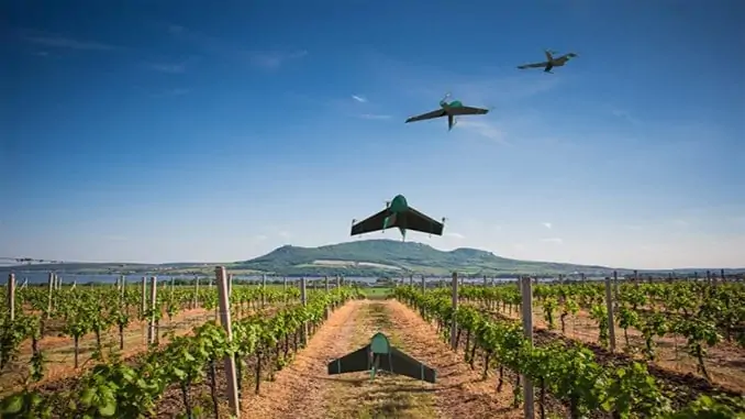
Topcon has entered into partnership with Atmos UAV, a Dutch manufacturer of hybrid VTOL/fixed-wing drones for mapping and surveying. Topcon’s TopNETlive GNSS RTK reference network will now be available with every Atmos Marlyn drone.
TopNETlive is a flexible subscription-based solution that provides real-time GNSS corrections via services such as Network RTK, RTK, DGNSS, and agriculture-specific GNSS. Managed and operated by Topcon geodesy teams, and incorporating multiple stations for redundancy, TopNETlive provides survey-grade results without the need for a base station. The solution delivers high-accuracy positioning for professional land surveying and construction, and the lack of requirements for base stations provides greater efficiency and thus higher production and decreased costs.
TopNETlive is also ideal for utility mapping, asset management, and other applications that demand precise GIS data collection. It is fully interoperable with third party owners, providing both real-time differential corrections as well as access to raw data for post-processing.
Marlyn is a fully autonomous hybrid drone that can take-off vertically from anywhere, efficiently and rapidly producing high-quality outputs for professional users. It is designed to perform in harsh and windy conditions, with easily swappable multiple payloads that provide operators with superior flexibility.
René Worms, Commercial Director at Atmos, commented: “Keeping the needs of our users in mind, we try to take steps that will make their work easier and more efficient in the field. We believe this partnership will add great value to our platform and streamline operations for our customers.”


