Solving boresight misalignment with data

Webinar Details
  • Hosted by OxTS
  • January 27, 2022 , 14:00 (UTC)
  • Solving boresight misalignment with data

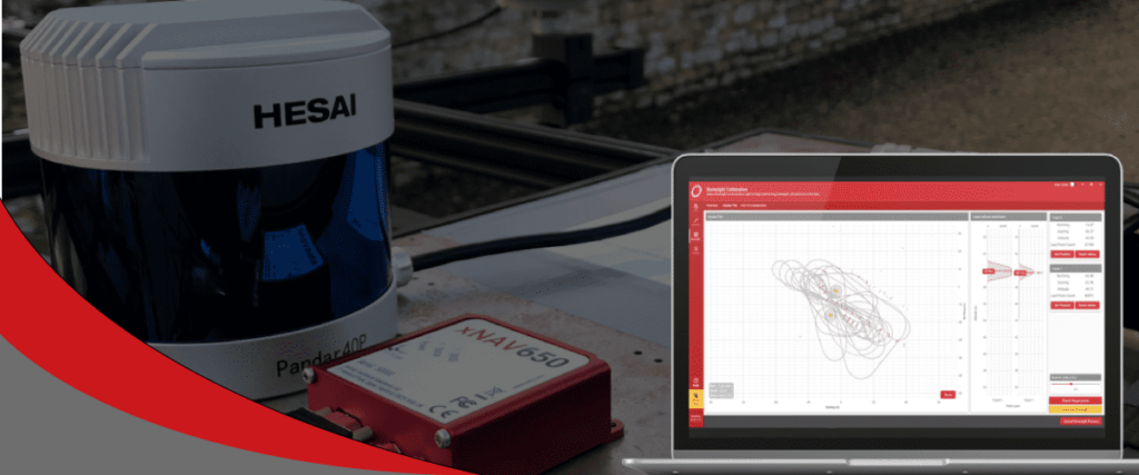
    Boresight misalignment is one of the most common, yet most difficult to overcome LiDAR survey challenges.

    Failure to align the coordinate frames between a LiDAR sensor and INS, to a high degree of accuracy, can lead to an unusable pointcloud and wasted time and effort.

    It is an error factor that has been plaguing LiDAR surveyors for years, however there is a quick and simple remedy…data.

    OxTS Georeferencer - Boresight misalignment

    Join OxTS Product Engineer, Jacob Amacker at 14:00 hrs (GMT) on Thursday, 27th January as he discusses why boresight misalignment no longer needs to hold LiDAR surveyors back.

    During the webinar we will discuss:

    • What happens when a boresight misalignment occurs?
    • How data can be used to align INS and LiDAR coordinate frames
    • The results you can expect to see

    The webinar is free to attend, and all registrants will receive a copy of the recording after the event.

    Posted by Oxford Technical Solutions Connect & Contact

    Featured Content

    Ellipse Series Enhanced with Latest Firmware Upgrade

    The new firmware update from SBG Systems integrates the latest World Magnetic Model (WMM) to improve navigation precision, even for first-generation Ellipse sensors

    Feb 11, 2025
    Advanced FOG-Based Inertial Sensing Solutions for Drones & Robotics

    Aegiverse's products feature a multi-layered architecture that combines multiple elements into a compact module, providing significant, size, weight and cost reductions

    Feb 06, 2025
    Vertiq’s 81-08 G2 Module Added to DIU’s Blue UAS Framework

    Vertiq's 81-08 G2 servo motor and control system for Group 2 sUAS has become the first motor and ESC combination to be approved under the U.S. government's Blue UAS Framework

    Feb 05, 2025