Maritime Situational Awareness with IHO Bathymetric Surface Dataset

Feature Article by Teledyne Geospatial

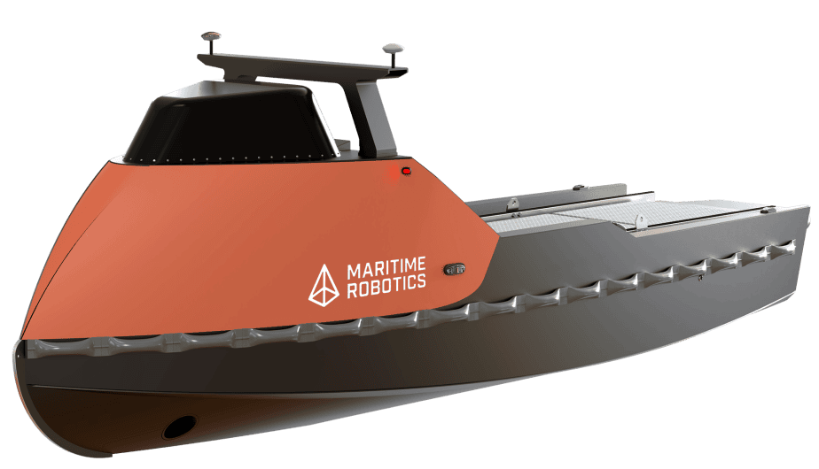
Autonomous Surface Vehicles (ASV)

Discover cutting-edge solutions from 7 leading global suppliers
SUPPLIER SPOTLIGHT
Teledyne CARIS S-102 article 1
Follow UST

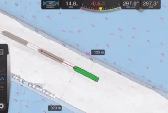
Teledyne Geospatial has released the following article highlighting the work the company has performed in conjunction with Trelleborg Marine in using data based on the IHO’s (International Hydrographic Organization) S-102 Bathymetric Surface specification to create new situational awareness solutions for manned and unmanned marine vessels.

Teledyne Geospatial has been at the forefront of industry participation in defining and implementing S-100 standards, offering technical expertise and guidance to the international teams charged with the creation of these revolutionary future product specifications.

S-102, when used in conjunction with ENCs (electronic navigational chart) and other S-100 products such as surface currents, represents a vast digital leap for safe navigation and deeper levels of situational awareness on our oceans.

Teledyne CARIS S-102 article 1

Figure 1: Non S-102 enabled data


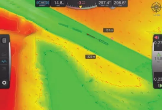
Figure 2: S-102 enabled data


Teledyne Geospatial and Trelleborg Marine have supported S-102 v2.1, enabling sea trials with pilots from multiple ports using the new datasets in day-to-day activities. The trial has been a huge success, and pilots have expressed a number of positive sentiments:

“Safety is increased as mariners get a highly detailed view of the seabed to help them make informed decisions about where to go— and where not to.”

“S-102 data makes it possible to get accurate real-time distances from own vessel to safety and shallow contours, adjustable in 10 cm steps, either manually or automatically based on draught, tide, and desired under keel clearance.”

“Vessel traffic can be maximized as it is possible to get very close to the limit regarding under keel clearance and still be safe. No longer necessary to wait for the perfect tide to feel confident.”

“Dredging to maintain a certain depth in channels and other areas has negative environmental impacts and is very expensive. With S-102, less dredging is required as mariners can see exactly where the dredged areas are and stay within their boundary.”

The S-102 datasets used in these trials will soon be applied to Maritime Autonomous Surface Ships (MASS).

Posted by Mike Ball Mike Ball is our resident technical editor here at Unmanned Systems Technology. Combining his passion for teaching, advanced engineering and all things unmanned, Mike keeps a watchful eye over everything related to the unmanned technical sector. With over 10 years’ experience in the unmanned field and a degree in engineering, Mike’s been heading up our technical team here for the last 8 years. Connect & Contact

Featured Content

Vertiq’s 81-08 G2 Module Added to DIU’s Blue UAS Framework

Vertiq's 81-08 G2 servo motor and control system for Group 2 sUAS has become the first motor and ESC combination to be approved under the U.S. government's Blue UAS Framework

Feb 05, 2025
Compact Remote ID Receiver Released for Enhanced Drone Safety

Dronetag has introduced RIDER, a pocket-sized, drone-agnostic Remote ID receiver designed to improve airspace situational awareness and support commercial and public safety applications

Jan 30, 2025
New GCS Software Released for C100 Quadcopter

Performance Drone Works introduces PDW CORE, a comprehensive software bundle enhancing the C100 quadcopter's capabilities with a new UI, flight simulator, mission planner, ATAK integration, and fleet management tools

Jan 29, 2025
Advanced Signal Mapping Tool Released for Effective UAV Flight Planning

Elsight has launched HeatSight, a signal strength mapping tool that provides UAV operators with reliable cellular coverage data, improving flight planning efficiency and safety for BVLOS missions

Jan 28, 2025
Doodle Labs Unveils Mobile App for Managing Mesh Networks

Doodle Labs is introducing the Mesh Rider® Mobile App, providing intuitive tools for managing wireless mesh networks across devices such as ground control stations (GCS) and UAVs

Jan 23, 2025
Advanced FOG-Based Inertial Sensing Solutions for Drones & Robotics

Aegiverse's products feature a multi-layered architecture that combines multiple elements into a compact module, providing significant, size, weight and cost reductions

Jan 21, 2025