Partnership Uses USVs to Advance Global Ocean Mapping

A Memorandum of Understanding signed by Saildrone and Seabed 2030 outlines a shared commitment to leveraging technological innovation to make bathymetric data available to the global community By Caroline Rees / 24 Apr 2023

Smart Sourcing for Unmanned Systems

Discover cutting-edge solutions from leading global suppliers
SUPPLIER SPOTLIGHT
Partnership Uses USVs to Advance Global Ocean Mapping
Follow UST

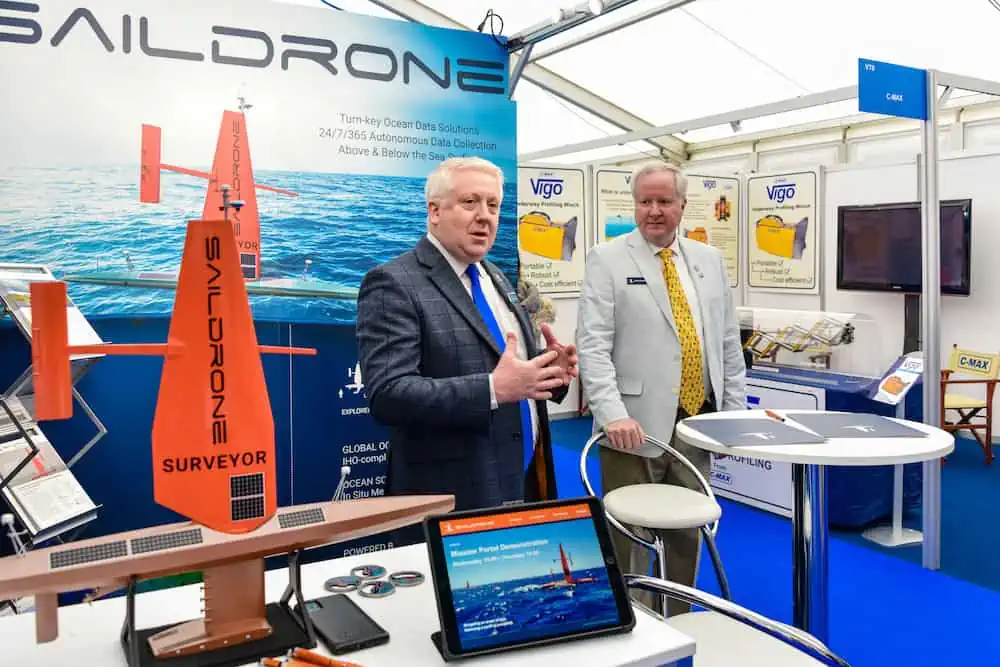
Saildrone has signed a Memorandum of Understanding (MoU) with Seabed 2030 to work together to advance ocean mapping in support of the United Nations Decade of Ocean Science for Sustainable Development, leveraging Saildrone’s expertise in unmanned surface vehicles for ocean mapping.

The MoU, signed during Ocean Business 2023, outlines a shared commitment between Saildrone and Seabed 2030 to leverage technological innovation to more quickly and efficiently collect ocean mapping data and support solutions for ocean mapping and bathymetric data management.

Seabed 2030 is a collaborative project between The Nippon Foundation and The General Bathymetric Chart of the Oceans (GEBCO) to inspire the complete mapping of the world’s oceans by 2030 and to compile all bathymetric data into the freely available GEBCO Ocean Map. 

GEBCO is a joint program of the International Hydrographic Organization (IHO) and the Intergovernmental Oceanographic Commission (IOC) and is the only organization with a mandate to map the entire ocean floor.

Accurate ocean depths and seafloor topography are essential for navigation, telecommunications, offshore energy, and understanding weather and climate, but, according to Seabed 2030, only 23% of the global ocean has been mapped using modern, high-resolution tools. 

“We can only realize our goal of a complete map of the ocean floor if we mobilize the international community and work together. We are therefore delighted to partner with Saildrone and leverage their expertise in unmanned surface vehicles for ocean mapping,” said Jamie McMichael-Phillips, director of Seabed 2030. “The capabilities of Saildrone’s fleet will greatly enhance our ability to obtain essential data and increase our understanding of the ocean, allowing us, in turn, to make informed and impactful decisions with regard to the future of the planet.”

“Saildrone’s vision is of a healthy ocean and a sustainable planet. A complete map of the ocean floor is fundamental to achieving that vision,” said Saildrone founder and CEO Richard Jenkins. “We are proud to collaborate with Seabed 2030, to enable the mapping of our entire seabed, for the benefit of the global community.”

Saildrone’s fleet of USVs are designed to make ocean data collection cost-effective at scale, offering exciting new capabilities for ocean exploration and mapping. According to the company, its platforms are the only USVs capable of long-endurance ocean mapping operations using renewable energy as the primary source of power.

Surveyor-class vehicles carry a similar sophisticated suite of acoustic instruments to deliver International Hydrographic Organization-compliant bathymetry data to a depth of 33,000 feet (11,000 m). Saildrone’s 33-foot (10-meter) Voyager-class vehicles are equipped for near-short ocean mapping to depths of 900 feet (300 meters). 

Find suppliers of unmanned surface vessels for hydrographic survey, oceanographic research and other applications>>

Posted by Caroline Rees Caroline co-founded Unmanned Systems Technology and has been at the forefront of the business ever since. With a Masters Degree in marketing Caroline has her finger on the pulse of all things unmanned and is committed to showcasing the very latest in unmanned technical innovation. Connect & Contact

Latest Articles

TUALCOM Showcases Communications Solutions & RF Equipment at Defense Conference

TUALCOM participated in the Loitering Munitions Conference in Virginia, showcasing its latest technologies and sharing insights on future electronic warfare and navigation systems

Apr 28, 2025
Hitec Introduces Specialized Servos for Demanding Environments

Hitec will be releasing a new line of servos in 2025, featuring specialized models for redundant systems, underwater use, and drone applications

Apr 28, 2025
Acecore to Supply Tactical Quadcopter Drones for Dutch Military

Acecore Technologies is providing its Zoe M4 quadcopters to the Royal Netherlands Army, supporting bridge assessments and troop movements with real-time 2D and 3D mapping capabilities

Apr 28, 2025
Advanced AI-Powered Drone, Autopilot & Hardware Solutions

Airvolute's open-architecture NVIDIA-based autopilots and UAS platforms have been utilized by NATO members as well as some of the world’s leading aerospace and defence companies

Apr 25, 2025
Most Read Articles on UST This Week

Here’s our round-up of the five most read articles on UnmannedSystemsTechnology.com this week

Apr 25, 2025
Nanomotion’s Velox Gimbal Enhances Border Surveillance Capabilities

Discover how Nanomotion’s Velox gimbal is enhancing drone surveillance with unmatched coverage, stability, and tracking—ideal for advanced border security operations

Apr 25, 2025

Featured Content

Apollo & Moonrock Launch $122.5m Drone, eVTOL Insurance Facility

Apollo and Moonrock take the lead on new $122.5m drone, eVTOL and aviation innovation insurance facility

Apr 22, 2025
ParaZero Unveils Advanced Parachute Recovery System

ParaZero launches the SafeAir M4, an advanced parachute recovery system designed for the DJI Matrice 4, enhancing drone safety, compliance, and mission readiness

Apr 17, 2025
Compact High Resolution MWIR Zoom Lens Released for UAV & ISR Platforms

MKS Instruments introduces the Ophir SupIR 10-135mm f/1.8 zoom lens, engineered for compact MWIR systems demanding long-range detection and high-resolution thermal imaging

Apr 17, 2025
Advancing Unmanned Systems Through Strategic Collaboration UST works with major OEMs to foster collaboration and increase engagement with SMEs, to accelerate innovation and drive unmanned systems capabilities forward.