


Discover World-Leading Unmanned and Autonomous Technologies
Discover cutting-edge solutions from leading global suppliers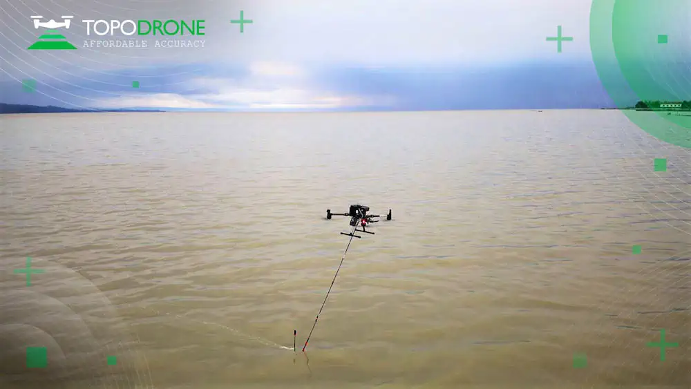
TOPODRONE has entered into a technological partnership with RASA Surveying, an integrated surveying company, to advance airborne surveying approaches and accommodate coastal management and monitoring demands in the Philippines.
RASA Surveying will adapt Swiss hardware and software for data collection and processing to overcome local operational limitations for coastal mapping.
TOPODRONE and RASA Surveying have agreed on the strategic partnership and technology exchange to collect elevation and depth data for effective coastal management and planning. RASA Surveying’s new approach synchronizes current photogrammetry and LiDAR practices with the bathymetric data collection capabilities of the drone-based TOPODRONE AQUAMAPPER.
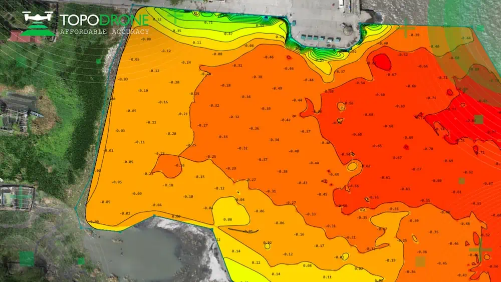
The join between orthophotos, above and below waterline point clouds and bathymetric data is expected to better support authorities to manage coastlines and enhance the resilience of coastal communities.
“Coastal cities in the Philippines are vulnerable to the effects of climate change and climate-related disaster events. However, coastal areas are expensive and challenging to map using conventional technologies,” said Maxim Baklykov, TOPODRONE CEO. “UAV-based surveying of coastal environments allows quickly and accurately to collect shallow water data and details on the land-sea interface.”
“TOPODRONE AQUAMAPPER will provide RASA much-needed efficiency in doing bathymetric survey,” said Raymund Arnold S. Alberto, President & Owner. “We will be able to conduct our bathymetric surveys with ease since the equipment involves only 2 people to operate. Furthermore, it can quickly cover a large survey area within a short span of time without sacrificing data accuracy.”


