


Discover World-Leading Unmanned and Autonomous Technologies
Discover cutting-edge solutions from leading global suppliers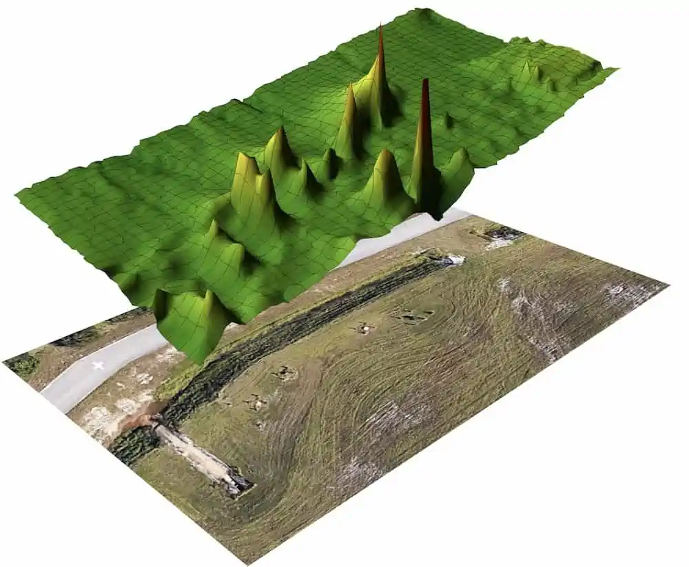
Censys Technologies and The Aerospace Corporation have signed a limited field exclusive license for Censys to use Aerospace’s retro-reflector spectroscopy system, a UAV-based laser and electro-optics system.
By working together with Censys, Aerospace’s technology can be leveraged to measure the concentration of gases and address the greenhouse gas challenge in the atmosphere.
The technology is now implemented in Censys’ new RetraSpectra system which enables long-range intelligence gathering in high resolution for 3D mapping of methane, carbon dioxide and other greenhouse gases.
“This licensing opportunity allows us to leverage this intellectual property helping industries across the country detect these harmful gases more efficiently,” said Noel Heiks, Vice President of Sensing & Data at Censys Technologies. “The RetraSpectra system exemplifies how we can enrich and improve lives through technology. As the leading US manufacturer of intelligent long-range drone solutions, we are constantly looking for ways to create technology or make use of what’s already out there. Aerospace’s retro-reflector technology produced a perfect foundation for detecting these gases, and this licensing agreement is just one example of how we leverage technologies to create results.”
Current airborne payloads use a laser beam aimed in a downward direction at target locations with reflection from any topological surface to detect methane and other emissions, Censys explained. The resultant detected signal on board the aircraft is noisy from scattering upon reflection from surrounding surfaces, such as ground, pipes, grass, etc.
Censys believes that by employing a retro-reflector optimized for the detection system – and one that can be situated in any location or on a mobile platform – the signal quality can be enhanced and allow for dynamic scanning across any region of interest above targets. Typically, these inspections are conducted over pipelines or orphaned wells, seeking out the hidden sources of methane leaks that are impacting the climate.
According to the Environmental Protection Agency (EPA), more than eight million metric tons of methane are emitted each year. Censys’ RetraSpectra system identifies and maps greenhouse gases to rapidly locate methane sources and other fugitive emissions so that actively leaking wells or pipeline equipment can be triaged and fixed.
The novel system can also map carbon dioxide emissions and sinks, which is important for industries like agriculture and forestry as they determine which vegetation can be beneficial for the environment.
“We are excited to see our technology licensed by a leading US manufacturer of UAVs,” said Jim Myers, Senior Vice President of The Aerospace Corporation. “We are committed to collaborating with US small businesses to advance US space capabilities in the national interest.”


