


Discover World-Leading Unmanned and Autonomous Technologies
Discover cutting-edge solutions from leading global suppliers
GEO Business is back again for 2022, taking place on 18-19 May at ExCeL London, UK. The event is the UK’s largest geospatial event designed for everyone involved in the gathering, storing, processing and delivery of geospatial information.
“There’s so many reasons to attend the show on 18-19 May 2022 at ExCeL London,” says Event Director, Ollie Hughes. “Visitors will have the chance to get hands-on with the latest geospatial innovations. Plus, they’ll hear from the profession’s brightest minds and get up to speed with the key trends in the theatres.”

Hear from the Geospatial Commission
The Government’s Geospatial Commission will be at the show sharing their expertise and insights about the UK’s geospatial strategy and the best use of geospatial data. Visitors can meet them in-person at their dedicated pavilion and hear directly from them in a range of inspiring talks.
The Commission and partners will feature across the seminar program, with sessions covering topics including Asset Owner engagement, National Underground Asset Register (NUAR) platform development, why standards matter and future use cases.
Speakers include the Geospatial Commission’s Deputy Director Chris Chambers, who will outline The benefits of the UK’s National Underground Asset Register. Kevin Yue, Principal Economic Advisor for the Geospatial Commission, will also present Developing the economic case for geospatial data sharing, principles and examples, which will include specifics about the NUAR Economic Case.
The Geospatial Commission will also host a series of exclusive presentations on the Main Stage, exploring geospatial strategy, decarbonisation and the future of transport.
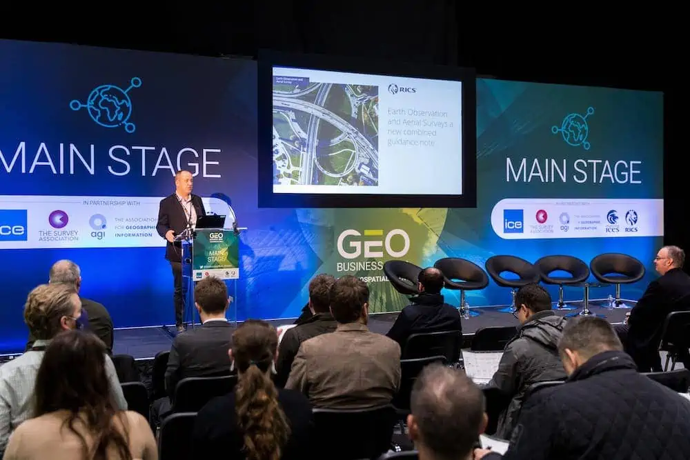
Learn from inspiring speakers
The education program at GEO Business has 60+ hours of free-to-attend content delivered by expert speakers from across the geospatial profession.
Among the sessions taking place are The Infrastructure Mapping Application – Transforming infrastructure delivery in London with Helen Markides, Infrastructure Data and Innovation Lead at Greater London Authority. She will discuss how spatial data and GIS tools are supporting better collaboration in the planning and delivery of London’s infrastructure and development.
Simon Chester, Communication Manager at the Open Geospatial Consortium (OGC) will present The metaverse is geospatial, the metaverse is open. The session will outline what the metaverse is, discuss how it’s inherently geospatial and will therefore impact the geospatial industry (and vice versa), and underscore the importance and value of a standards-based approach to its creation.
Donna Lyndsay, Innovation Lead at Ordnance Survey will share how they are using their innovation capability and expertise in location to support sustainability initiatives in Geospatial and the sustainability challenge.
Other speakers include: Andrew Evans, President of the Chartered Institution of Civil Engineering Surveyors (CICES); Dr Pooja Mapahatra, Solution Owner – Geospatial at Fugro; Dr. Anthony Veal, Senior Scientific Consultant at Met Office; Phoebe Parry-Crooke, Partnerships Manager at what3words; Lt Col Drew Craig from the British Army – Royal Engineers; Geospatial Marketer Elaine Ball; Vida Williams, Technical Director for Geospatial at Jacobs; Bo Larsson Gruber, Surveying Specialist for the Swedish Transport Administration – Large Projects; Allan Jamieson, Data Standards Lead at Ordnance Survey; and many more.
See ground-breaking technology
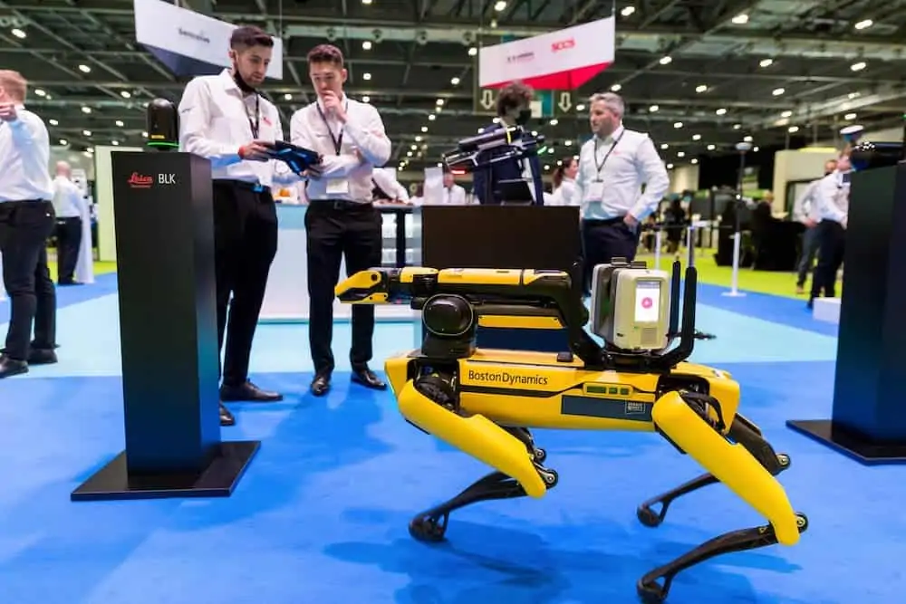
As well as the content-packed program on offer, GEO Business also features a range of interactive demos. Visitors will experience ground-breaking technology in action live on the show floor, with a series of live demonstrations featuring the Leica BLK ARC autonomous laser scanning module for robots combined with Spot from Boston Dynamics.
In the main exhibition, you can test your drone pilot skills at stand GB11 with Aetha and Vantage UAV, get a look at the latest USVs for hydrographic survey from Seafloor Systems at stand GC10, or head over to stand GF41 to see how easy it is to capture and process data with GeoSLAM.
At the Trimble/KOREC stand (GC52) they’ll showcase their latest tech, including the Trimble X7 3D Laser Scanner, R12i GNSS and S-Series Robotic Total Stations, and the Trimble MX50 Mobile Mapping System along with a range of Mixed and Augmented Reality solutions.
RIEGL will have the latest LiDAR technology and systems on show at stand GC40, including the VQ-840-G topo-bathymetric airborne laser scanner, their robotic solution for railroad surveying applications, the new RIEGL VMR, and much more.
That’s only a taster of the impressive companies who will be at GEO Business this year. The extensive exhibitor list features many of the biggest names and newest disruptors in geospatial.
With so many influential brands and inspiring innovators in one place, GEO Business is an unrivalled opportunity to see the most recent developments for mapping, scanning, surveying, monitoring, GIS, visualization and much more.
Register now for GEO Business 2022
Click here to register for a free trade ticket.


