


LiDAR Software
Discover cutting-edge solutions from leading global suppliers
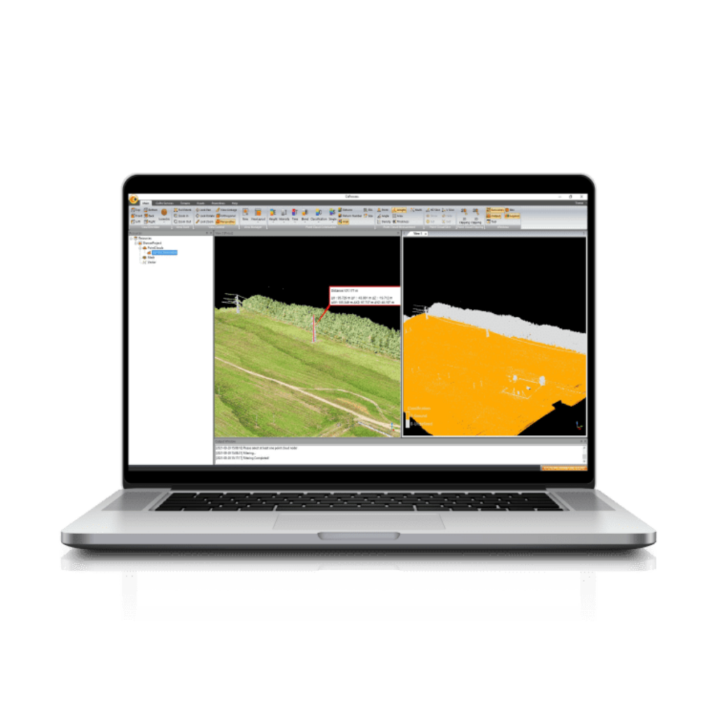
OxTS has released version 2.0 of OxTS Georeferencer, a LiDAR georeferencing software package that surveyors can use alongside any OxTS Inertial Navigation System (INS). Users can quickly and easily georeference LiDAR data from multiple sensors to create precise 3D pointclouds.
Previous iterations of OxTS Georeferencer saw almost 30 new LiDAR sensors integrated, as well as multiple user experience enhancements. Version 2.0 includes several key improvements, particularly for professional LiDAR surveyors. These include:
Global coordinates – OxTS Georeferencer 2.0 users can now process data in a range of coordinate systems. These include local coordinates, ECEF, and LLA (latitude, longitude and altitude).
New processing options – Users of OxTS Georeferencer 2.0 can maximise the usability of their pointclouds and minimise data size through a range of processing options. These include:
- Filter points by position uncertainty keeping every point within a specified accuracy
- Maximise the accuracy of the data while minimising data size with a Voxel sampling algorithm
- Filter points by intensity, azimuth and elevation angle of the LiDAR
- Filter points by speed and range from vehicle
Easier to create map files – OxTS Georeferencer 2.0 can add the direction from which each point is surveyed into the pointcloud, allowing mesh surfaces to be easily reconstructed. Furthermore, OxTS Georeferencer 2.0 gives surveyors the ability to add point normal information into the pointcloud and view the vehicle trajectory as a pointcloud.
Processing advances – Users benefit from the best performance yet due to new revisions of the OxTS Georeferencer processing algorithms. Using version 2.0, users can process pointclouds faster than ever before and take advantage of improved precision and consistency of the boresight calibration feature which now utilises target dimensions.
The developers of OxTS Georeferencer are also hosting a webinar at 14:00 hrs (GMT) on Tuesday, 15th March. During this event they will discuss:
- How OxTS Georeferencer has evolved since launch
- What the new features mean for professional LiDAR surveyors
- Using OxTS Georeferencer alongside an OxTS INS


