


Kongsberg Geospatial has signed a Memorandum of Understanding with Pegasus Imagery Ltd. to partner in advancing the development of safe, autonomous Unmanned Aircraft.
Pegasus will be implementing Kongsberg Geospatial’s IRIS UxS airspace situational awareness system as a navigational system for their Beyond Visual Line-of-Sight (BVLOS) flight operations, and as part of their PV-02 Eos autonomous aircraft system.
IRIS enables multiple drones and sensor feeds to be monitored simultaneously by a single remote operator and provides real-time calculation of aircraft separation and communications to enable BVLOS operations.
Built on Kongsberg Geospatial’s TerraLens Software Development Kit (SDK), IRIS provides advanced real-time 2D and 3D visualization of all airborne track and weather data, as well as cues, alerts and warnings to enable the operator to monitor complex airspace environments.
“We’re very pleased to be working with an industry innovator like Pegasus” said Ranald McGillis, President of Kongsberg Geospatial. “We’ve worked closely with them to integrate our technology with their PV-02 Eos platform.”
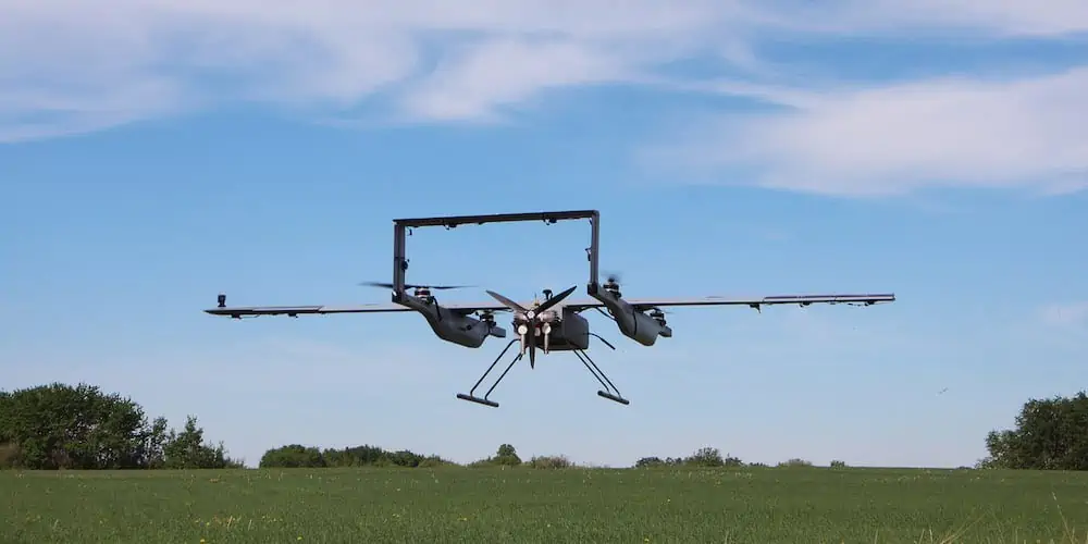
Equipped with proprietary Detect-and-Avoid (DAA) sensor systems, the Pegasus PV-02 Eos autonomous aircraft system is able to safely operate in shared airspace with manned and unmanned aircraft to collect and deliver scalable, on-demand, data solutions for missions ranging from infrastructure surveys of power transmission lines to surveillance of forest fires.
“Kongsberg has a deep history delivering mission-ready solutions like IRIS UxS for enhanced airspace management in the most challenging environments”, said Cole Rosentreter, CEO of Pegasus Imagery.
“Integrating these capabilities with our aircraft and onboard DAA systems will expand the safety and situational awareness essential for routine operations in integrated airspace.”


