


LiDAR Software
Discover cutting-edge solutions from leading global suppliers
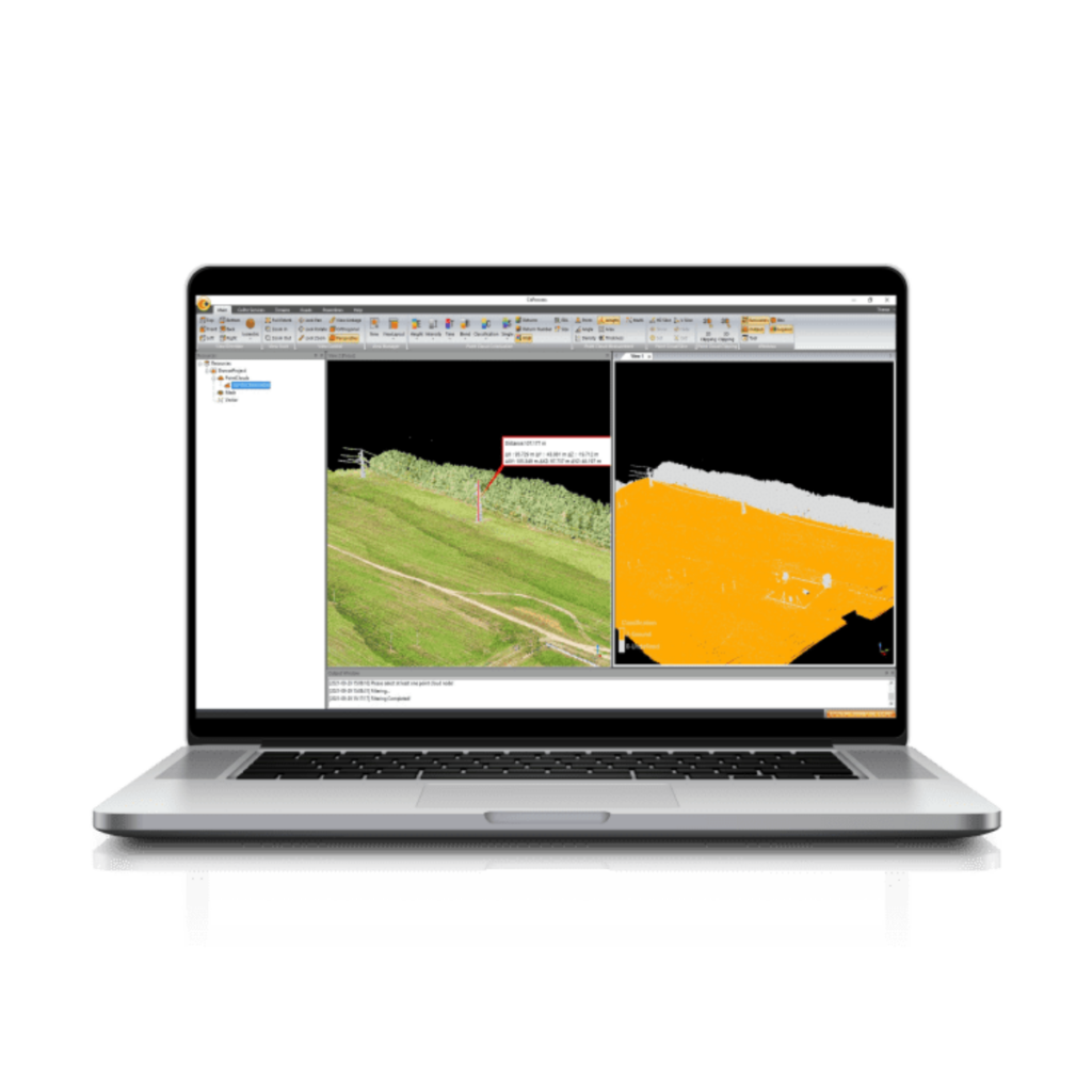
OxTS Georeferencer fuses position, navigation and timing (PNT) data from an OxTS INS with raw LiDAR data to output highly accurate 3D pointclouds. The software uniquely makes use of navigation diagnostic data that provides surveyors with LiDAR point error estimation. This error estimation allows surveyors to focus their analysis on viewing parts of their survey based on estimated errors in points, helping them to understand if there are any parts of a survey that need to be looked at again. An optional boresight calibration tool uses data to calibrate the angles between the navigation and survey devices.
Support for new LiDAR sensors
Version 1.4 of OxTS Georeferencer adds pre-integration support for seven new sensors from Hesai:
- Pandar40 (beta)
- Pandar40M (beta)
- Pandar64 (beta)
- PandarQT (beta)
- Pandar128 (beta)
- PandarXT-16 (beta)
- PandarXT-32 (tested)
User experience upgrades
OxTS Georeferencer has added several new developments to enhance the overall user experience of the software and to make it more intuitive.
- 3D Hardware Setup Viewer – To help input the correct relative rotation angles, specific LiDAR models will be available to view depending on the surveyor’s choice of LiDAR. The model will represent the LiDAR in appearance, size and orientation within OxTS Georeferencer with respect to the OxTS INS for quick and intuitive configuration.
- Time overlap chart – Version 1.4 will see the reintroduction of a time overlap chart. The latest, enhanced chart will allow surveyors to visualise their survey route on a map and select the specific start and end times of their survey. This will enable surveyors to control the part of the route they would like to view, with the added ability to georeference only this particular part of the survey.
OxTS provides surveyors with the ability to build a full survey solution consisting of an OxTS INS, georeferencing software and a LiDAR sensor that best suits their specific application – with much of the integration work already taken care of. To find out more about the new features provided by OxTS Georeferencer 1.4, visit the OxTS website.


