


Discover World-Leading Unmanned and Autonomous Technologies
Discover cutting-edge solutions from leading global suppliers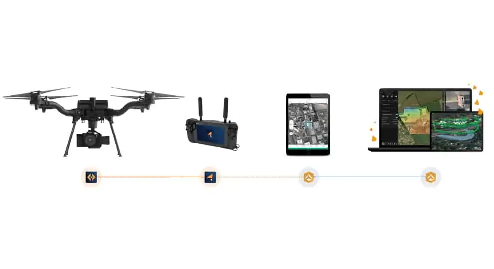
Esri has introduced new capabilities for its Site Scan unmanned aerial systems (UAS) flight planning and processing solution that will allow governments and critical infrastructure organizations to meet hardware and software regulations in the US and Europe.
Site Scan for ArcGIS is an all-in-one, cloud-based drone mapping solution for managing fleets and collecting, processing, analyzing, and sharing data products. It is used in industries such as architecture, engineering, construction, infrastructure, and government to gather drone imagery for visual inspections, site monitoring, asset management, and situational awareness.
The US government has recently issued a growing number of advisory warnings and bans on the use of drones that pose security risks. These precautions have adversely impacted federal agencies and private firms that manage critical infrastructure, causing them to adopt incongruous drone data capturing and processing workflows that consist of multiple vendor solutions. Through an established partnership with Auterion, developer of a widely used open-source drone autopilot operating system, security-conscious US organizations can use Site Scan with the US Department of Defense-approved Freefly Astro UAS, providing a single end-to-end drone solution.
By law within Europe, data from publicly funded or critical infrastructure projects cannot leave the European Union (EU). For organizations in Europe affected by these data sovereignty requirements, a new and fully independent instance of Site Scan for ArcGIS has been deployed to a server cluster in Ireland, ensuring that organizational data resides within the region.
Dave Sharpin, CEO of Auterion Government Solutions, commented: “Our expertise in providing an enterprise drone platform based on open-source software enabled us to meet the needs of the US government and governments worldwide. We are very excited to partner with Esri and provide [its] users with our groundbreaking technology.”
Richard Cooke, Esri director of imagery and remote sensing, said: “The relationship we have established with Auterion is key in being able to offer high-quality, secure drone software to our US customers looking to take advantage of our advanced, secure, drone-based imagery collection and management platform. Additionally, through the development of the EU deployment, an even wider range of customers located in Europe will be able to maintain their data and data processing locally.”


