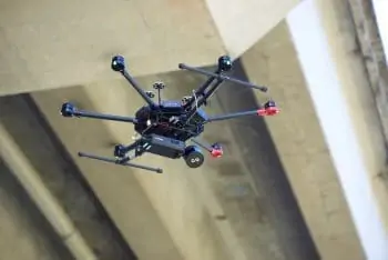
 LORD Microstrain has released an article that provides answers to commonly-asked questions concerning the used of combined GNSS and inertial navigation systems for BVLOS (beyond visual line of sight) operation of drones.
Read the Q&A article on LORD Microstrain’s website here
Unmanned aerial vehicles (UAVs) used for BVLOS applications such as delivery, mapping and aerial surveying must maintain precise positioning in order to successfully carry out their missions. Environmental features such as tunnels and urban canyons can weaken GNSS signals or even cause them to be lost completely. In order to maintain accuracy in GNSS-denied environments, drones can use RTK-capable inertial navigation systems (INS) that provide information from accelerometers and gyroscopes to provide accurate estimation of position, velocity, heading, and attitude.
LORD Microstrain’s 3DMGQ7-RTK GNSS/INS is an ideal solution for drone and unmanned vehicle navigation, providing global multiband GNSS coverage, RTK correction capability, dual-antenna heading, and calibrated MEMS sensor performance over the entire operating temperature range in a SWaP (size, weight and power)-optimised package.
The article answers the following questions:
- How is an inertial navigation system different from traditional GNSS?
- Where are inertial navigation systems used?
- In what environments can a user expect GNSS signal disruption?
- What is RTK positioning and how does it benefit an inertial navigation system?
- How easy is it to integrate an RTK INS system?
- How accurate is the 3DMGQ7?
- How is the 3DMGQ7 different from competitors?
- What are the best features of the 3DMGQ7?
To find out more about GNSS/INS solutions for BVLOS drone operation, read the full article on LORD Microstrain’s website.


