


Guidance Systems
Discover cutting-edge solutions from 7 leading global suppliers
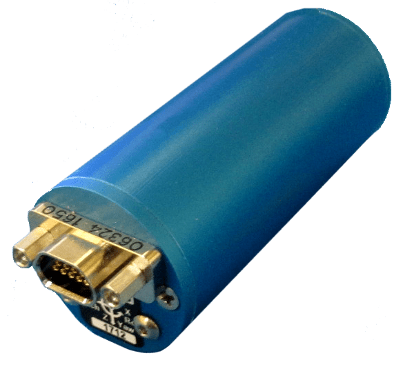
The INS1000 embeds ACEINNA’s 9 degree-of-freedom inertial sensor technology to achieve Automotive Dead Reckoning performance in GNSS challenged environments like urban canyons, heavily tree lined roads, tunnels, underpasses, bridges, etc.
The dual frequency RTK and tight coupling between GNSS and inertial sensors provide cm-level accuracy, enhanced reliability, and superior performance during GNSS outages.
Find suppliers of Inertial Navigation Systems (INS) for unmanned systems >
“Without access to satellite delivered guidance and localization information, autonomous vehicles can quickly get off track,” says Mike Horton, CTO of ACEINNA. “The INS1000 delivers the essential detailed position and heading accuracy at a price point that is suitable for startups as well as fleet-wide vehicle deployment. As the leading supplier to the precision agriculture autosteer market, ACEINNA is focused on driving the cost and complexity out of GNSS/INS solutions to enable wide-spread adoption in automotive ADAS applications.”
INS1000 is an integrated navigation system consisting of an inertial measurement unit (IMU) and other sensors. It provides the position, velocity and attitude information of the vehicle. A dual-frequency (L1/L2), dual-antenna GNSS receiver is used as the primary aiding sensor. Also supported is a distance measurement indicator (DMI) which can be attached to a wheel of the vehicle/robot to measure the rotation rate of the wheel. Integration of a DMI would give an improved solution in challenging environments: urban canyons, tunnels, warehouses and indoor facilities and campuses.
With horizontal position accuracy of 2cm (RTK), vertical position accuracy of 3cm (RTK), and velocity accuracies of 0.01m/s and 0.02m/s (horizontal and vertical, respectively), the INS1000 provides the precision navigation capabilities required for the automotive autonomous, automotive track testing, precision agriculture, and construction markets.
The INS1000 is compatible with all major global satellite systems (GPS, GLONASS, Beidou, Galileo, SBAS); it supports USB, Ethernet, CAN and RS-232 interfaces; and it supports dual GNSS antennae for accurate heading in static and dynamic scenarios, and difficult magnetic environments.
The easy-to-use embedded software allows extensive configuration and diagnostic capabilities. For optimal flexibility, the tools enable configuration of the output position, initialization of heading, IMU transformation matrix, GNSS antenna lever-arms, and NTRIP client. The control software can log and decode output data from the system or use the web application to plot results on a map.


