3DR Launches UAS Ground Control Point App

By Mike Ball / 01 May 2018

Smart Sourcing for Unmanned Systems

Discover cutting-edge solutions from leading global suppliers
SUPPLIER SPOTLIGHT
Follow UST

Construction site drone

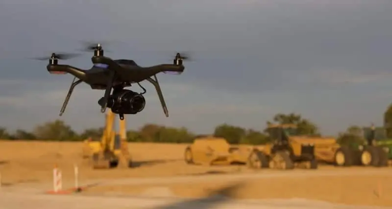
3DR, developers of the Site Scan drone software platform for construction and engineering professionals, have announced the release of 3DR GCP, an Android app enabled by the Trimble Catalyst on-demand Global Navigation Satellite System (GNSS) service that allows Site Scan users to capture and use ground control points (GCPs) on commercial drone projects.

Instead of having to export ground control point data files and manually upload them into Site Scan, 3DR customers can use 3DR GCP to quickly capture ground control points and automatically transfer them to their corresponding projects in the Site Scan cloud for georeferencing and processing. This makes it easy for any Site Scan user to create accurate drone maps and models of their projects.

3DR GCP is enabled by Trimble Catalyst, a software-defined GNSS receiver and on-demand positioning service for Android phones and tablets. Developed by Trimble, a provider of geospatial positioning solutions, the service uses a small, lightweight, plug-and-play digital antenna to deliver high-quality satellite data to the 3DR GCP app running on the user’s Android device. The service is available as a monthly subscription, which unlocks a range of precision levels from meter to only a few centimeters. Users go on-site, plug the Catalyst DA1 antenna into their Android device, launch 3DR GCP, and capture ground control points at the level of accuracy enabled by their Catalyst subscription.

“3DR GCP provides our customers an end-to-end, cloud-based ground control point workflow from the field to the office,” said Chris Anderson, CEO, 3DR. “With this app, we’ve closed the loop on ground control points by making one simple, connected workflow from start to finish.”

“Trimble is excited for 3DR to join our ecosystem with the launch of 3DR GCP,” said Gareth Gibson, business development manager for Trimble Catalyst. “With this innovative ground control app, 3DR is making it easier than ever for their customers across the world to create accurate, reliable drone maps and models and better capture their projects.”

Posted by Mike Ball Mike Ball is our resident technical editor here at Unmanned Systems Technology. Combining his passion for teaching, advanced engineering and all things unmanned, Mike keeps a watchful eye over everything related to the unmanned technical sector. With over 10 years’ experience in the unmanned field and a degree in engineering, Mike’s been heading up our technical team here for the last 8 years. Connect & Contact

Latest Articles

Cellen Expands UAV Mission Capabilities with Hydrogen Fuel Cell Technology

Cellen outlines how its H2‑6 hydrogen-powered drone delivers long-endurance flight and zero-emission performance, overcoming battery limitations and enabling reliable, low-impact operations in sensitive or remote environments

Jul 15, 2025
Tulip Tech Extends Autonomous Drone Missions with Lithium Metal Technology

Tulip Tech and Tective have partnered to extend the ReFly drone’s range and endurance using advanced Lithium Metal battery technology

Jul 15, 2025
UAV Navigation to Supply Flight Control System for Fixed-Wing UAV Platform

UAV Navigation collaborates with SE Aviation to provide the DRIADE UAV with a VECTOR-600 flight control system enabling autonomous reconnaissance and wildfire response missions

Jul 15, 2025
AlarisPro Empowers UAS Operators to Meet Federal Mandates with Safety & Compliance Tools

AlarisPro describes how their Fleet Management Platform is positioned to help UAS operators prepare for BVLOS certifications under the new Executive Order

Jul 15, 2025
Police Department Utilizes Drones to Map Crash & Crime Scenes

Discover how Windham Police use drones and Blue Marble Geographics’ GIS tools to enhance crash investigations, speed up processing, and improve scene accuracy

Jul 15, 2025
SPECTRUM300 Mission-Ready Imaging for Small UAV Platforms

Explore Blitz Technology SPECTRUM300, a 330g dual-sensor gimbal delivering full HD EO and thermal imaging, built for lightweight UAVs and demanding ISR missions

Jul 15, 2025

Featured Content

SBG Systems Evaluates INS Performance in GNSS-Denied Marine Applications

SBG Systems evaluates the performance of its INS solutions in GNSS-denied marine environments, comparing system accuracy with and without DVL and warm-up support

Jul 14, 2025
USAF Uses Inertial Labs Drone Lidar for Tree Obstruction Survey

The US Air Force successfully used Inertial Labs drone Lidar and cloud software to quickly map tree obstructions at Joint Base Lewis-McChord (JBLM), improving airfield safety

Jul 11, 2025
New UAV to Combine Solar Hydrogen & Battery Power for Extended Flight

XSun and H3 Dynamics are developing the first UAV powered by solar, hydrogen, and batteries, aiming to deliver zero-emission, long-endurance unmanned flight

Jul 07, 2025
Advancing Unmanned Systems Through Strategic Collaboration UST works with major OEMs to foster collaboration and increase engagement with SMEs, to accelerate innovation and drive unmanned systems capabilities forward.