


Discover World-Leading Unmanned and Autonomous Technologies
Discover cutting-edge solutions from leading global suppliers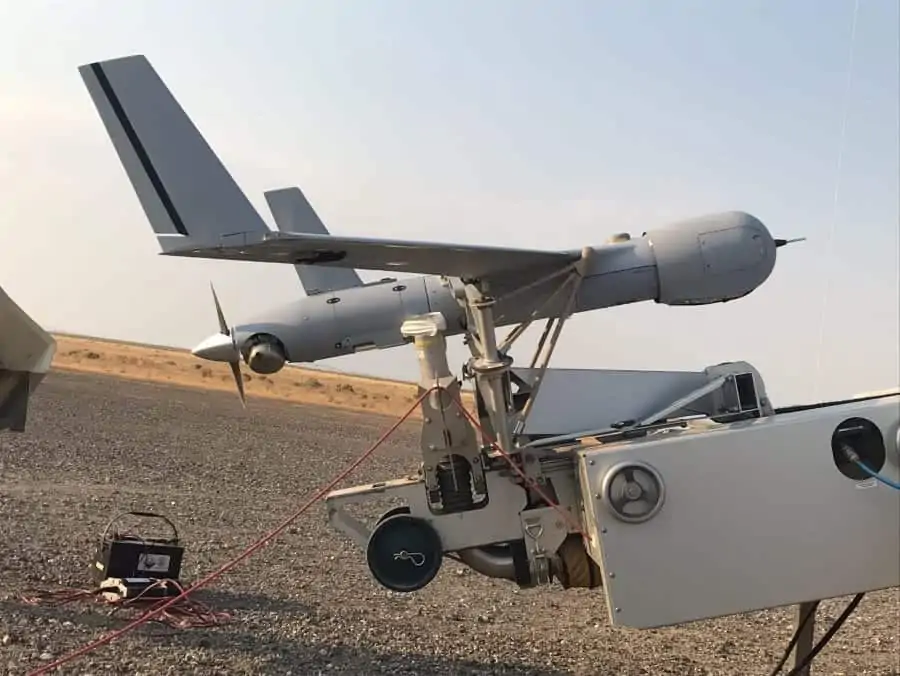
Insitu and Overwatch Imaging have announced that the two companies have successfully integrated a customized TK-5 Firewatch smart tactical mapping payload on Insitu’s ScanEagle UAS. The Firewatch-equipped ScanEagle will provide real-time fire line maps and wide-area, high-resolution imagery intelligence for wildfire management, disaster recovery, and other applications.
Integrated onto ScanEagle, the TK-5 Firewatch payload maps more than 50,000 acres per hour with resolution much greater than high-altitude or space-based multi-band imaging systems, and features ideal image data and onboard processing capability to enable faster identification and delivery of precision geospatial intelligence at large scale.
Firewatch will enable ScanEagle to operate during times when traditional mapping or surveillance assets are unavailable or conditions are hazardous for manned aircraft to fly.
“Insitu is committed to supporting fire managers and emergency response coordinators by safely and efficiently providing time-critical information, said Mark Bauman, Vice President, Insitu Commercial – Americas.
“The system automatically finds and maps areas that could be unsafe for ground crews, and provides incident commanders the information they need, when they need it, to make the best decisions,” he continued.
The TK-5 Firewatch payload autonomously collects high-quality imagery in visible, near infrared, and thermal infrared spectral bands simultaneously, and analyzes that imagery in real time onboard, using GPU-accelerated processors and advanced computer vision software. The Firewatch payload supports live automated fire line mapping, automatic small hot-spot detection, large-scale vegetation index land monitoring and fire fuels analysis, multi-band photogrammetry, and timely wide-area image maps for situational awareness, change analysis, and response planning.
Data from the Firewatch payload, including multi-band imagery and vector map layers, is integrated with Insitu’s INEXA Solutions suite of remote sensing products and information delivery services, and is compatible with Esri’s ArcGIS software.
“The customized TK-5 Firewatch, which operates on ScanEagle in addition to the EO/IR video payload, provides a great imaging and aerial data processing platform to drive Insitu’s sophisticated analytics solutions. This payload operates in harmony with Insitu INEXA computer vision software, and helps to further differentiate ScanEagle from other airborne assets by providing real-time geospatial intelligence tailored for each of our customer applications,” explained Andrew Duggan, Vice President and General Manager, Insitu Commercial – Asia/Pacific. “Building on the TK-5 Firewatch capability, we will continue to expand our extensive computer vision and artificial intelligence software capabilities to provide tailored, autonomous, end-to-end solutions for customers.”
“We are honored that Insitu has chosen the TK-5 Firewatch payload to be part of its emergency management solutions,” said Greg Davis, Founder and Manager of Overwatch Imaging. “Insitu is a proven leader in aerial intelligence delivery, and we are excited to extend the capabilities of ScanEagle with our smart mapping system. Working together, we enable faster data availability, safer operations and better decision-making for emergency managers.”


