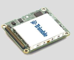
 Trimble has announced the introduction of three new GNSS-Inertial Systems for Direct Georeferencing on Unmanned Aerial Vehicles (UAVs): the Trimble APX-15-EI UAV, Trimble APX-18 UAV, and Trimble APX-20 UAV. Direct Georeferencing allows the location of image elements collected by Light Detection and Ranging (LiDAR) and hyperspectral sensors to be accurately computed without extensive networks of ground control points, reducing costs while maintaining accuracy to produce maps.
The APX-15-EI UAV features dual inertial measurement units (IMU); one embedded onto the GNSS-Inertial board that is mounted on the UAV airframe with the GNSS antenna, and one that is mounted on an external sensor contained in a gimballed mount. With this feature, the APX-15-EI UAV can compute two sets of orientations — the UAV airframe and the gimballed mount—enabling automatic, precise positioning of the sensor without requiring an external interface to the gimballed mount or autopilot.
The APX-18 UAV is a single-board GNSS-Inertial solution that supports two antenna headings for high accuracy in low-speed multi-rotor survey applications such as building facade scanning. Measuring just 10 cm x 6 cm and weighing only 62 grams, the APX-18 UAV uses on-board inertial sensors calibrated with the Applanix SmartCal software compensation technology for superior performance in a small, compact form, ideal for UAVs.
To meet the higher accuracy demands driven by the allowance of higher altitude, Beyond Visual Line of Sight (BVLOS) UAV flights, and the introduction of higher resolution, larger format imaging sensors, Trimble has developed the APX-20 UAV. Also, featuring dual IMUs for automatic gimballed mount support, the APX-20 UAV uses a new, MEMS-based lightweight external IMU. With a total weight of less than 425 grams, the APX-20 UAV provides high performance without sacrificing flight time.
“We are very pleased to announce these new additions to our portfolio of products for Direct Georeferencing on UAVs,” said Joe Hutton, Director of Inertial Technology and Airborne Products at Applanix, a Trimble Company. “We have listened to our customers and worked very hard to come up with solutions that meet their needs, both from a technical and cost perspective.”
The APX products use state-of-the-art low noise, multi-frequency Trimble Maxwell GNSS technology, and track all current satellite signals including GPS L1/L2/L2C/L5 and GLONASS L1/L2, QZSS, BeiDou, IRNSS and Galileo, supporting SBAS, RTK and Trimble CenterPoint RTX positioning modes.
All APX products include the Applanix POSPac UAV post-processing software for generation of high-accuracy carrier-phase differential GNSS-Inertial position and orientation for highest accuracy map products. POSPac UAV supports single GNSS base station processing with automatic coordinate survey using Trimble CenterPoint RTX, multi-single base station processing, and Applanix SmartBase Virtual Reference Station processing (optional), as well as the Trimble CenterPoint RTX post-processing trajectory generation available as a subscription.


