Robota Selects LeddarOne Altimeter For New Professional Survey Drone

By Mike Ball / 22 Nov 2016

Smart Sourcing for Unmanned Systems

Discover cutting-edge solutions from leading global suppliers
SUPPLIER SPOTLIGHT
Follow UST

Robota Eclipse UAV

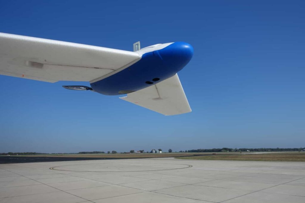
LeddarTech, a developer of solid-state LiDAR solutions, has announced that its LeddarOne optical sensor has been selected by unmanned aerial vehicle (UAV) manufacturer Robota as the altimeter for the Eclipse, Robota’s new generation of fixed-wing UAV for professional surveying applications. LeddarOne will provide the drone’s autopilot with the precise, real-time height-above-ground-level measurements required during the sensitive landing phase.

Benchmarked with other ranging technologies as part of a thorough evaluation process, LeddarOne proved superior to ultrasonic sensors, with its superior range and environmental durability, and outperformed optical flow sensors in accuracy and speed. The LeddarOne also outperformed competing LiDAR solutions to which it was compared.

“Finding a small sensor with sufficient range and precision that would work in a variety of outdoor conditions turned out to be very challenging,” stated Antonio Liska, Robota’s president. “When selecting an altimeter for the Eclipse, we considered many criteria including size, power consumption, detection range, refresh rate and reliable detection on targets in various conditions, including snow,” added Liska.

Robota’s engineers concluded that the LeddarOne’s use of a diffuse infra-red LED source (instead of a narrow-beam collimated laser) delivered superior performance. The sensor’s wide light beam, coupled with its proprietary digital signal accumulation and oversampling, helps smoothen the terrain measurements and provides consistent readings, especially in cases of flying over brush, bushes or tall grass. In comparison, other LiDARs using collimated laser beams tended to return variations in altitude, which may be unwanted and can mislead the auto-pilot. The LeddarOne also demonstrated the required measurement rates and efficient data transmission, which are paramount when landing a drone that is descending at 5m/s.

“Besides the superior functionality of the product, I enjoy the configurability of the device and the frequent firmware updates provided. Moreover, we received consistent support and prompt feedback from the LeddarTech team,” added Liska.

The custom-made Eclipse UAV is an advanced mapping system that can cover nearly 400 acres per 50-minute flight and capture high resolution images with on-board cameras. Its applications include agriculture, construction, mining, and urban analysis.

LeddarOne is a very compact, high performance optical sensor module that is entirely dedicated to a single point measurement. This fixed-beam LiDAR solution can be used in various types of drones, including multi-rotors, for altimetry applications. Other models of Leddar sensors, such as the multi-segment LeddarVu, cater to other drone navigation applications, including collision avoidance.

Posted by Mike Ball Mike Ball is our resident technical editor here at Unmanned Systems Technology. Combining his passion for teaching, advanced engineering and all things unmanned, Mike keeps a watchful eye over everything related to the unmanned technical sector. With over 10 years’ experience in the unmanned field and a degree in engineering, Mike’s been heading up our technical team here for the last 8 years. Connect & Contact

Latest Articles

High-Energy Density Batteries for Drones & Robotic Vehicles

The SCIO Brick® platform offers industry-leading energy density in a compact and lightweight footprint, and can be scaled to meet high-voltage requirements

Jul 12, 2025
Most Read Articles on UST This Week

Here’s our round-up of the five most read articles on UnmannedSystemsTechnology.com this week

Jul 11, 2025
Vertiq Speed Firmware v0.1.1 Now Available with Bug Fixes

Vertiq has released firmware v0.1.1 to correct a parameter bug affecting telemetry and 3D mode settings on select G1 and G2 modules

Jul 11, 2025
The Role of ROVs in Unmanned Marine Operations

Oceanbotics has answered the most common questions about ROVs, covering how they work, where they're used, and key capabilities

Jul 11, 2025
LiveU File Transfer Speeds Up Drone Data Delivery for Critical Missions

LiveU’s File Transfer enables rapid transmission of large drone data files, reducing delays and supporting faster decision-making in public safety and infrastructure operations.

Jul 11, 2025
Exploring Differences Between M9PLUS & M9 GNSS Antennas

Discover the key upgrades in Maxtena’s new M9PLUS GNSS antenna, including improved performance, signal purity, and multipath mitigation over the original M9

Jul 11, 2025

Featured Content

USAF Uses Inertial Labs Drone Lidar for Tree Obstruction Survey

The US Air Force successfully used Inertial Labs drone Lidar and cloud software to quickly map tree obstructions at Joint Base Lewis-McChord (JBLM), improving airfield safety

Jul 11, 2025
New UAV to Combine Solar Hydrogen & Battery Power for Extended Flight

XSun and H3 Dynamics are developing the first UAV powered by solar, hydrogen, and batteries, aiming to deliver zero-emission, long-endurance unmanned flight

Jul 07, 2025
Enhancing Mangrove Restoration Through 3D Printed Drone Design

Explore how Inverto Earth, in collaboration with HP Additive, is using sustainable 3D printing and drone technology to drive large-scale mangrove restoration and protect vulnerable coastal ecosystems

Jul 03, 2025
Advancing Unmanned Systems Through Strategic Collaboration UST works with major OEMs to foster collaboration and increase engagement with SMEs, to accelerate innovation and drive unmanned systems capabilities forward.