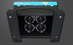
Visual Intelligence and Cardinal Systems have announced a strategic agreement that will combine high-quality and affordable aerial image collection with the processing and delivery of intelligent data for large-scale and UAV imaging applications. The two companies have industry-leading solutions for image collection and processing that when combined, will enable unprecedented positional accuracy for oblique and 3D products.
The Visual Intelligence iOne® Sensor System is reconfigurable, and supports various image types including nadir and oblique. The Cardinal Systems triangulation solution efficiently handles the aero-triangulation of oblique and nadir images together, correlating the orientation points in both sets of imagery simultaneously, achieving better than 2 pixel absolute accuracy. The two companies plan to release a large-scale production solution in early 2015.
“Visual Intelligence is pleased to team with Cardinal Systems to integrate the Vr Mapping software suite with our iOne Sensor System solutions. Using Cardinal Systems’ powerful mapping tools with an iOne Sensor System will give image providers a highly-effective end-to-end workflow that will significantly enhance the collection, production, and use of oblique aerial images to generate 3D models in industries such as insurance, real estate, construction, urban planning, utilities, and public safety,” said Visual Intelligence President and CEO Dr. Armando Guevara.
A leading provider of high-quality multipurpose digital sensor systems for airborne geo-imaging applications, Visual Intelligence’s award-winning technology innovations include sensor systems that are field-configurable to support a variety of applications including large area collection to oblique for 3D applications.
“We are impressed with the quality imagery that is produced using the iOne Sensor System. Aerial image providers can benefit from the system’s versatility and performance and, together with Cardinal Systems’ Vr Mapping software, we provide an ideal turnkey solution for stereo and oblique airborne acquisition customers,” said Cardinal Systems Manager of Software Development Mike Kitaif.
Because the vertical and oblique imagery collected with the iOne Sensor System is extremely precise, this contributes to the exceptionally high-quality image data produced by the Vr Mapping software suite. In addition, integrating the software and hardware solutions bring new and efficient aerial imaging technologies that use the same base architecture and software processing suite.
According to Jane Smith, Managing Member of Cardinal Systems, “Aerial image providers will now have a coordinated hardware and software bundle that will give them a cost-effective and modernized workflow that will produce highly-accurate images that are rich in data.”


