


Discover World-Leading Unmanned and Autonomous Technologies
Discover cutting-edge solutions from leading global suppliers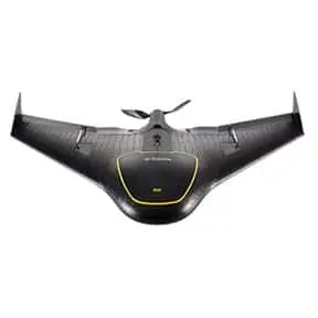
Trimble UX5 UAS
Trimble has announced the latest enhancements to its Trimble® Access™ Aerial Imaging 2.0 application — making it even more robust, intuitive and easier to use. Part of the Trimble Access field software suite of applications, the Aerial Imaging application is a software tool used with the Trimble Tablet Rugged PC for planning aerial missions, performing pre-flight checks, and monitoring flights for the Trimble UX5 Aerial Imaging Rover. The software enhancements include a full redesign of the user interface for a streamlined workflow, and major upgrades to flight design and control. These improvements provide greater flight planning flexibility in applications such as boundary and topographic surveying, mining assessment and exploration, heavy construction modeling and much more.
Enhanced User Interface
Trimble Access Aerial Imaging 2.0 enhanced user interface enables Trimble UX5 pilots to prepare a flight in minutes and quickly begin collecting data, such as orthophotos, point clouds or surface models. The full interface redesign simplifies the user experience for flight planning by using a step-by-step, tabular navigation to guide the user through the flight process from planning to completion. Project management is also easier with new project overview thumbnails and detailed project properties. These interface enhancements are designed to save time in the field, and provide users with an optimal flight planning and monitoring experience.
Powerful Flight Planning
The new Trimble Access Aerial Imaging 2.0 functionality optimizes flight times and enables corridor mapping along rivers, roads, and railways that have areas not connected to each other. Pilots can now import multiple map layers, such as georeferenced background maps, ground control point locations, and areas of interest. The software also enables users to fly irregular shaped areas, cover multiple areas and heights in a single flight, and plan multiple takeoff and landing locations. Once a plan has been established, users can perform flight simulations to confirm the flight plan, give a demonstration to clients and aviation authorities, and export the flight plan to a KML file to check terrain clearances. These new enhancements benefit pilots by saving time in flight planning, increasing safety, and meeting requirements of their mission through customized planning before takeoff.
Flexibility in Flight Control
New features with in flight control build an additional level of viewing options and safety for landing when air traffic or weather conditions suddenly change. Pilots can now check flight settings, view or hide map layers, adjust landing properties, select an alternative landing, and execute pre-programmed interventions while the system is in-flight.
“Delivering the premium UAV experience for trained geospatial professionals means we need to have the most advanced flight planning and inflight control capabilities to offer, and Trimble Access Aerial Imaging 2.0 shows our commitment to doing just that,” said Phil Sawarynski, business area director of Imaging Solutions for Trimble’s Geospatial Division. “Our customers can feel confident that we are committed to providing tools to streamline flight operations and automate capabilities for safe and successful use of their Trimble UAV systems.”


