Spectracom Announces Integrated INS for ISR Platforms

By Caroline Rees / 21 Nov 2014

Smart Sourcing for Unmanned Systems

Discover cutting-edge solutions from leading global suppliers
SUPPLIER SPOTLIGHT
Follow UST

Spectracom Geo-PNTSpectracom, a provider of GNSS signal management solutions, along with its partner, Geodetics of San Diego, California, has announced a new combination master clock and GPS-aided inertial navigation system. The Geo-PNT is the first commercial device that integrates precision references for position, attitude, and timing all-in-one-box.

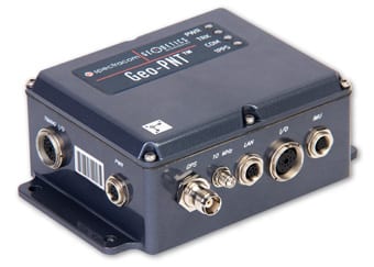
Geo-PNT will benefit any mobile ISR platform, as signal/electronic intelligence applications require precision positioning, navigation, and timing references. Electro-optic sensors and other imaging technologies, antenna steering, and encrypted communications always need a combination of precision motion compensation, geolocation, time stamping, and frequency reference.

The high degree of integration within the Geo-PNT supports the goals of low size, weight and power (SWaP) and cost optimization while achieving a high level of performance for ISR platforms and mobile communications systems. A single subsystem for all PNT functions in a volume of about 40 cubic inches is about 3 times less than the traditional approach of deploying dedicated devices.

The Geo-PNT is a highly configurable platform to provide the capabilities needed for ISR missions:

-Single box solution combining precision local oscillator, inertial motion unit (IMU) and GPS receiver
-Configurable output interfaces for timing and navigation
-Standalone or RTK/differential GPS, commercial (non-ITAR) or SAASM GPS receiver
-Choose from a variety of IMUs to meet performance specifications
-NTP server, precision 1PPS, 10 MHz with low phase noise
-Rugged and tested to MIL-STD-810G
-Low SWaP (< 0.7 liters, <0.8 Kg, <10 watts)

According to Spectracom’s sales and marketing VP, Rohit Braggs, “Our time and frequency technology combined with Geodetics positioning and navigation capability in the same module provides an opportunity for platform designers to lower SWaP requirements while staying within the limits of today’s demanding system specifications.”

Geo-PNT is the latest example of Spectracom’s highly flexible configure-to-COTS approach. The use of commercial technology reduces leadtime and offers the lowest cost of ownership for both standard and semi-custom configurations. Hardware and software can be easily adapted to meet the needs of the application.

Posted by Caroline Rees Caroline co-founded Unmanned Systems Technology and has been at the forefront of the business ever since. With a Masters Degree in marketing Caroline has her finger on the pulse of all things unmanned and is committed to showcasing the very latest in unmanned technical innovation. Connect & Contact

Latest Articles

UK MOD Validates PDW C100 for Aerial Target Designation

Performance Drone Works (PDW) demonstrated the capabilities of its C100 quadcopter for the UK MOD, successfully designating targets with precision and completing extended-range missions during a live-fire event in Texas

Jul 09, 2025
SatLab Showcases Geospatial Technologies at CSPI-EXPO 2025

SatLab attended CSPI-EXPO 2025 in Chiba, Japan from 18-21 June, showcasing its latest innovations across the full spectrum of geospatial solutions

Jul 09, 2025
DeltaQuad Collaboration to Boost VTOL Surveillance Drone Production

DeltaQuad has partnered with VDL Groep to expand production of its Evo surveillance drone, enhancing manufacturing capabilities to meet rising defence sector demand

Jul 09, 2025
FarSounder Argos Powers Autonomous Navigation on Unmanned Surface Vessel

FarSounder’s Argos sonar technology has been integrated into DARPA’s NOMARS vessel, advancing autonomous navigation and situational awareness in unmanned maritime operations

Jul 09, 2025
Impact of Jamming & Spoofing on GNSS Positioning

Tersus GNSS explains how jamming and spoofing interfere with GNSS signals, outlines their distinct impacts, and presents technical strategies for detection and mitigation

Jul 09, 2025
ESA Feasibility Study to Advance Autonomous Drone Landing Without GPS

Agilica completes an ESA-backed study advancing precision drone landing tech that works without GPS, targeting urban, maritime, and complex autonomous UAV operations

Jul 09, 2025

Featured Content

New UAV to Combine Solar Hydrogen & Battery Power for Extended Flight

XSun and H3 Dynamics are developing the first UAV powered by solar, hydrogen, and batteries, aiming to deliver zero-emission, long-endurance unmanned flight

Jul 07, 2025
Enhancing Mangrove Restoration Through 3D Printed Drone Design

Explore how Inverto Earth, in collaboration with HP Additive, is using sustainable 3D printing and drone technology to drive large-scale mangrove restoration and protect vulnerable coastal ecosystems

Jul 03, 2025
Partnership Combines Drone Swarms & Situational Awareness to Boost Wildfire Response

Kongsberg Geospatial and FireSwarm Solutions have partnered to integrate autonomous drone swarms with real-time situational awareness for faster, smarter wildfire response

Jun 30, 2025
Advancing Unmanned Systems Through Strategic Collaboration UST works with major OEMs to foster collaboration and increase engagement with SMEs, to accelerate innovation and drive unmanned systems capabilities forward.