Discover World-Leading Unmanned and Autonomous Technologies
Discover cutting-edge solutions from leading global suppliers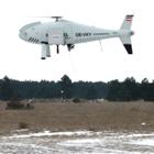 Monitoring the soil composition of agricultural land is important for maximizing crop-yields. Carinthian Tech Research, Schiebel GmbH and Quest Innovations B.V. have developed a multi-spectral imaging system that is able to simultaneously capture three visible and two near infrared channels. The system was mounted on a Schiebel CAMCOPTER S-100 UAV for data acquisition. Results show that the system is able to classify different land types and calculate vegetation indices.
Soil monitoring is important for maximizing crop-yields. Accurate and up-to-date maps of water status, nutrient deficiencies and pest infestation allow farmers to take rapid, targeted action that minimizes costs and environmental impact. Manual monitoring involves taking ground samples and estimating the soil water status at random locations. For large areas this is time consuming and cost intensive, furthermore, it gives only a sparse sampling of the area.
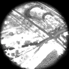 Recently Unmanned Aerial Vehicles (UAV’s) have become much more widely used and economic. Advances in imaging and computation have also made spectral imaging techniques more affordable. By combining these technologies, remote sensing techniques, which were previously limited to satellite-based or military systems, can now be economically applied to make frequent and high resolution surveys of agricultural land.
This article reports preliminary trials of a multi-spectral system mounted on an UAV. The UAV was flown over land containing various types of vegetation. The imaging system captured five bands (three in the VIS, two in the NIR) with a spatial resolution of approximately 10cm x 10cm. The image sequence was stitched together and the Normalized Difference Vegetation Index (NDVI) was calculated and used to classify each pixel in the image. The system was found to accurately classify land usage and we are currently working on a system to identify water stress in crops.