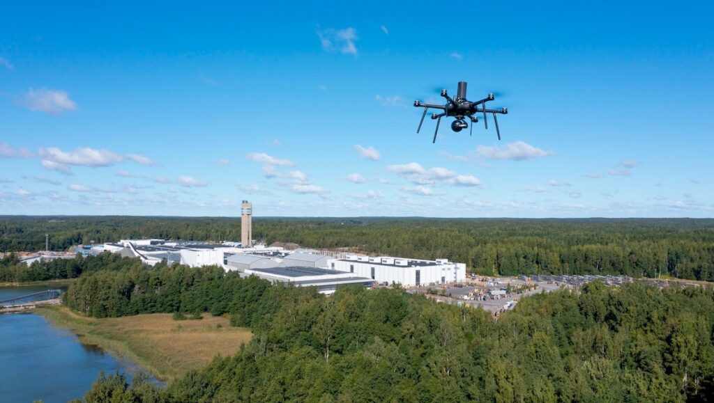
Nokia’s 5.2 XLR enhancements deliver extended range, new cooling features, updated motors, and regulatory-focused capabilities that strengthen automated 5G BVLOS operations for public safety and industrial inspection activities
Advanced Navigation demonstrates its recent flight trials using a Mooney 201 aircraft, where fusing its Boreas D90 FOG INS with an LVS and its Certus Evo MEMS INS with an ADU enabled precise, reliable navigation in GPS-denied environments
Dronetag RIDER provides first responders and UAV operators with reliable real-time drone detection, enhancing situational awareness in complex environments through advanced features and seamless integrations
Elite Robots, represented by KT Technical Solutions, develops collaborative robots with continuous innovation and user-centered design, featuring advanced sensors, AI capabilities, and simplified programming to provide practical, safe, and accessible automation across industries
Discover how Advanced Navigation’s INS + Laser Velocity Sensor system is transforming underground mining by delivering precise vehicle and ore tracking, closing the long-standing data gap
Blue Marble Geographics’ Global Mapper software is used by Egis teams to process LiDAR and topographic data, create 3D terrain models, and perform hydrological analyses for environmental and hydraulic projects
Aerobits demonstrates its integrated airspace ecosystem, bringing together UAVs, drone operators, public safety institutions, and manufacturers to provide real-time airspace awareness, seamless UAV connectivity, compliance, and integration with UTM systems
Jeffrey Starr, D-Fend Solutions' CMO, shares insights into the AI-driven EnforceAir PLUS C-UAS system, detailing its integrated RF-cyber and radar detection, multilayer mitigation capabilities, scalability, and adaptability across complex operational environments to address evolving drone threats
In this whitepaper, Rotron Aerospace explains the Defence Industrial Strategy 2025, highlighting how SMEs, innovation, and sovereign capability are shaping the UK's defense sector, exemplified by Rotron’s work on advanced UAV and propulsion systems
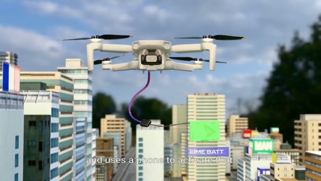
Explore how ParaZero’s DropAir enables precise, reliable last-mile aerial delivery for military and emergency missions, transforming modern logistics capabilities
San Francisco Circuits details how its U.S.-based PCB fabrication and assembly capabilities, supported by comprehensive cybersecurity controls and multi-industry expertise, provide secure, traceable solutions for system integrators and R&D teams
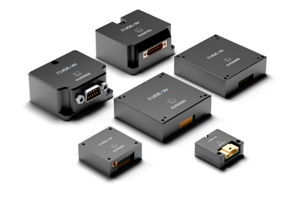
GuideNav explains how 10-axis MEMS IMUs integrate rotational, linear, magnetic, and altitude sensing, providing comprehensive motion and environmental data for reliable control and positioning in unmanned systems operating in complex, GNSS-challenged environments
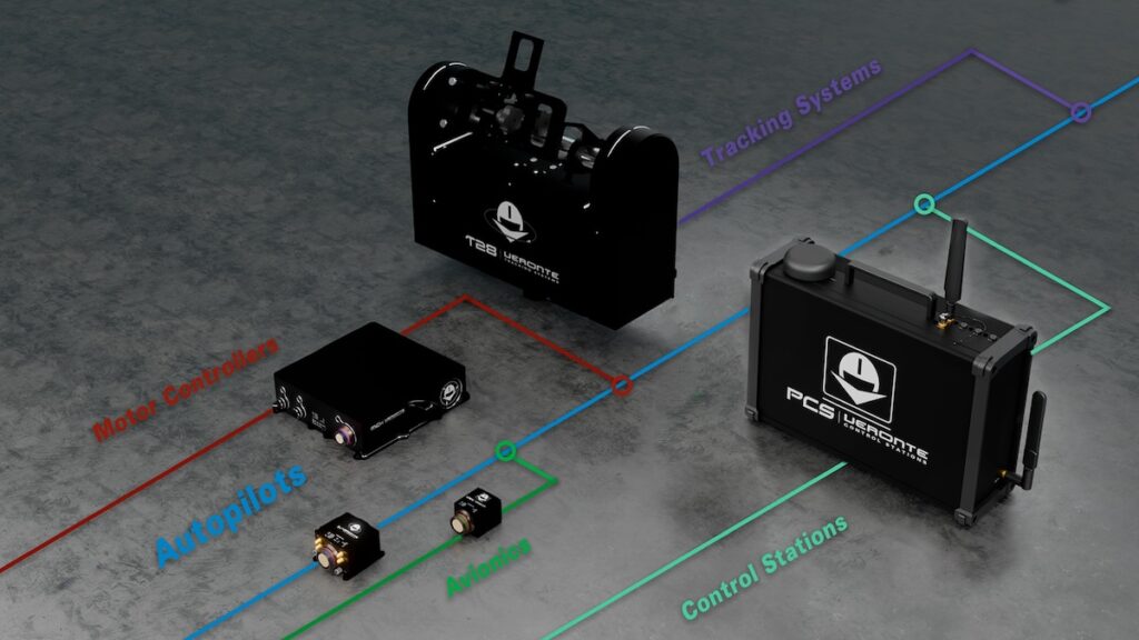
Embention’s Veronte Ecosystem integrates certified autopilots, avionics, and control technologies to deliver interoperable, safety-focused solutions for autonomous and advanced air mobility applications
SubC Imaging’s DVR+ Overlay supported deep-sea research on NORMAR’s Ægir 6000 ROV with automated still-image capture, multi-camera feed switching, customizable software settings, and live streaming, enabling documentation of seafloor habitats, geological structures, and underwater ecosystems
Aegiverse is advancing fiber optic gyro technology with compact, high-precision inertial sensors designed for integration into a wide range of unmanned platforms
In a recent white paper, Alpine Eagle outlines how integrating airborne counter-UAS systems could enhance NATO’s Eastern Shield against evolving low-cost aerial threats
Explore how Honeywell Aerospace' ONEBOX fuses robust navigation, secure computing, and compact design to support demanding unmanned operations and future air mobility needs
ROV pilot Max Jackson reveals how Oceanbotics’ SRV-8 supports reliable underwater inspections, pipe profiling, and hurricane-ready infrastructure across Florida
In this Q&A, members of the Zephyr team explore how the company’s advanced simulation platform combines realism, innovation, and user feedback to deliver adaptable, real-world drone training experiences
Aegiverse's SG-3A-EC is a compact single-axis closed-loop fiber optic gyro developed to provide reliable, high-accuracy angular velocity measurement for stabilization, control, and integration into advanced inertial systems and unmanned platforms
WISPR Systems quadcopter platform, SkyScout2, features faster setup, hot-swappable batteries, and advanced GNSS with seamless RTK & PPK integration to maximize operational efficiency
Micro Magic outlines how its 32-bit converter design enhances inertial signal capture through improved thermal stability, precise synchronization, and high-resolution measurement for demanding navigation applications
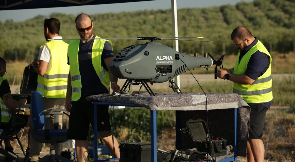
Alpha Unmanned Systems equips its rotary-wing UAVs with redundant autopilot and visual navigation technologies that sustain reliable ISR operations in GNSS-denied environments and increasingly contested electromagnetic conditions
American Lithium Energy advances lithium-metal and solid-state designs, delivering innovations in next-generation battery chemistry that increase energy output and strengthen safety performance
Inertial Labs, a VIAVI Solutions company, highlights how its drone-based reality capture technologies, integrating PNT, LiDAR, and cameras, are being used to map and support post-wildfire recovery and rebuilding efforts in Lahaina, Hawaii
Advancing Unmanned Systems Through Strategic Collaboration
UST works with major OEMs to foster collaboration and increase engagement with SMEs, to accelerate innovation and drive unmanned systems capabilities forward.