RIEGL introduced latest advancements at INTERGEO 2025, October 7-9, 2025, Germany, including a new airborne LiDAR bathymetry solution and UAV-based laser scanner.
Powered by Ultimate LiDAR Technology, RIEGL’s latest breakthroughs deliver impressive performance, precision, and versatility, setting new benchmarks in 3D data capture.

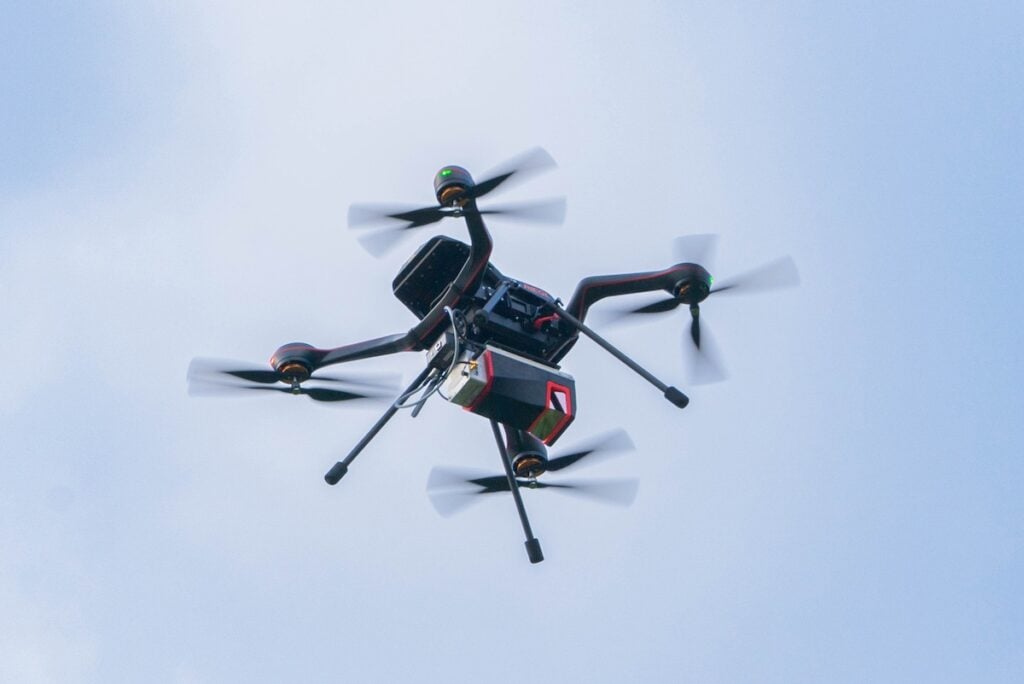
With the RIEGL VUX-820-G, RIEGL offers a new compact, fully integrated complete solution for surveying underwater structures and topography.
RIEGL’s “All-in” Package includes:
- Compact and powerful LiDAR sensor providing up to 2.2 Secchi depth
- RIEGL RiLOC-F-inside inertial navigation system
- An integrated RGB camera to complement the LiDAR data with imagery
- RIEGL’s proprietary software licenses for generating georeferenced and refraction-corrected point clouds
The compact design and the light weight of just 5.7kg / 12.5 lbs make the RIEGL VUX-820-G especially well-suited for use on UAVs. Extra features like a display and status LEDs enhance interactive handling and operation.
RIEGL RiLOC-F-inside
Last year, RIEGL presented its IMU/GNSS solutions RiLOC-E-25 and RiLOC-F at INTERGEO, enabling it to offer high-performance LiDAR sensors and matching IMU/GNSS solutions from a single source.

RIEGL now provides a new high-precision, fully integrated subsystem for localization and orientation, the RiLOC-F-inside IMU/GNSS solution for VUX-series laser scanners, that is fully integrated in the VUX-100-25, VUX-120-23, VUX-160-23 and VUX-180-24 UAV LiDAR sensors. It includes a high precision Micro Electro Mechanical System (MEMS) Inertial Measurement Unit (IMU), a GNSS unit, and corresponding software.
Redefining size, weight, and performance standards:
- High-precision positioning: 0.02 – 0.03 m (post-processed)
- No increase in system dimensions
- Minimal additional weight
- Tightly coupled IMU, GNSS, and LiDAR data
- Fully integrated into the RIEGL post-processing workflow
At INTERGEO, RIEGL also unveiled…

RIEGL’s VQ-1060, an integrated aerial mapping solution designed specifically for power line and corridor applications, seamlessly integrates multi-directional 3D laser scanning, forward and aft oblique RGB imagery, and nadir multispectral imaging into a single, streamlined platform.
The VQ-1060 provides ultra-high-resolution data with unmatched efficiency, all from a single instrument, for utility asset inspections, vegetation encroachment analysis, and corridor planning.
RIEGL VMX-3HA Mobile Mapping System

RIEGL’s new VMX-3HA Mobile Mapping System sets a new standard for high-speed, high-accuracy mobile LiDAR.
Powered by two RIEGL VUX-3HA laser scanners, it captures the full 360° environment with scanning speeds up to 6 MHz PRR and 800 lines per second, delivering dense, detailed data without slowing down.
Built for professionals in transportation, infrastructure, and environmental mapping, the VMX-3HA Mobile Mapping System combines speed, precision, and efficiency in one powerful system, ready to take on complex projects with confidence.
Part of the INTERGEO showcase was the new RIEGL website, a brand new unified global platform to explore RIEGL‘s latest innovations, product releases, and global support resources.