MicroStrain ROS driver version 4.0.0 key features include ROS standards compliance, enhanced GNSS capabilities, and support for 3DM-CV7-INS and 3DM-GV7-INS
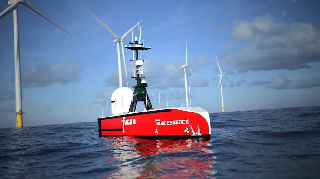
SubC Imaging provided Fugro with Real-Time Streaming and Audio Rooms technology to meet the key requirements for a fully remote offshore wind farm inspection
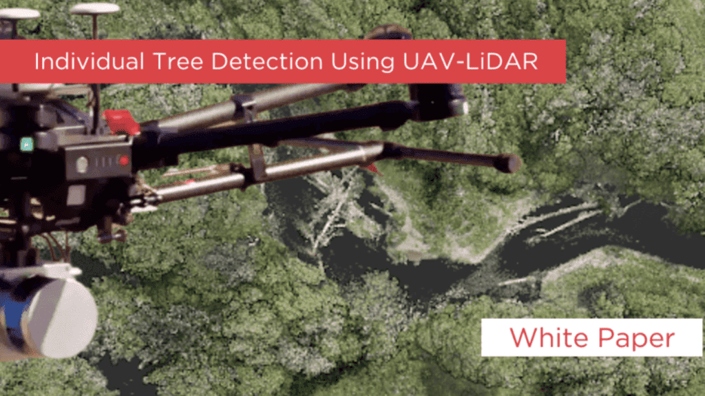
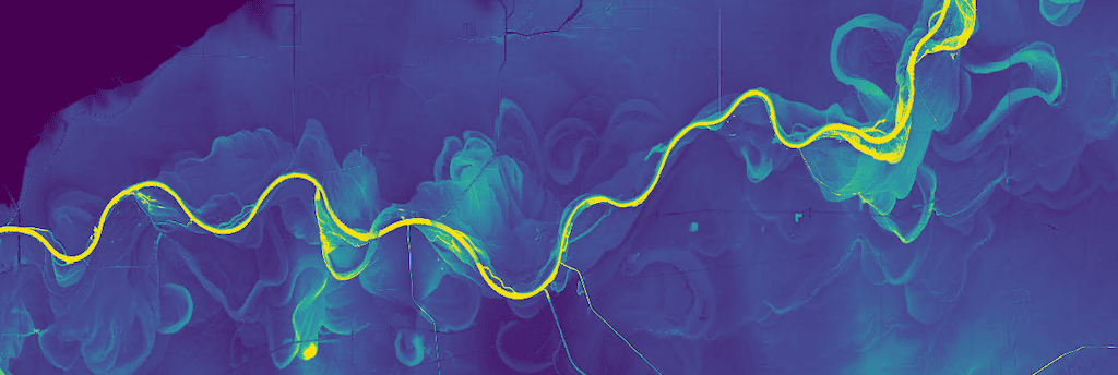
This white paper explains how to do ITD using LiDAR maps and images from UAVs equipped with Phoenix Scout LiDAR cameras, and also how to use open source software to process the data
Application note: MKS-Ophir believes the SWIR & NIR 25-250mm continuous zoom lens represents a paradigm shift in long-range detection and integration within small airborne systems
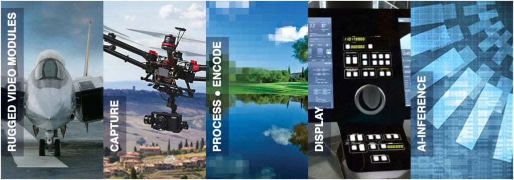
WOLF products range from extremely low power modules to industry-leading data analysis, processing and AI modules designed to meet the embedded systems SWaP-constrained requirements typically required by unmanned systems
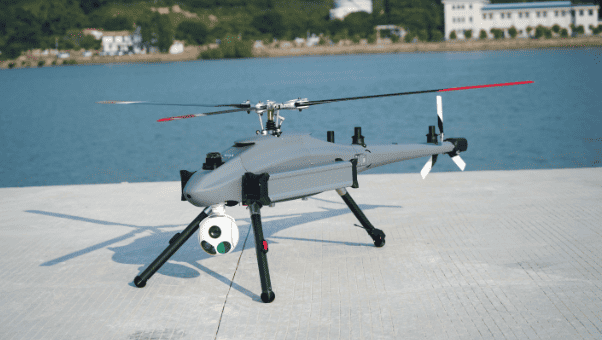
Ziyan's Falcon-10 UAV, with its agile maneuverability, high-altitude perspective, wide coverage, and extended endurance, emerges as the "Sky Guardian" in law enforcement
SEABOTS’ multipurpose USV SB 100 PRO equipped with a WASSP S3r multibeam echosounder aims to enhance the efficiency and ease of necessary port activities
Knight Optical believes the synergy between ROVs, AUVs, and cutting-edge optics is undeniable, and that optical components are pivotal to the systems’ functionality
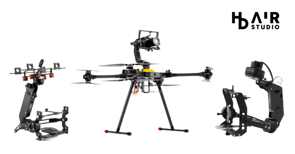
Kuba Jakubczyk from HD Air Studio sits down with UST to discuss the company’s custom drone gimbal stabilizers, the Sonda X8 foldable multi-mission X8 octocopter and upcoming projects in 2024
Blue Marble discusses the features of its GIS application, Global Mapper, which has complete interoperability with impressive data support, as well as extensive raster and vector capabilities
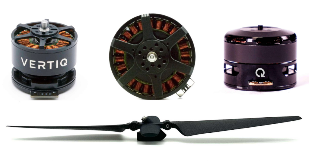
Vertiq is aiming to create the longest lasting motors and ESCs on the market with data from lifetime testing allowing the company to iterate on designs to further improve the reliability and longevity of the product
The company outlines the importance of proper water tank inspection and maintenance, including methods, regulations, and the ROVs that best suit the needs of different tanks
SEABOTS found that its multipurpose SB 100 PRO USV equipped with a WASSP S3R multibeam echo-sounder offered impressive performance in marine preservation tasks
Jon Broome co-founder and CEO at Vertiq takes timeout to talk with UST about the company’s unique NDAA-compliant propulsion solutions for aerial vehicles
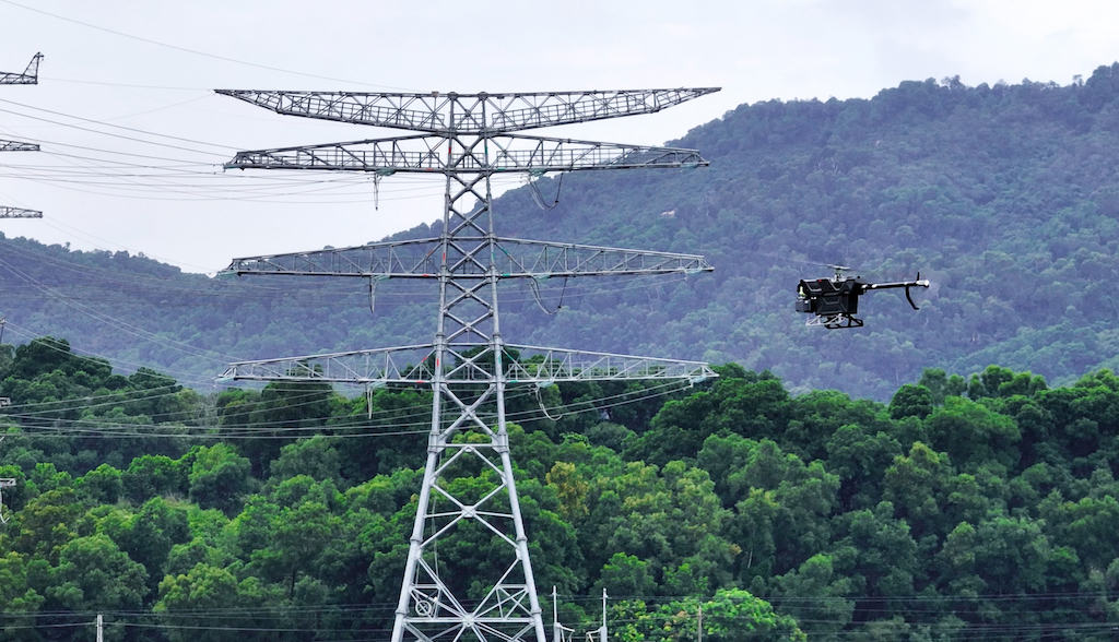
Ziyan outlines its aims to revolutionize how inspections are approached in the power and energy industries by elevating the intelligence of operations in the sector with its UAS
A Phoenix LiDAR has been used as part of research to protect the biologically diverse savanna from further human impacts, restore native species, & increase CO2 absorption
u-blox’s OpenMower delivers centimeter-level positioning accuracies, with real-time kinematic (RTK) GNSS receivers guiding robotic lawnmowers so they never mow the same place twice
Elsight discusses the use of the FAA’s Type Certification process as a method of facilitating growth in the drone industry, approving UAV design similarly to aircraft in manned aviation
Elsight delves into the increase in drone numbers that comes with an inevitable inflation of collision risk – with people, property, other UAVs, or with manned aircraft
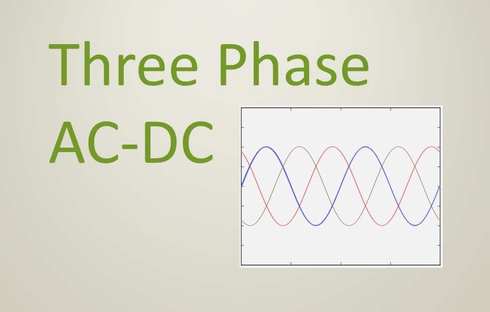
Aegis specializes in creating three-phase AC-DC power supplies with high power output levels, operating frequencies of 60Hz or 400Hz, smart monitoring technologies, and other features
Seabots' case study discusses the deployment of the company's SB 100 PRO unmanned surface vehicle (USV) in the Port of Barcelona for water analysis and multibeam bathymetry
Advancing Unmanned Systems Through Strategic Collaboration
UST works with major OEMs to foster collaboration and increase engagement with SMEs, to accelerate innovation and drive unmanned systems capabilities forward.