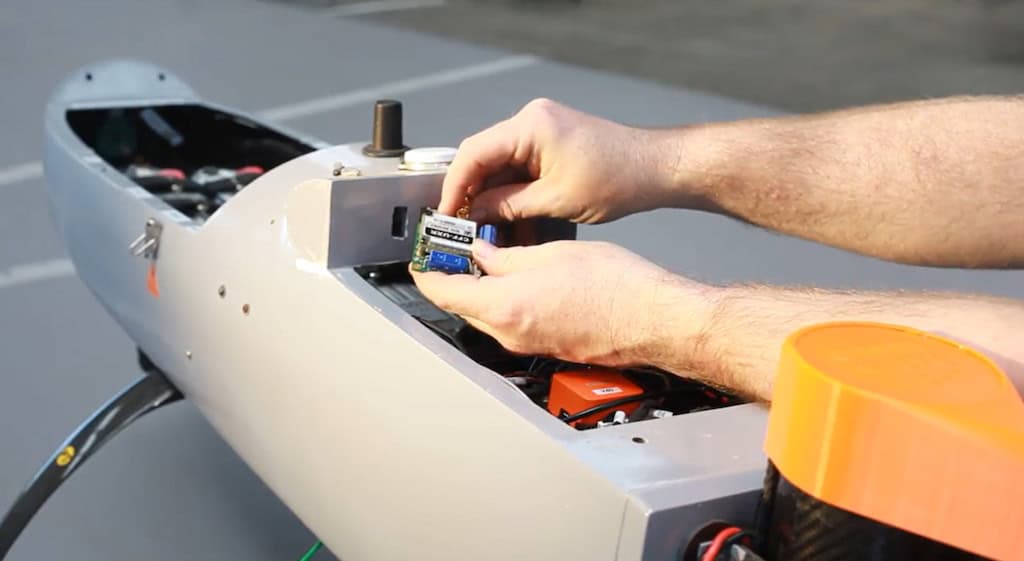
Ainstein has released an article discussing the benefits of its LR-D1 Pro radar altimeter, detailing how it integrates with UAVs, who it’s ideal for, and the overall reasons to use a radar altimeter
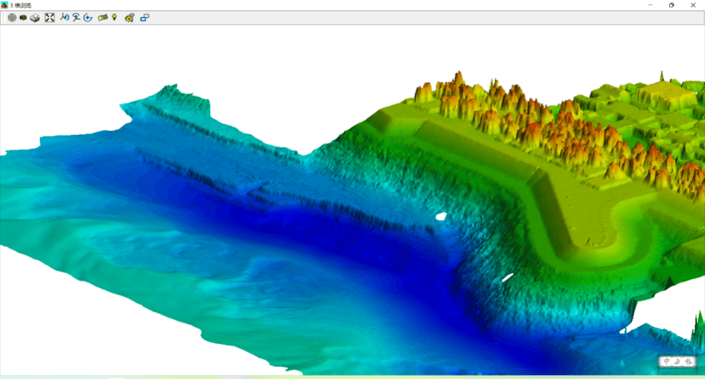
Hydro-Tech have released a paper outlining the company’s bathymetric survey of the Yellow River, utilizing their MS400U multi beam echo sounder and an unmanned surface vessel
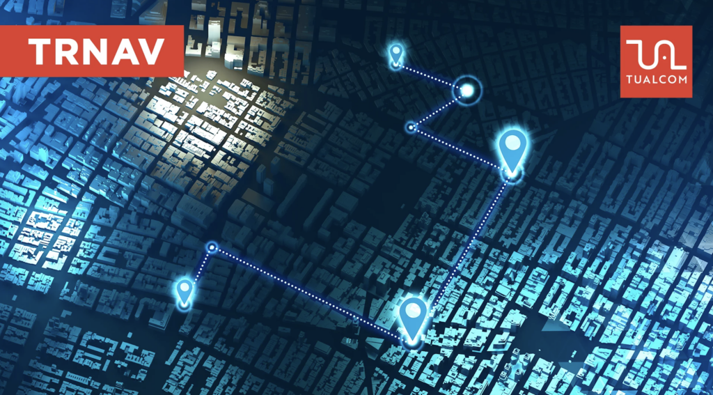
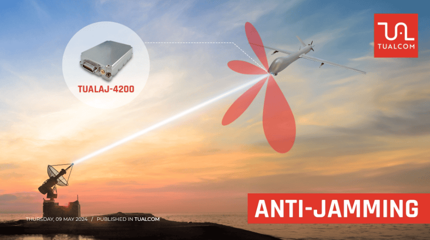
TUALCOM has developed the TRNAV system in response to the deficiencies of GNSS based navigation, providing accurate and reliable positioning information in challenging environments
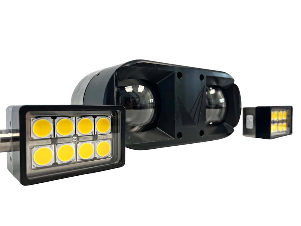
Nanomotion outlines the capabilities and benefits of its Velox EOIR camera gimbal, a gyro-stabilized platform equipped with visible and thermal cameras for impressive clarity and stability
WISPR Systems delves into the technology behind LiDAR payloads and the capabilities they provide, including a comparison study using its Ranger Pro drone integrated with Inertial Labs’ RESEPI XT-32 and RESEPI M2X
Ground Control outlines the ways their BVLOS communication technology is transforming UAV logistics, particularly in areas like medicine delivery and offshore infrastructure monitoring
SubC Imaging has released a case study discussing the effectiveness of its Digital Video Recorder (DVR) system for Ocean Infinity’s robotic vessels, providing a robust and adaptable video system to enhance subsea inspections
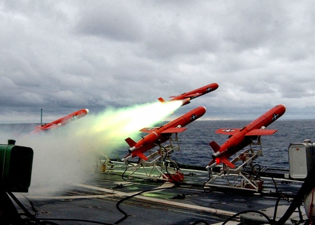
Tundra Drone discusses drone lights in law enforcement, which can help to illuminate crime scenes for forensic analysis, assist in traffic management during accidents, and provide tactical support during high-risk operations
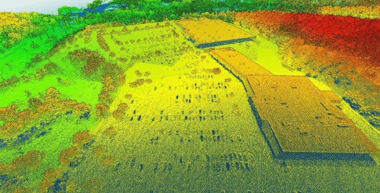
A topographic map can be created from a point cloud in Global Mapper Pro, learn how to create your own in the latest article from Blue Marble Geographics
Ground Control is providing its RockBLOCK global satellite connectivity solution to LOHAN, a project aiming to launch a glider from a high-altitude balloon at the edge of space
From unmanned vehicles to critical military operations, learn how Aided Inertial Navigation Systems (AINS) sets new standards for accuracy and dependability
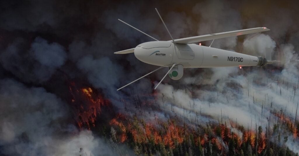
Designed for low altitude flights and precise positioning, Ainstein explores the advantages of using its US-D1 radar altimeter in drones for forestry management and wildfire surveillance
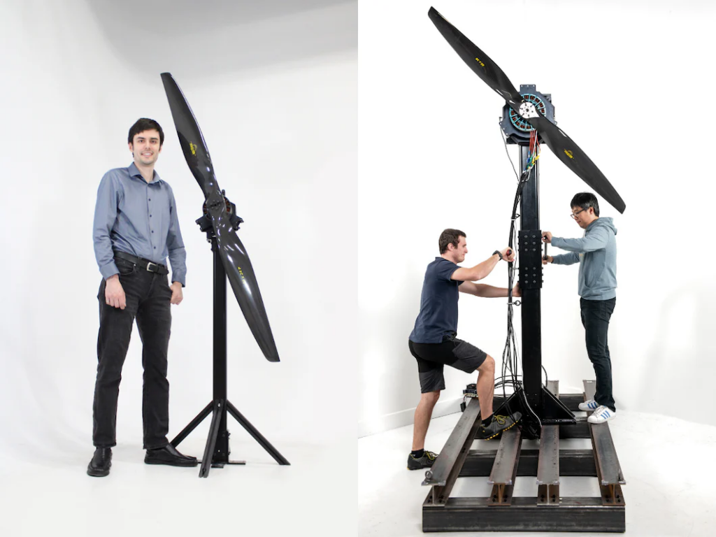
Drawing on its drone motor and propeller test stand technology, Tyto Robotics has conducted a comparison study of a range of large and powerful brushless motors
LCR Embedded Systems has explored thermal management strategies for VPX and SOSA aligned systems, addressing chassis and module design considerations to mitigate internal cooling
Skydio discusses the benefits of using security drones to respond to border emergencies and for border patrol, outlining the reality of rapid responses at the US border
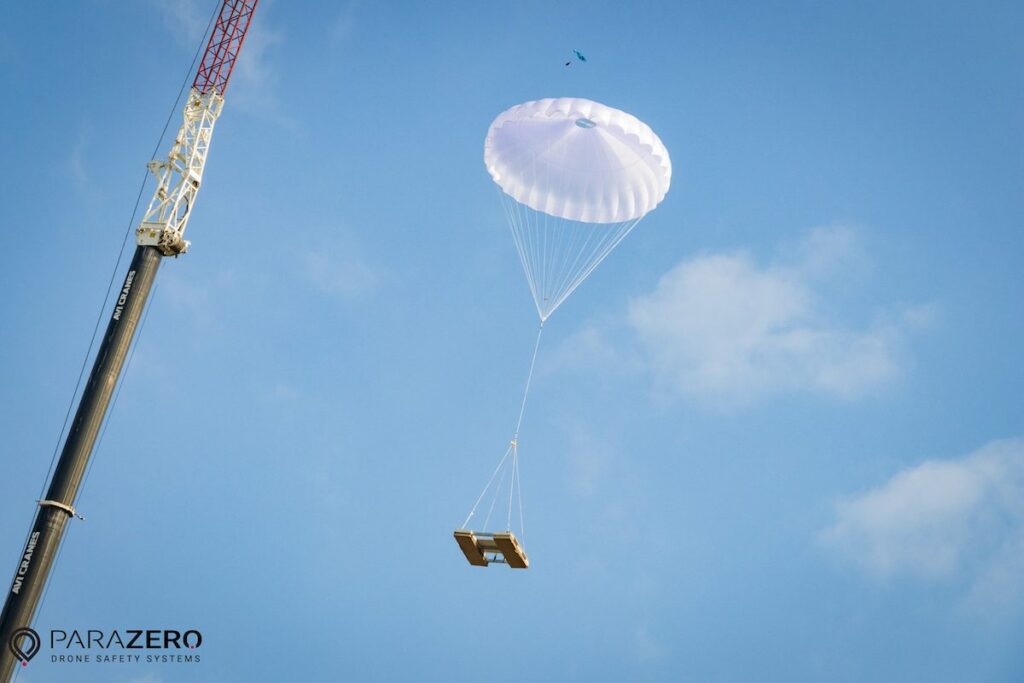
ParaZero discusses the importance of crane drop-testing for real-world parachute evaluation, using its SmartAir Pro flight computer to monitor key parameters that are crucial for safe drone operations
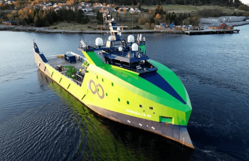
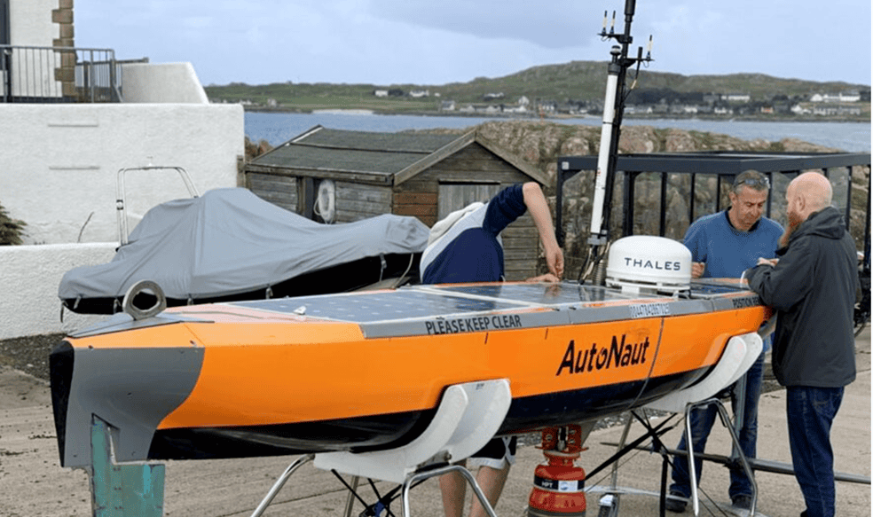
Dynautics outlines control system technology for wave-powered USVs, detailing the benefits of its ‘power generation controller’ and using wave energy for propulsion
Find out how VPX and SOSA standards are contributing to the MOSA approach in this article by LCR Embedded Systems, including the goal of open standards and the benefits of each standard
Revector discusses the factors at play in the operational costs of search and rescue missions, and posits IMSI technology used on UAVs as a potential method of reducing these costs
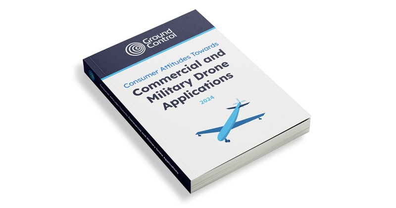
Ground Control surveys 500+ American adults to find out if people felt more or less comfortable about commercial vs military drone applications, and whether the benefits outweighed their reservations
Voyis outlines how crucial dams are in the protection of communities and infrastructure, and how to inspect them most effectively with underwater optical sensors so they can remain safe
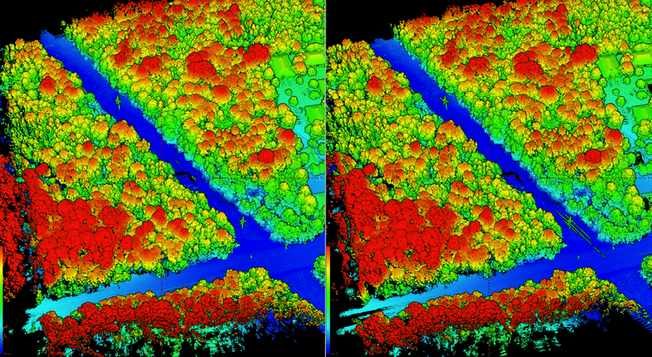
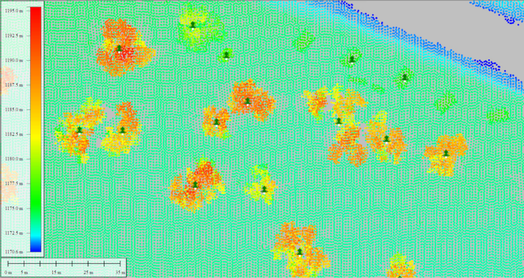
Blue Marble Geographics has released the v25.1 release of Global Mapper Pro, featuring an updated Compare Point Cloud tool that can be used for identifying changes in tree height by comparing point clouds to terrain
Ainstein has released an article outlining the use of its US-D1 altimeter in crop-spraying drones, including its benefits, ideal uses, and how it works on UAVs and agrodrones
Advancing Unmanned Systems Through Strategic Collaboration
UST works with major OEMs to foster collaboration and increase engagement with SMEs, to accelerate innovation and drive unmanned systems capabilities forward.