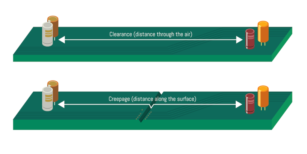
San Francisco Circuits has released an article outlining how PCB Line Spacing is critical for both safety and function in high voltage circuitry, as well as the specific spacing standards required
The in-vehicle AI-aided VTC 7260-xC4 telematics computer from NEXCOM is designed for smart public transport and warehouse automation, featuring 11th Generation Intel® Core™ i7-1185GRE processing
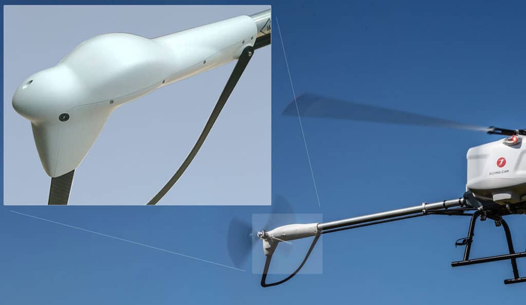
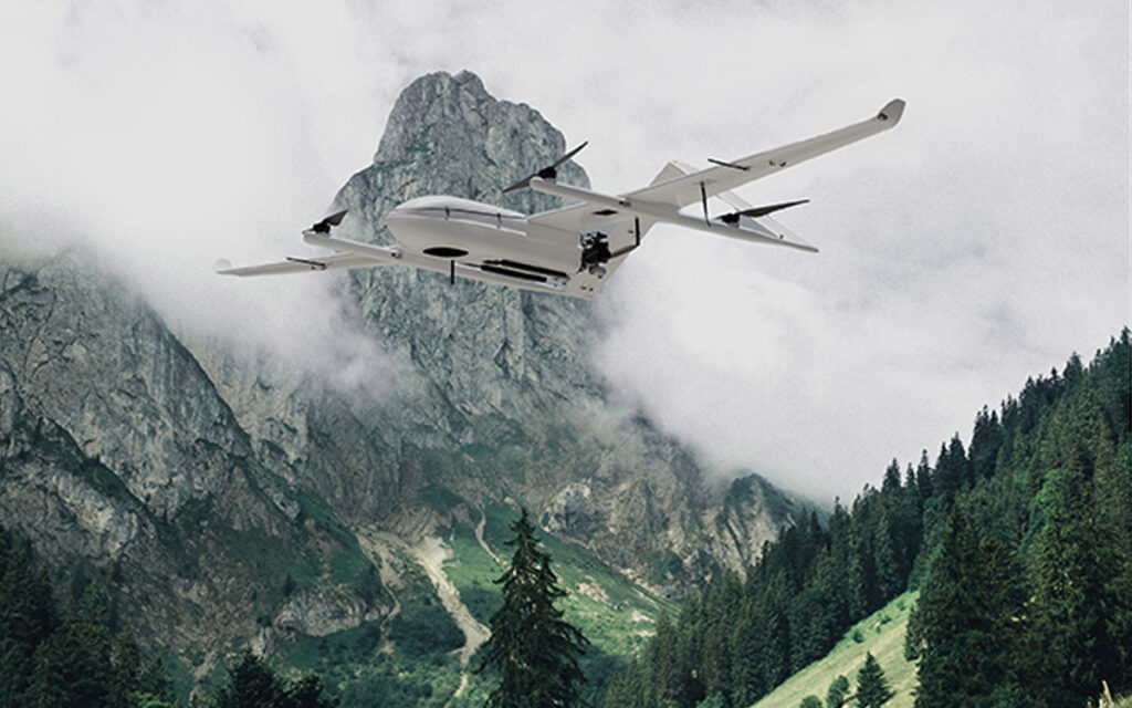
Flying-Cam turns to CRP Technology and its advanced 3D printed solutions in Additive Manufacturing and composite materials in order to complete the construction of the Discovery UAS
Inertial Labs has discussed the role of its Kernel IMUs, INS, and AHRS in autonomous vehicle navigation, bringing enhanced orientation and positioning capabilities to self-driving systems
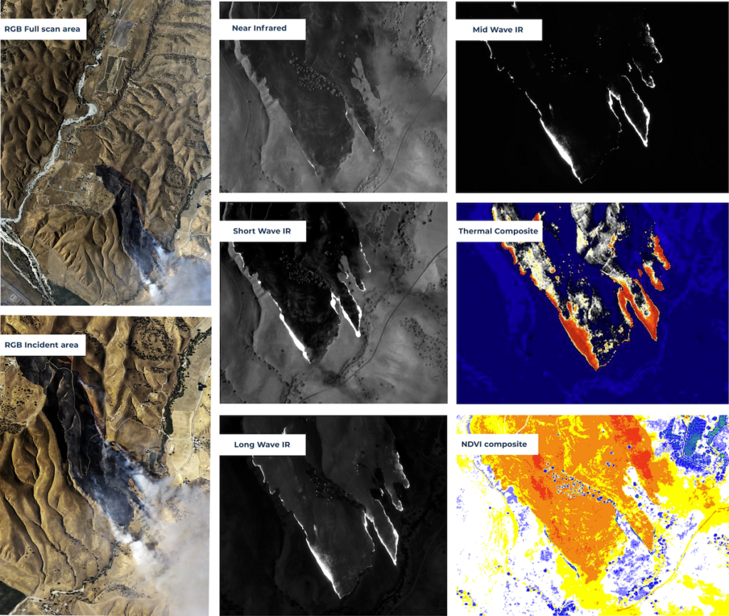
Overwatch Imaging has compared different spectral bands for capturing detailed images of wildfires, discussing the advantages of each wave length to penetrate smoke density and observe environmental conditions
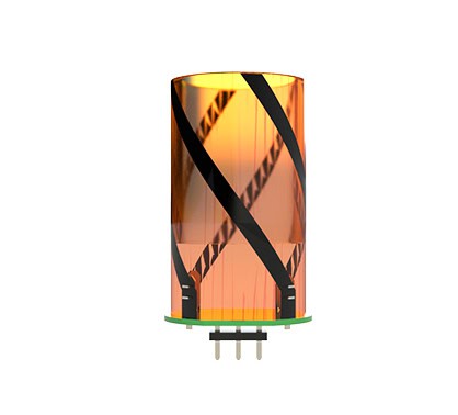
Alva Industries has outlined the FiberPrinting™ process, its new production method for slotless and ironless electric machines, enhancing performance and efficiency while enabling scalable and flexible manufacturing
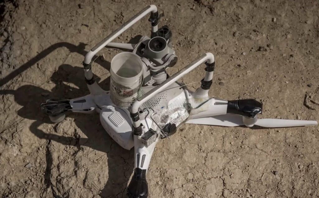
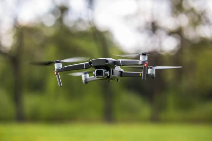
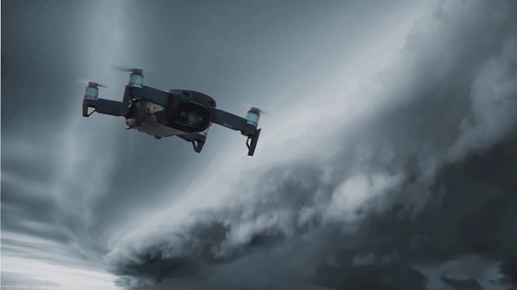
D-Fend Solutions has outlined the threat of commercial drones to naval ships, detailing vulnerabilities around modern vessels, and expanding on the growing need for RF Cyber C-UAS systems
Ainstein outlines how its LR-D1 radar altimeter is ideal for geophysical surveying and mapping missions, functioning onboard UAVs to report altitude at an update rate of 40 Hz, even in harsh conditions
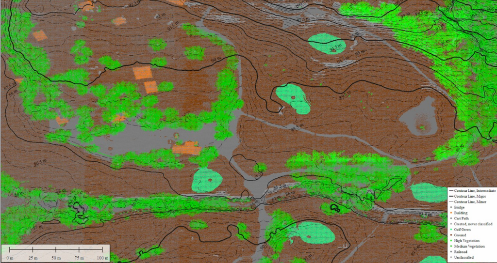
Blue Marble Geographics explores how Global Mapper Pro's latest features streamline the process of sub-classifying point clouds, enabling users to achieve higher levels of precision and efficiency in geospatial projects
Hargrave Technologies has clarified key information around brushless DC motor (BLDC) electronic speed controllers (ESCs), detailing the intricacies of powering ESCs and how the company rates them
Greensea IQ has released a research paper outlining the positive effect that their EverClean hull cleaning robot had on the greenhouse gas emissions of two international shipping vessels
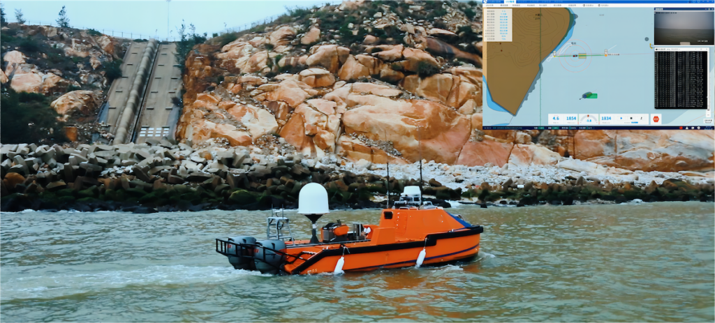
Hydro-Tech has released a paper outlining the process of efficiently surveying a 830 square kilometer reservoir in China using the MS400U multibeam echosounder and a small USV
TUALCOM discusses the advantages of using CRPA antennas for applications requiring anti-jamming technology, designed to receive and process GPS/GNSS signals in a way that minimizes interference and maximizes accuracy
D-Fend Solutions has discussed the threats that cheap and small commercial drones are posing to armed forces, expressing a need for counter-drone systems worldwide, and outlining recent security breaches in military airspaces
OceanAlpha explores the advantages of using unmanned surface vehicles (USVs) for subsea inspection, diving into a recent mission where its L25 USV effectively mapped the area around an undersea pipeline
Intelligent Energy’s new case study looks at their collaboration with ISS Aerospace and the benefits of having fuel cells and hydrogen cylinders on UAVs, as well as alternative options
Tundra Drone discusses the regulations surrounding night flights for drones, covering the importance of drone lights for nighttime operations and how Tundra Drone lighting meets regulatory requirements
HZO discusses the various conformal coatings that can protect drones operating in adverse environments, and outlines the benefits of its Parylene coating properties for drones
Maxtena has released a whitepaper comparing patch and helix antennas in reference to multipath propagation, outlining the advantages of both antennas and evaluating their performance
CENTUM has released data from search and rescue missions that have used Lifeseeker, the company’s airborne phone location system that provides fast and accurate geolocation
Greenroom Robotics has discussed the process of developing maritime autonomy software, detailing the regulatory hurdles, operational challenges, and how its GAMA software addresses these complexities
Advancing Unmanned Systems Through Strategic Collaboration
UST works with major OEMs to foster collaboration and increase engagement with SMEs, to accelerate innovation and drive unmanned systems capabilities forward.