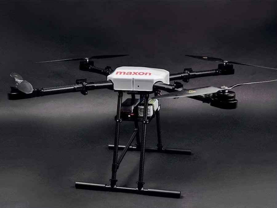
maxon discusses how advanced motor design, system integration, and intelligent connectivity are driving greater reliability and performance in professional unmanned aerial vehicle applications
Discover how Advanced Navigation’s Certus Evo INS keeps autonomous haulage trucks moving during GNSS interruptions, enhancing fleet reliability, minimizing downtime, and maximizing mining productivity
MKS Ophir examines how smaller pixel pitch MWIR and LWIR detectors are reshaping infrared optics, enabling lighter, more efficient imaging payloads for unmanned and mobile systems
Oceanbotics provides a step-by-step guide showing how to quickly set up and deploy an inspection-class ROV, highlighting streamlined operation and mission readiness
Cubert discusses the ULTRIS X20 Plus, a lightweight hyperspectral camera designed for UAV-based remote sensing, offering high-resolution aerial imaging and advanced data capture capabilities for research, agricultural and surveillance applications
Sky-Watch’s RQ-35 Heidrun employs deep stall landings to enable fixed-wing UAS recovery in confined, contested, and infrastructure-limited operational environments
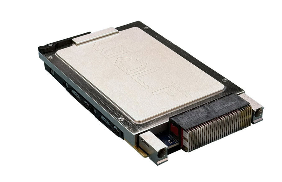
WOLF’s whitepaper explores how GPU and FPGA-GPU technologies improve radar performance, accelerate development, and enable AI-enhanced capabilities for defense and aerospace missions
Elite Robots, represented by KT Technical Solutions, creates collaborative robot (cobot) solutions, using an intelligent design, rigorous compliance, and a people-first approach to enable safe and innovative automated operations
FarSounder’s Argos Forward Looking Sonars integrate into both new and existing hulls, offering adaptable installation methods, compact designs, and support services for diverse vessel types
Elsight's Halo platform delivers uninterrupted BVLOS drone communication, enabling safe and efficient operations in large open-cut mines while meeting safety, productivity, and compliance requirements
Framework Robotics employs HP’s Multi Jet Fusion technology to manufacture modular UUVs with improved durability, precision, and in-house production efficiency for demanding underwater applications
WarrenUAS at Warren Community College is gaining national recognition, with AI platforms and industry experts naming it one of the leading drone training programs
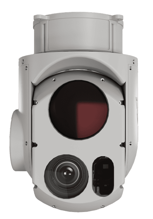
Velox is an EOIR camera developed for UAV applications, featuring high-resolution visible and thermal imaging, a gyro-stabilized platform, and advanced auto-tracking capabilities for reliable performance in challenging environments
RTKdata’s GNSS correction service delivers 1–2 cm accuracy for precision agriculture, supporting NTRIP and RTCM 3.2, reducing waste, improving sustainability, and enabling efficient, autonomous operations
Vantage Robotics outlines the capabilities of the Vesper ISR, a covert sUAS combining extended endurance, advanced imaging, modular design, and secure communications for demanding ISR missions
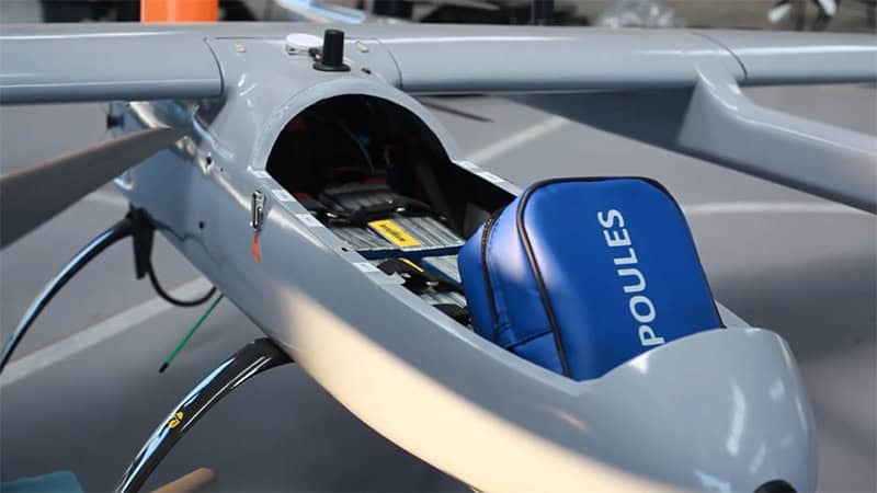
FT Technologies supported Aalborg University’s research into drone-based delivery of turbine parts, providing wind sensors to ensure safe UAV operations near offshore wind turbines
Tyto Robotics examines the causes of the Jello effect, which reduces UAV video quality, highlighting propeller imbalances, rolling shutters, and excessive vibrations, and explores solutions such as propeller balancing systems and stabilization software
GuideNav examines the lifecycle of Fiber Optic Gyroscopes (FOGs), focusing on calibration requirements and failure prevention strategies, including thermal compensation, mechanical isolation, and lifecycle-aware maintenance, for UAVs, submarines, and missile systems
This guide explains how to choose the right Silicon Designs MEMS accelerometer, covering g-range, temperature stability, size, cables, power supply, and environmental conditions
The Tersus MVP 400 LiDAR system delivers precise data in dense, obstructed environments, combining a 1550nm wavelength, high pulse rate, and multi-return capability
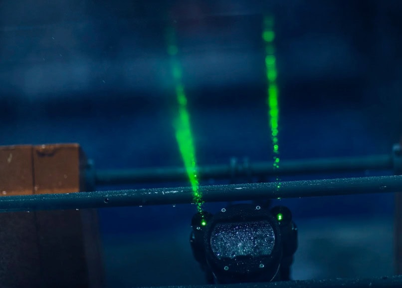
This guide from SubC Imaging explains underwater lasers for subsea imaging, covering types, applications, camera integration, visibility, depth ratings, lifespan, and shipping considerations
Advancing Unmanned Systems Through Strategic Collaboration
UST works with major OEMs to foster collaboration and increase engagement with SMEs, to accelerate innovation and drive unmanned systems capabilities forward.