High-Performance Synthetic Aperture Radar (SAR) for Unmanned Aerial Vehicles (UAV)

United States of America
IMSAR

High-Performance Synthetic Aperture Radar (SAR) for Unmanned Aerial Vehicles (UAV)

IMSAR is democratizing radar by producing Low Size, Weight and Power (Low SWaP) synthetic aperture radar systems to be integrated with unmanned aerial vehicles and drones. Our lightweight, compact radars complement EO/IR and electronic warfare (EW) payloads and provide advanced geospatial intelligence capabilities typically reserved for use on much larger platforms, in all weather conditions, day or night.

Synthetic Aperture Radar

IMSAR’s radar ecosystem allows users to plan their flights, collect images, and turn radar returns into actionable intelligence with a variety of easy to interpret data products such as high-resolution SAR images, Coherent Change Detection (CCD) products, and Moving Target Indicator (MTI) feeds.

NSP-2 Synthetic Aperture Radar

Multi-mode & multi-domain UAV SAR

Multi-mode & multi-domain UAV SAR

Designed for Group 1 and 2 UAS, the NSP-2 is an extremely lightweight multi-mode SAR/GMTI payload that provides actionable intelligence for ground and maritime environments.

SAR for Group 1-2 uncrewed airborne platforms

Requiring only power and Ethernet, the easy-to-operate NSP-2 can be controlled via our intuitive Lisa 3D Command and Control (C2) and Processing, Exploitation, and Dissemination (PED) software. A Radar Control API is also available for easy integration with third-party and custom-developed software suites.

The NSP-2 can be connected to a Ground Processing Server via a datalink for real-time data processing, or radar data can be stored onboard the pod for post-mission processing.

NSP-3 Synthetic Aperture Radar

All-weather multi-mode SAR for UAVs

multi mode SAR

The NSP-3 is an all-weather multi-mode SAR designed for land and maritime operations both during the day and at night. The low-SWaP (size, weight and power) system is available in a Mod-Payload configuration, which allows the NSP-3 to be easily integrated with the antenna pod mounted externally and the electronics inside the fuselage, or with any custom mounting arrangement.

NSP-3 Synthetic Aperture Radar

Requiring only power, ethernet, and a connection to a GPS antenna, the easy-to-operate NSP-3 can be controlled via our intuitive Lisa 3D Command and Control (C2) and Processing, Exploitation, and Dissemination (PED) software. A Radar Control API is also available for easy integration with third-party and custom-developed software.

The NSP-3 can be connected to a Ground Processing Server via a datalink for real-time data processing, or radar data can be stored onboard for post-mission processing.

NSP-5 Multi-Mode Radar

Tactical MTI SAR for land and maritime operations

Tactical MTI SAR
NSP-5 Multi-Mode Radar

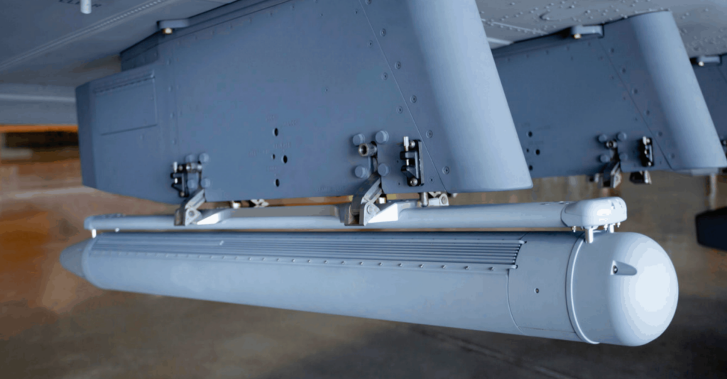
The NSP-5 is a low SWaP multimode SAR/MTI radar system designed to gather real-time actionable intelligence when employed with tactical UAVs for both land and maritime environments. Built into a rugged weatherproof pod, the system can be installed via a quick-connect rail with blind mate connections, a strongback rail, designed into a payload bay, or even as a quick attach/release with MIL-Spec 14” lug mounts.

Requiring only power and ethernet, the easy-to-operate NSP-5 can be controlled via our intuitive Lisa 3D Command and Control (C2) and Processing, Exploitation, and Dissemination (PED) software. A Radar Control API is also available for easy integration with third-party and custom-developed software suites.

The NSP-5 can be connected to a Ground Processing Server via a datalink for real-time data processing, or radar data can be stored onboard the pod for post-mission processing.

Command and Control (C2) and Processing, Exploitation, and Dissemination (PED) software

NSP-7 Long-Range Radar

Extended-range SAR for large UAVs

NSP-7 Long-Range Radar
Long range synthetic aperture radar

The NSP-7 is an extended-range multi-mode SAR designed for larger UAVs. Capable of imaging at distances of up to 55 km at a 1 metre resolution, it provides high-performance intelligence-gathering capabilities during the day or at night under all weather conditions.

The NSP-7’s rugged weatherproof pod requires only power, ethernet and a connection to a GPS antenna, and can be attached with MIL-Spec 14” lug mounts or via an adapter plate to the pod’s strongback rail. We can also design custom integration solutions for specific UAVs.

The easy-to-operate NSP-7 can be controlled via our intuitive Lisa 3D Command and Control (C2) and Processing, Exploitation, and Dissemination (PED) software.

Developers can also take advantage of a Radar Control API for easy integration with custom-developed or third-party software.

High-performance SAR

The NSP-7 can be paired with either an onboard Airborne Processing Server, or via a datalink to a Ground Processing Server, for real-time data processing. Radar data can also be stored on board the pod for post-mission processing.

PSAR Stratospheric Radar

Multi-mode synthetic aperture radar for stratospheric UAVs

PSAR is a low-SWaP SAR designed to provide imaging capabilities to HALE (high-altitude long endurance) UAVs, HAPS (high-altitude pseudo-satellites), unmanned balloons and other stratospheric platforms previously unable to carry radar sensors.PSAR Stratospheric Radar

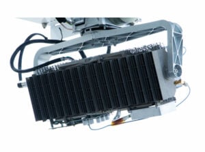
Based on our military-proven NanoSAR technology, the innovative system uses a low-loss, additive-manufactured aluminum antenna as a structural and thermal component as well as transmitting and receiving radar signals, saving space and weight. The unit can be connected to a Ground Processing Server via a datalink for real-time data processing.

PSAR can be controlled via our intuitive Lisa 3D Command and Control (C2) and Processing, Exploitation, and Dissemination (PED) software. A Radar Control API is also available for easy integration with third-party and custom-developed software suites.

Lisa 3D – C2 & PED Software for actionable intelligence

Fully integrated mission planning and multi-sensor data processing

Fully integrated mission planning software

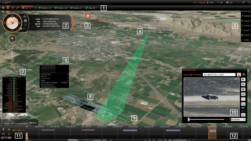
Lisa 3D is a fully integrated software package that provides intuitive mission planning and data handling for multiple sensors. It allows operators to perform real-time analysis of data from radars, EO/IR payloads, vessel AIS and a variety of other sources and generate actionable intelligence for improved decision-making.

Drone operators can create detailed data collection plans for multiple sensors and modes, and use these to generate flight plans. Lisa 3D provides real-time tracking of sensors and monitoring of flight characteristics, and mission plans and collection modes can be dynamically altered on the fly.

Lisa 3D supports a wide range of file types for import and export, and data products from multiple sensors can be easily viewed, annotated and marked.

Applications & Capabilities

Maritime Monitoring

Our SAR systems allow UAVs to monitor maritime and littoral environments with wide-area searches, automatically detecting objects and discerning vessels and semi-submersibles from background sea clutter.

Maritime Monitoring Radar
MMTI Radar

Moving Target Indication (MTI)

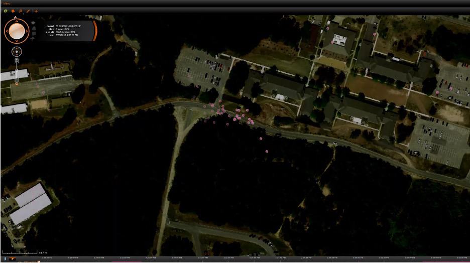
Using multiple receive antennas along the length of a UAV, MTI radar systems can analyse the Doppler effect of the reflected signals, distinguishing between moving and stationary objects and providing real-time tracking of multiple fast and slow moving targets.

Moving Target Indication (MTI) Radar
MTI radar system

Coherent Change Detection (CCD)

CCD uses images of the same scene captured during multiple UAV flights and calculates the changes that have occurred over time, providing vital intelligence that may be missed in a single pass.

Coherent Change Detection (CCD) Radar
CCD Radar

Products

Lisa 3D - C2 & PED Software for actionable intelligence

Fully integrated mission planning and multi-sensor data processing

NSP-2 Synthetic Aperture Radar

Multi-mode & multi-domain UAV SAR

PSAR Stratospheric Radar

Multi-mode synthetic aperture radar for stratospheric UAVs

NSP-5 Multi-Mode Radar

Tactical MTI SAR for land and maritime operations

NSP-7 Long-Range Radar

Extended-range SAR for large UAVs

NSP-3 Synthetic Aperture Radar

All-weather multi-mode SAR for UAVs

Articles

Latest
Democratizing Radar Technology: IMSAR’s Approach to Advancing SAR Systems

IMSAR is redefining radar accessibility with compact Synthetic Aperture Radar (SAR) systems, ideal for unmanned and manned platforms across various applications

Jan 02, 2025
IMSAR’s Advanced Synthetic Aperture Radar Integrated with Schiebel’s Unmanned Helicopter

IMSAR's advanced Synthetic Aperture Radar (SAR) technology enhances Schiebel’s CAMCOPTER S-100 with high-resolution imaging, Ground Moving Target Indication (GMTI), and all-weather operational capabilities

Dec 19, 2024
Low-SWaP Synthetic Aperture Radar Systems for UAVs

IMSAR's systems complement EO/IR and EW payloads and provide smaller UAVs with advanced geospatial intelligence capabilities typically reserved for use on much larger platforms

Dec 09, 2024
IMSAR Supports EMSA RPAS in Maritime Surveillance Operations

Synthetic Aperture Radar by IMSAR is supporting the European Maritime Safety Agency (EMSA) on Textron Systems’ Aerosonde unmanned aircraft flying over the East Baltic Sea region in support of national authorities in Finland, Estonia and Latvia

Jun 24, 2022
IMSAR Radar System Integrated into AIMS-ISR Product Suite

The integration, to be developed by CarteNav, will deliver low SWaP-C multimode radar capabilities with OEM engineering support and expertise provided by IMSAR for crewed and uncrewed ISR surveillance platforms

Jun 07, 2022
IMSAR Upgrades SAR & MTI Radar

IMSAR has released a new Block II variant of its NSP-7 Synthetic Aperture Radar (SAR)/Moving Target Indication (MTI) system. The...

Sep 02, 2021
Enhanced Long-Endurance Surface Search Demonstrated with Group III UAS

IMSAR, in conjunction with Vanilla Unmanned, has successfully demonstrated enhanced long-endurance surface-search using a Group III UAS (unmanned aerial system)...

Aug 13, 2021
Whitepaper: Radar Solutions for Maritime Applications

IMSAR has released a whitepaper illustrating the application of high-performance, low-SWaP (Size, Weight, and Power), and low-cost airborne Synthetic Aperture...

Jul 29, 2021
IMSAR Develops High-Performance Synthetic Aperture Radars for UAVs

IMSAR, a leading developer of low-SWaP (size, weight and power) synthetic aperture radar systems for unmanned aerial vehicles, has partnered...

Oct 20, 2020
SAR Imaging System Integrated into Long-Endurance Hybrid Multirotor UAS

Skyfront has partnered with IMSAR to integrate a synthetic aperture radar (SAR) imaging system into Skyfront’s Perimeter 8 long endurance...

Aug 17, 2020
3D Printed Radar Array Developed for HALE UAS

IMSAR and antenna manufacturer Optisys have collaborated to create a low-Size, Weight, and Power (SWaP) radar designed specifically for use...

Jun 18, 2019
US Marine Corps Selects SAR Payload for Blackjack Tactical UAS

IMSAR has announced that its NSP-5 Synthetic Aperture Radar (SAR) system has been configured for unmanned aircraft systems (UAS) usage...

Apr 09, 2019
IMSAR Announces Extended Range Imaging Radar for High Altitudes

IMSAR has announced that it is expanding its line of miniaturized synthetic aperture radar (SAR) systems to include a new...

Oct 13, 2017
IMSAR to Launch Collision-Avoidance Radar for Small UAS

IMSAR LLC, a developer of Synthetic Aperture Radar (SAR) devices and radar image processing technology, has announced that its family...

Oct 07, 2015
Regional Offices & Locations
IMSAR, LLC United States of America Springville, UT, USA +1 801-798-8440 Contact Website