SBG Systems has announced details of an upcoming webinar, in which they will reveal new features of its popular Qinertia INS/GNSS PPK software, specifically designed for UAV photogrammetry.
The webinar will explain how Qinertia can dramatically reduce GCP need and maximize ROI with an optimal workflow, demonstrated with a DJI Phantom 4 RTK.
UAV-based photogrammetry is a booming sector where technology allows economical and large-scale data collection. Solutions are evolving quickly to meet the needs of geospatial professionals, who require a smooth and efficient workflow with the highest levels of accuracy.
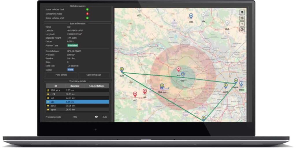
With the new version of Qinertia, SBG Systems continues to democratize access to centimeter level accuracy to all photogrammetry applications. The unique Qinertia Virtual Base Station (VBS) and PPP solutions enable photogrammetry jobs in even the most remote locations.
To discover the optimal workflow for your UAV, attend SBG’s webinar on July 1st at 17:00 CEST (UTC+2). Register here >
Agenda:
- How precise image geotagging is becoming a standard for UAV photogrammetry jobs: quality assessment with DJI Phantom 4 RTK data
- Why PPK is the best choice for photogrammetry jobs?
- Discover the ideal workflow with Qinertia and PIX4D through a live demo
- Q/A
What is Qinertia Post-processing for UAV Photogrammetry?

After the mission, Qinertia gives access to RTK corrections from more than 7,000 base stations located in 164 countries. Trajectory and orientation are then greatly improved by processing inertial data and raw GNSS observables in forward and backward directions. New features dedicated to photogrammetry, such as image geotagging and specific outputs, are to be announced during the webinar.
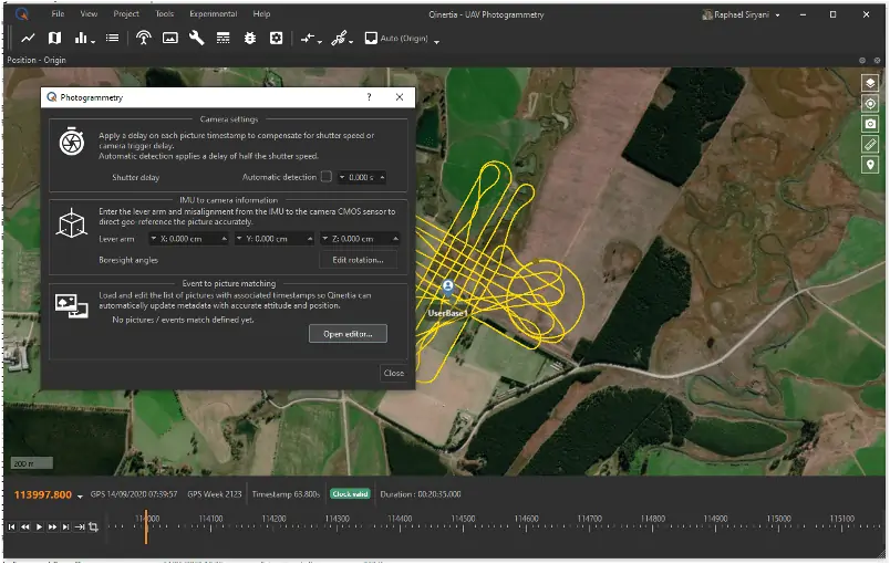
In Qinertia, JPG are directly read, and geo-tagged images are easily editable and exportable
As an open software, Qinertia is compatible with all survey grade GNSS receivers, as well as several Inertial Measurements Units (IMU). Qinertia pricing has been tailored to meet UAV specific needs with dedicated editions. Integrators will appreciate the fully documented and modern Command Line Interface to enable fully automated workflows.
For more information about Qinertia, visit: https://www.sbg-systems.com/products/qinertia-ins-gnss-post-processing-software/