


Blue Marble Geographics’ GIS solutions are playing a crucial role in modernizing how police departments investigate crash sites and crime scenes. Find out more > >
At the GEOTalks® User Conference in January, Detective Eugene Gallant and Captain Jason Burke from the Windham, Maine Police Department shared how they’re using drones in combination with Global Mapper Pro® to document and analyze emergency response scenarios with speed and precision.
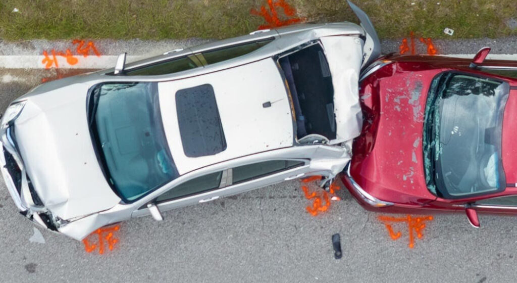
Speaking at the event, and later on the GEOTalks Podcast, the officers discussed their department’s transition from traditional surveying methods to drone-based mapping. Equipped with UAVs and Blue Marble’s Pixels to Points® photogrammetry tool, they generate 3D models of accident scenes that can serve as critical evidence in court or be used to extract valuable investigative details long after the scene has been cleared.
One key benefit highlighted was the efficiency of the data processing pipeline. Captain Burke noted a significant drop in processing time, from several hours to just 30–45 minutes, thanks to recent software optimizations. This streamlined workflow allows their team to act faster and cover more ground, both literally and figuratively, when responding to emergencies.
Accuracy remains a top priority. During their presentation, the officers described how they establish ground control points (GCPs) before flight by placing physical targets and marking critical locations with red pavement indicators. These reference points, when processed through Global Mapper Pro, enable highly accurate measurements and visualizations. The software’s automatic GCP identification feature also helps simplify the process for teams with varying levels of GIS expertise.
Beyond crash reconstruction, the Windham Police Department operates three drones equipped with thermal imaging, which are regularly used in missing persons cases and suspect tracking. Drone-collected geospatial data not only saves the department time, up to 2.5 hours compared to traditional total station methods, but also enhances situational awareness in real time.
With its combination of speed, accuracy, and affordability, drone mapping is becoming an indispensable tool for law enforcement agencies like Windham PD.


