


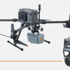
CHC Navigation aims to improve waterway management, examining the use of the AlphaAir 10 LiDAR+RGB System on a DJI Drone to unlock waterway potential. Read more >>
Leveraging technology and digitizing inland waterways could result in a host of benefits by using data to optimize the safety, sustainability, and management of vital navigation infrastructure.
By identifying possible challenges early, digitization facilitates maintenance, enabling the safety and reliability of waterways for transporting goods, passengers, and crucial resources.
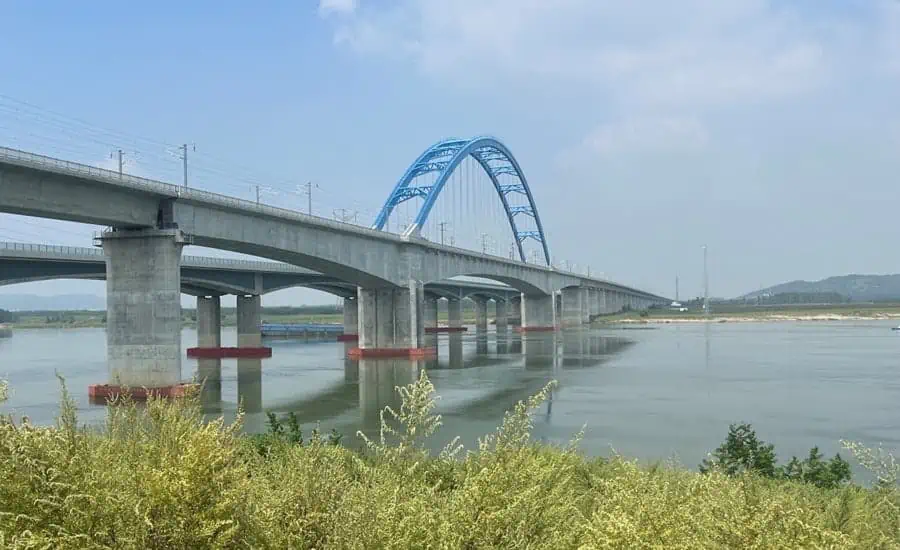
In the full case study on a Yangtze river waterway, CHCNav digitally maps the route, going on to discuss:
- Precision Made Simple: 3D Mapping with UAV & LIDAR Technology
- Streamlined Excellence: Effortless Operation & Rapid Data Processing
- Transforming Waterway Surveying: The Power of LIDAR UAV Technology
- Elevating Surveying: LIDAR Innovation Soars Along the Yangtze River
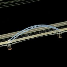
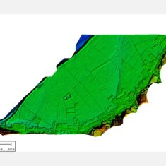
The collaboration between AlphaAir 10’s LiDAR and UAV technology has brought forward a new era of accuracy and efficiency in waterway surveying.
The ability to collect data at pace, paired with unparalleled precision, makes this technology an indispensable tool for surveying professionals along the Yangtze River.
Read the full article, or discover more about AlphaAir 10 (AA10) on CHCNAV’s website.


