Leading developers of hydrographic survey equipment Hydro-Tech has published a study examining the accuracy of multi-beam echosounders in an underwater topographic survey.
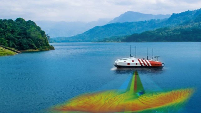
In the article titled “How USV Mounted Multibeam Echosounder Enhances Accuracy in Bridge Pier Scouring Survey“, an Unmanned Surface Vessel (USV) integrated with a Hydro-Tech MS400U multi-beam echosounder carried out moving measurement sounding with the aim of obtaining high-precision underwater 3D data.
The project set out to assess the safety of Minjiang Bridge, which is located in a unique geographical location with a severe topographic drop from upstream and a turbulent water flow.
Hydro-Tech say that if an underwater environment has a large tidal range, rapid flow velocity, serious sedimentation or scouring, it can pose a risk to structures mounted in the water.
Hydro-Tech’s case study covers:
- Project Solution
- Conformal Design
- Project Operation
- Post Processing
- Data Analysis
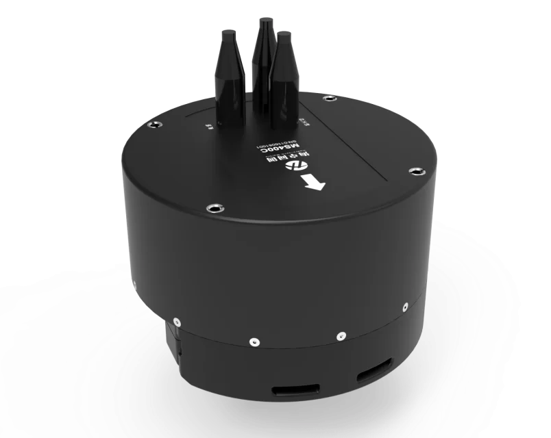
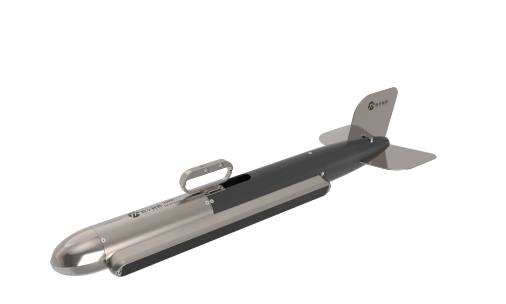
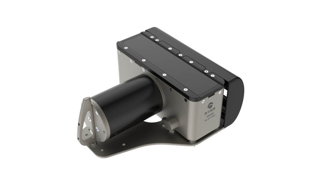
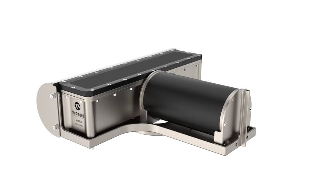
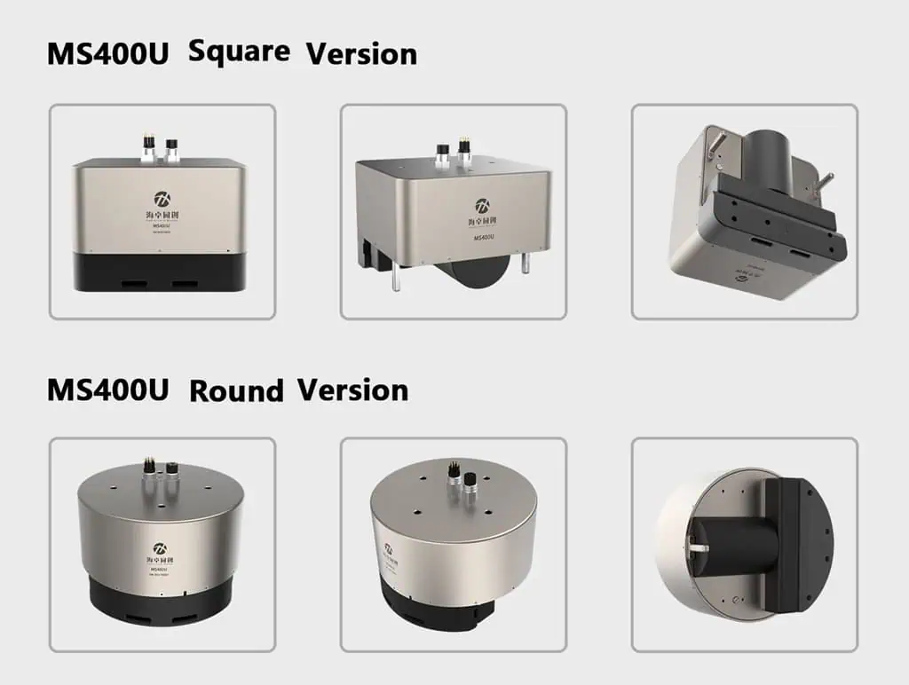
MS400U

Hydro-Tech’s MS400U combines underwater technology with on-deck operating units. The on-deck Sonar Interface Module connects with MS400U’s underwater transducer (which has receiving & projecting array), Surf Master’s IMU sensor and the sound velocity sensor of SVS1500.
The on-deck unit uses a built-in GNSS module to connect with GNSS Antennas, the main control computer which runs sonar display, control software, navigation and data acquisition software used for sonar control.
MS400U has built-in auxiliary survey sensors including a sound velocity sensor, IMU and GNSS.
Underwater topographic survey

Surveyors stood at the shore end, controlling the operation of the USV, monitoring the equipment status and underwater operation.
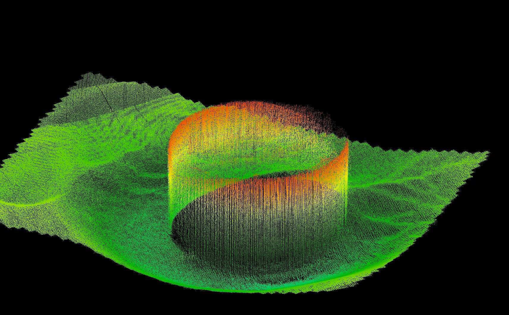
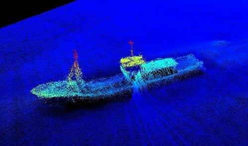
MS400U carried out the underwater 3D sounding survey with a 143° swath sector, directly measuring the underwater terrain within the coverage area and the 3D structure of the underwater pile foundation, recording any underwater terrain changes in the survey area.
Results
Hydro-Tech used Hypack to output point cloud data of the underwater pile foundations and terrain, building a 3D model from the underwater data using a TIN model.
Hydro-Tech say that the MS400U accurately measured the scouring area of the underwater pile foundation, stating that using USVs efficiently solve the challenges posed with traditional bridge pier scouring surveys that use an RTK GNSS receiver, and reduce overall risks to surveyors.