


In this case study, CHCNAV explains the creation of a digital elevation model by performing large-scale topographic mapping of a future coal mine using the company’s AlphaAir 450 LiDAR system.
Coal is a major chemical raw material used significantly for power generation, heating, and other applications in many countries. This resource is known to be limited in quantity, and its extraction may result in the release of harmful chemicals into the air and water. It is, therefore, essential that the development of new coal resources be conducted in a rational and environmentally optimized manner.
New technologies allow for rapid and efficient expansion of coal mines, such as acquiring spatial data of any volume in a minimum amount of time using aerial survey solutions. Moreover, due to many mines’ challenging topography and hazardous environment, aerial surveys are generally the best possible option for collecting the GIS data needed to formulate effective engineering solutions for the sites.
The project, implemented by the CHCNAV’s partner, describes the creation of a DEM (digital elevation model) by performing large-scale topographic mapping of a future coal mine using the AlphaAir 450 LiDAR system. The AA450 is a lightweight and rugged system that integrates a high-performance laser scanner with a professional 26 MP industrial-grade camera and a high-accuracy inertial navigation system for quality mass data collection.
Overview of the mine site project and related key deliverables:
- Survey area: 700 ha.
- Equipment: high precision AlphaAir450 LiDAR, third-party GNSS receivers, and a UAV were used in this project.
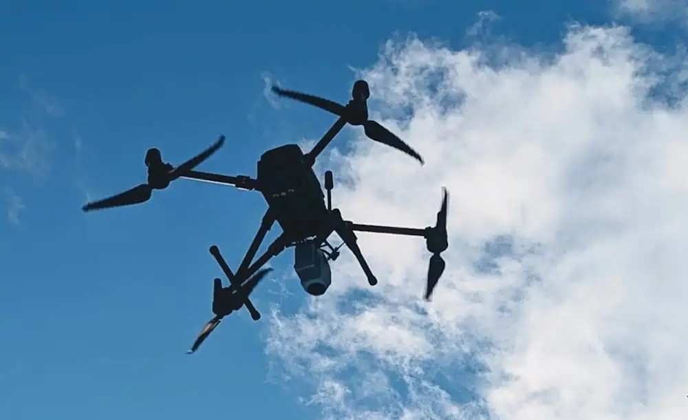
Figure 1. The AlphaAir 450, an airborne LiDAR system with a built-in IMU, GNSS, 3D scanner, and camera.
- Climatic conditions: the work was done during the first snowfall of the year, when there were no areas of snow accumulation, making it possible to determine the depth of the snow cover, as opposed to the mid- and late-winter periods.
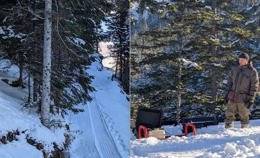
Figure 2. The site area where the project was realized by the CHCNAV’s partner.
- Work in the field: airborne laser scanning, survey of control points, and collection of information for further processing took 1 day.
- Data Processing: an additional day was dedicated to the processing and interpretation of the data collected.
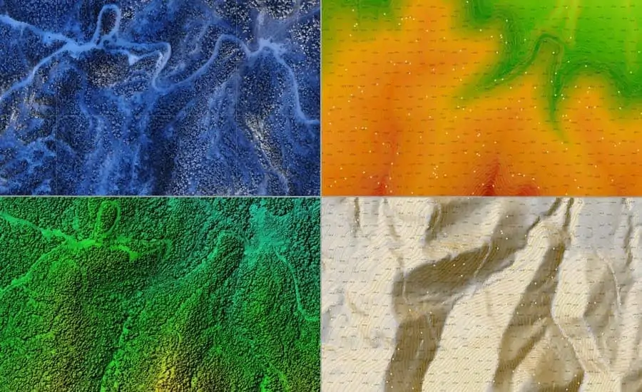
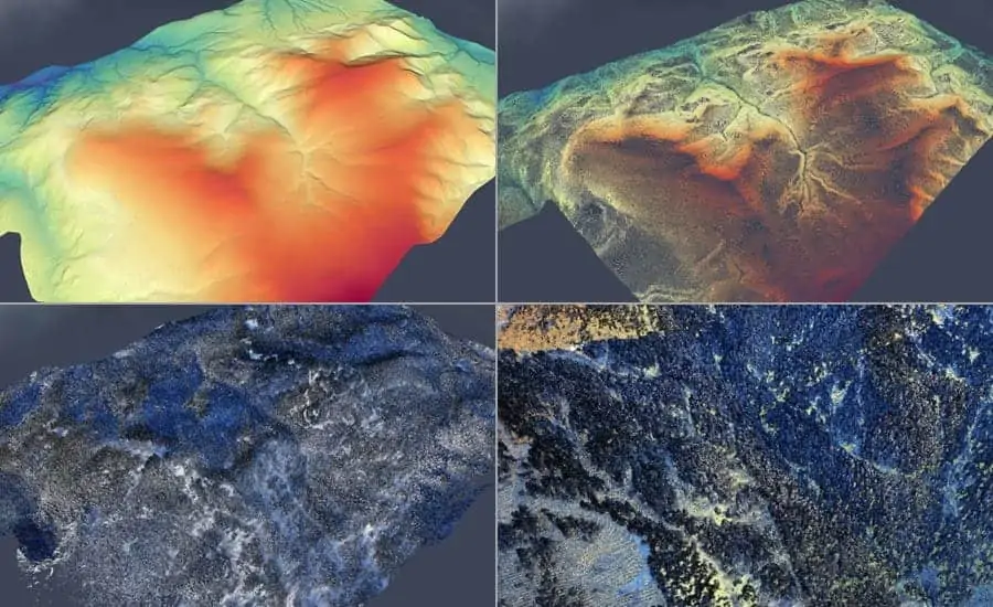
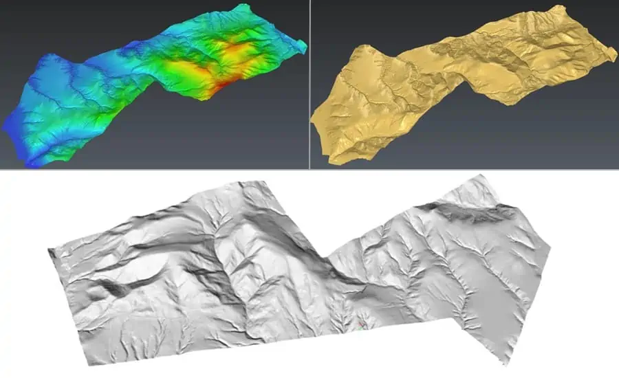
Figures 3, 4, and 5. The post-processed survey results represented by high-resolution DEM & DTM, contour lines map, and RGB point cloud.
The field surveys are processed into orthophotos, point clouds, topographic maps, and digital elevation models. Based on these results, snow height correction matrices are prepared and applied to the digital elevation model to refine it.
What are the main benefits of the LiDAR airborne survey in the initial mine site investigation?
1) Accuracy, durability, and weather resistance
Suitable for the most challenging geological (homogeneity, dense vegetation, slope conditions, etc.) and meteorological (high/low temperatures, snow, clouds, humidity, dust, etc.) conditions, the AA450 LiDAR scanner accurately and precisely identified elevation differences encountered in such an environment.
2) Comprehensiveness and safeness of the survey method
Professional drones fitted with the AA450 LiDAR have increased the speed and accuracy of the survey process while reducing safety risks to personnel, particularly in areas with steep terrain or cliffs. In addition, the resulting data will be used to accurately identify potentially hazardous and safe areas to create risk maps for future phases of the project.
The AlphaAir 450 LiDAR improves the efficiency of preliminary site surveys for new mining projects.
Today, drones with LiDAR scanners are widely used by mining companies to collect geospatial data and estimate production volumes at various stages of the mine life cycle. The data obtained provide a comprehensive source of information for the different work tasks to be undertaken and serve as the basis for future assessments as the mine is brought into production.
With the highest quality data at an accessible price, aerial survey systems and solutions like the AlphaAir LiDAR help mine managers reduce the risk, time, and cost of their surveying operations.


