


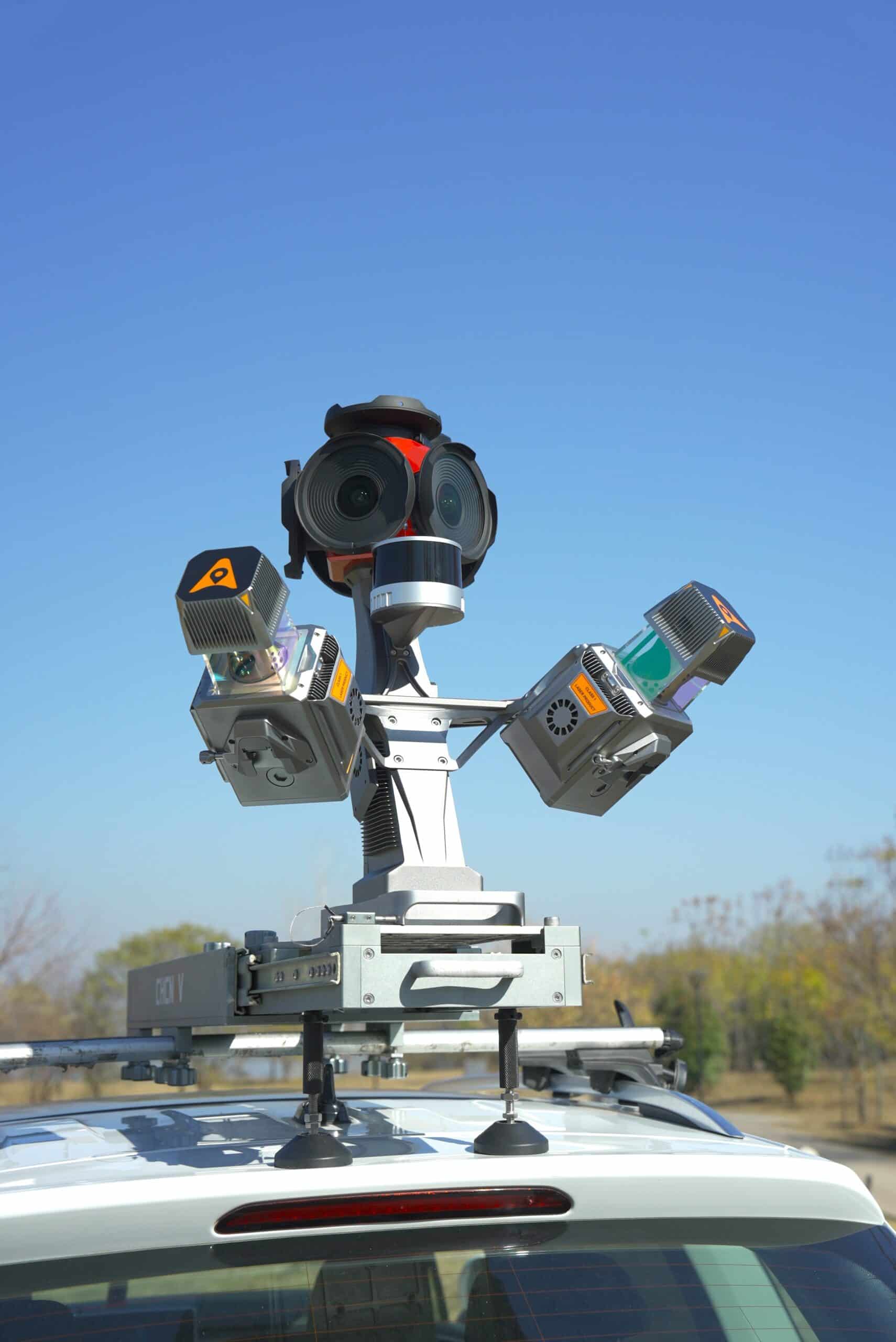
The CHCNAV AU20 MMS is a mobile mapping system engineered for vehicle-based deployment in surveying and geospatial data collection missions. Built on CHCNAV’s AP7 platform, the system integrates advanced long-range LiDAR, multi-sensor configurations, and AI-optimized processing to deliver survey-grade 3D data with exceptional clarity and reliability. Featuring real-time waveform processing and the capacity to capture up to 2 million points per second, the AU20 provides pinpoint accuracy of 5 mm and precision down to 3 mm—critical for mapping fine road textures, utility features, and complex roadside infrastructure.
The AU20's dual-laser architecture and configurable scanning angles enable multi-angle data acquisition with minimal blind spots, enhancing the recognition of road signs and vertical assets in fast-moving environments. AI-powered algorithms deliver over 95% panoramic colorization accuracy by filtering transient objects and noise, with automated vertical mapping alignment corrections ensuring consistency within 2 cm. Compatible with Ladybug5+/6 panoramic cameras and supporting up to eight auxiliary sensors, the AU20 offers unmatched versatility for road condition analysis, infrastructure verification, and digital twin generation.
| LiDAR Output Rate | Up to 2 million points per second |
| Accuracy / Precision | 5 mm / 3 mm |
| Scan Range | Up to 250 meters |
| Scanning Angle | 45°, dual-laser configuration |
| AI Colorization Accuracy | >95% panoramic colorization |
| VMA Correction | Automated, <2 cm alignment error |
| External Sensor Support | Up to 8 sensors, incl. pavement & panoramic cameras |
| Compatible Cameras | Ladybug5+, Ladybug6 |
| Real-Time Processing | 4th Gen Real-time Waveform Processing (RWP) |


