


CHC Navigation (CHCNAV), a leading provider of GNSS and inertial navigation solutions for professional geospatial and mapping applications, has released an article exploring Geographic Information System (GIS) data accuracy challenges, the company’s technological solutions, and the methods and benefits of effective GIS data collection.
GIS is fundamental for spatial data representation, utilizing coordinates, temporal markers, and associated attributes. The accuracy of GIS data is crucial for asset differentiation and maintaining current spatial information, which is vital for utility management, urban planning, and environmental research. Data currency is a significant concern, as approximately 20% of GIS data can become obsolete within a 12-month period, potentially compromising the integrity of data-driven decision-making processes.
Importance of GIS Data Precision
Accurate GIS data is essential for infrastructure management in utility sectors. Precise pipeline location data can mitigate the risk of excavation-related damage, potentially resulting in substantial cost savings. Empirical evidence suggests that utilities can achieve up to a 30% reduction in maintenance expenditures through the use of reliable GIS data. In urban development, GIS-based planning has demonstrated the potential to decrease urban expansion costs by 20%. Environmental studies heavily rely on GIS data for monitoring land cover and vegetation dynamics, with GIS-enhanced deforestation tracking improving conservation efficacy by 15%.
GIS Data Accuracy: Technical Challenges
Maintaining GIS data accuracy and currency presents several technical challenges:
- Data Interoperability: Inconsistencies often arise due to compatibility issues between centralized GIS servers and field data collection applications.
- Equipment Costs: Providing high-grade, ruggedized equipment to all field personnel can be financially prohibitive.
Recent Technological Advancements

GIS data collection, mapping, and landscaping with the tablets, smartphones, and smart antennas from CHCNAV.
In response to these challenges, CHCNAV introduced the MapCloud software in May 2024. This GIS data collection and mapping application, designed for Android platforms, is optimized for use with CHCNAV’s LT800H Rugged Tablet or LT60H Rugged GNSS RTK Smartphone. This integrated solution aims to address both data compatibility issues and equipment cost concerns, providing a comprehensive toolkit for GIS professionals.
Methods for Collecting and Maintaining GIS Data
- Field surveying: The most traditional approach, utilizes GNSS RTK instrumentation for high-precision spatial coordinate measurement, ideal for applications like pipeline inspections and construction projects.
- Mobile data collection: Leverages handheld GPS devices and smartphones for in-situ gathering of geographic data, particularly suited for distributed tasks such as forestry patrols and utility inspections.
- Remote sensing: Involves large-scale imagery acquisition through aerial photography, satellite technology, and LiDAR, enabling comprehensive datacapture over extensive areas for applications like land cover mapping and environmental monitoring.
These methods can be integrated to meet specific data collection needs, enhancing efficiency and cost-effectiveness through data fusion and unified collection strategies. This integration supports comprehensive, up-to-date GIS datasets crucial for informed decision-making and operational efficiency.
Specialized GIS data collection solutions offer numerous advantages over traditional surveying methods. While traditional surveying emphasizes high-precision coordinate accuracy for applications like cadastral surveying, GIS data collection integrates detailed attribute information such as pipeline pressure levels or vegetation health. These solutions enhance mobile workforce efficiency and data security through real-time device tracking, rugged hardware with IP67 ratings, and advanced software security featuring multiple encryption methods and robust backup systems.
Productivity is optimized through user-friendly interfaces with integrated tutorials and basemap integration, as well as high-performance engines supporting common GIS file formats and efficient large dataset handling. Flexible accuracy solutions cater to diverse needs, ranging from consumer-grade GNSS for meter-level accuracy to professional-grade devices offering sub-meter to centimeter accuracy.

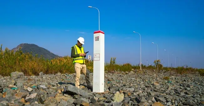
Surveying and landscaping with the LT800, a robust Android tablet tailored for professional applications, requiring meter-level GNSS positioning and uninterrupted performance.
Collaborative capabilities are enhanced through cloud connectivity, facilitating seamless data sharing and project management. This includes layer template sharing and inter-device file transfer, ensuring all team members access the most current data.
When comparing professional-grade and consumer-grade solutions, professional devices offer advantages in durability, display quality, battery life, and positioning accuracy. However, the choice depends on balancing these benefits against cost considerations and specific project requirements.
CHCNAV’s integrated solution, comprising MapCloud software and professional-grade Android devices like the LT800H Rugged Tablet and LT60H Rugged GNSS RTK Smartphone, exemplifies a comprehensive approach to modern geospatial data collection and management. This system addresses diverse accuracy needs, enhances team collaboration, and provides robust security features, empowering GIS professionals to meet the demands of contemporary geospatial tasks with precision and confidence.
Read the full article here, or visit the CHCNAV website to find out more.


