


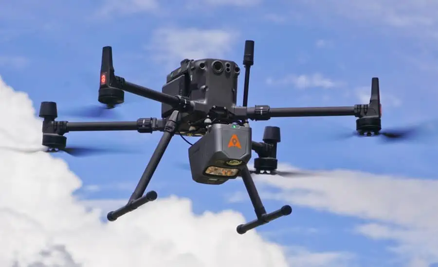
CHC Navigation (CHCNAV) has introduced the AlphaAir 10 (AA10), a new airborne mapping system for drones that seamlessly integrates high-precision LiDAR technology, accurate GNSS positioning, IMU orientation, and an industrial-grade full-frame orthophoto camera. Compatible with a wide range of UAV (unmanned aerial vehicle) platforms, the AA10 features a lightweight, compact design and advanced multi-target capabilities that allow it to detect up to 8 target echoes, greatly enhancing its ability to penetrate dense vegetation and acquire precise ground surfaces.
The AA10 incorporates a high-precision navigation algorithm that works in conjunction with the CHCNAV LiDAR to deliver 5 mm repeatability and exceptional absolute precision in the 2 to 5 cm range, even in complex environments. Capable of long-range measurements up to 800 m, rapid scanning at 500,000 points per second, and a continuously rotating mirror that enables scanning speeds of 250 scans per second, the AA10 enhances the detail of aerial mapping operations.
By integrating LiDAR and a 45MP full-frame orthographic internal camera, the AA10 supports the simultaneous acquisition of point cloud data and a large number of high-resolution images covering a significant area in a single flight. This fusion significantly improves mapping and surveying efficiency compared to traditional fusion solutions that require multiple flights over an area using LiDAR and cameras separately.
Complementing the solution, the CoPre and CoProcess software suite streamlines post-processing and feature extraction with an easy-to-use and efficient data workflow. High-quality point cloud data is used to create a mesh model, followed by efficient 3D model reconstruction with realistic point cloud colorization using high-resolution image mapping textures.
The AA10 LiDAR system is lightweight and compact, weighing only 1.55 kg and providing 30 minutes of flight time when integrated with drones such as the DJI M350. In addition, the AA10 is IP64-rated, ensuring the system’s ruggedness and providing consistent, reliable performance in a wide range of operating conditions.
Andrei Gorb, Product Manager at CHC Navigation, commented: “The AlphaAir 10 Airborne LiDAR + RGB system represents an exciting milestone in aerial surveying technology. Its precision, advanced scanning capabilities, highly efficient data acquisition, and user-friendly design underscore CHCNAV’s commitment to providing innovative 3D reality capture solutions that empower geospatial professionals. Combined with CHCNAV’s point cloud and image fusion modeling software, the AA10 provides an efficient and cost-effective approach to airborne 3D data collection and processing.”


