
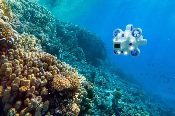
Advanced Navigation has released a whitepaper highlighting the effectiveness of its Hydrus autonomous underwater drone in accurately capturing data and coordinates of a shipwreck.
Download the full whitepaper here > >
Mission Overview
Determine wreck site perimeters
As part of the strategic reconnaissance phase, Hydrus was guided on a spiral flight path from the wreck’s last known coordinates. Programmed to maintain a 3m altitude above the seabed, Hydrus used integrated systems to stay stable amidst moderate currents, without anchoring to safeguard the site and its surroundings. This phase was completed in just 90 minutes.
Detailed site scanning
After analyzing the initial data to confirm the wreck’s location, the team employed Hydrus’ user-friendly mission planning software to organize a comprehensive survey. Hydrus was redeployed, utilizing a “lawn mower” pattern over the wreck site for extensive coverage. This phase highlighted its autonomous functionality, enabling precise data capture of the area without needing manual control.
Complementary survey for data
Advanced Navigation’s experts have identified several areas that require further exploration. Utilizing the mission planning software along with the captured geo-referenced data enables the accurate replication of follow-up missions to these specified areas of interest.
The data collected enabled the generation of high-fidelity 3D photogrammetry models, providing a detailed examination of the shipwreck within its ecological context and offering insights into its history. The study also showcases the versatility of Hydrus across various applications, including geohazard surveys and site investigations.
The whitepaper also covers:
- Sinking barriers to entry – discover how Hydrus removes the barriers of cost and complexity.
- Cost analysis of site investigation – see the cost savings made by selecting Hydrus in the case study.

Meet the Advanced Navigation team this week at Oceanology International on Stand K350.