
SBG Systems has partnered with YellowScan, a global leader in UAV LiDAR solutions, to deliver exceptional precision and efficiency in aerial mapping through the integration of the Quanta Micro, a high performance GNSS-aided Inertial Navigation System (INS).
YellowScan designs and manufactures professional-grade LiDAR mapping systems, such as the Explorer, Navigator, Voyager, and Surveyor Ultra, used across industries including forestry, mining, powerline inspection, bathymetry, and civil engineering.
When developing compact, high-performance LiDAR payloads, YellowScan faced the challenge of finding a lightweight, reliable, and accurate inertial navigation solution that would not compromise system portability. After evaluating several options, the company selected SBG Systems GNSS/INS, Quanta Micro, impressed by its superior accuracy, robustness, and ease of integration.

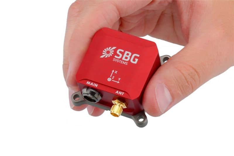
Quanta Micro GNSS/INS from SBG Systems.
The Quanta Micro’s compact form factor and exceptional reliability enabled YellowScan to deploy its LiDAR systems on multiple platforms, from UAVs to land vehicles and backpacks, without sacrificing precision. Integration was seamless, supported by SBG Systems’ responsive technical team.
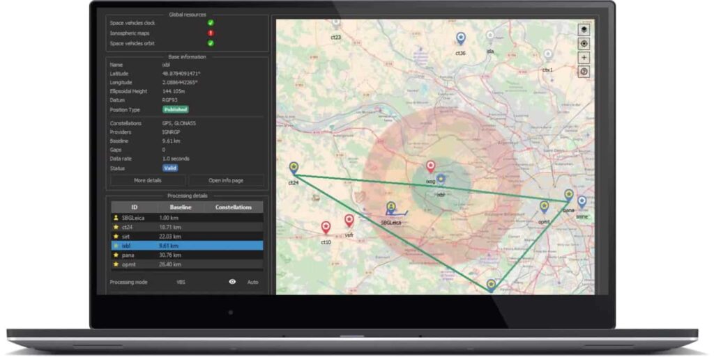
Incorporating Qinertia OEM, SBG’s advanced post-processing software, further streamlined YellowScan’s workflow by embedding it within the CloudStation suite for efficient data correction and reporting. Together, the companies also collaborated on Geoides integration, improving real-time positioning performance.
The result is a new benchmark in LiDAR mapping: optimized system design, enhanced data accuracy, and simplified processing. Through this strong partnership, SBG Systems and YellowScan continue to empower professionals worldwide with cutting-edge geospatial mapping capabilities.