


CHC Navigation (CHCNAV) pairs its high-performance unmanned aerial vehicles (UAVs) with advanced LiDAR sensors to enhance aerial mapping efficiency, combining robust flight capabilities with scanning technology to ensure professionals achieve greater data accuracy, broader coverage, and improved workflow management.
The CHCNAV X500 UAV and AlphaAir 15 (AA15) LiDAR together create a powerful aerial mapping system optimized for high-precision data acquisition in a variety of environments. The sections below detail how each component—the X500 UAV and AA15 LiDAR—improves efficiency and precision in airborne mapping.
The X500 UAV: Efficient Airborne Mapping
The CHCNAV X500 UAV is a professional-grade rotor drone designed for precision aerial mapping. Its advanced flight capabilities and high payload capacity make it well-suited for LiDAR-based surveying and geospatial data collection.
- High Payload Capacity – Supporting up to 5 kg, the X500 accommodates the 2.5 kg AA15 LiDAR system along with additional accessories such as high-resolution RGB cameras. This flexibility allows users to customize the UAV for different applications while maintaining performance.
- Prolonged Flight Endurance – When equipped with the AA15 LiDAR, the X500 achieves up to 52 minutes of flight time. Dual hot-swappable batteries and an intelligent charging system further reduce downtime, ensuring continuous operations.
- Reliable Operation in Harsh Conditions – The X500, rated IP55 for dust and water resistance, functions in winds up to 12 m/s and withstands temperatures ranging from -20°C to 50°C. It features millimeter-wave radar for 80-meter obstacle detection and a visual SLAM system for precise landings, even on moving platforms.
- Advanced Flight Management – CHCNAV’s SmartGo software improves mission planning with multiple flight path options, including rectangular, strip, polygonal, and façade routes. It also offers real-time monitoring of the drone and its surroundings, ensuring safe and efficient BVLOS operations.
The AA15 LiDAR: Accuracy & Speed in Data Acquisition
The CHCNAV AA15 LiDAR is a lightweight, high-performance sensor tailored for aerial 3D mapping. Weighing just 2.5 kg, it integrates seamlessly with the X500 UAV, maximizing data collection efficiency while maintaining high accuracy.
- High-Density Data Capture – With an ultra-high pulse rate of 2 million points per second, the AA15 generates detailed point clouds over large areas. Its 1,800-meter maximum range and 700-meter operational altitude make it well-suited for corridor mapping, urban planning, and topographic surveys.
-
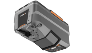
AlphaAir 15 (AA15) LiDAR
Enhanced Vegetation Penetration – Capable of up to 16 returns per pulse, the AA15 effectively captures ground elevation data beneath dense tree canopies. This ensures comprehensive datasets for forestry management, floodplain modeling, and environmental monitoring while reducing the number of flights required.
- Seamless Workflow Integration – The AA15 pairs with CHCNAV’s SmartGo software for automated data capture and real-time mission tracking. Post-flight, the CoPre and CoProcess software suite simplifies processing tasks such as georeferencing, feature extraction, and 3D modeling, accelerating the conversion of raw data into actionable insights.

A Unified Solution for Aerial Mapping Challenges
The CHCNAV X500 UAV and AA15 LiDAR system are engineered to enhance efficiency, accuracy, and reliability in aerial mapping. Unlike conventional multi-rotor drones with limited payload capacities and short flight durations, the X500’s 5 kg payload support and extended endurance allow for longer missions and integration of high-performance sensors without compromising stability.
Compared to fixed-wing UAVs, which require larger takeoff areas and lack hovering capabilities, the X500 provides precise maneuverability for complex terrains and corridor mapping.
On the sensor side, LiDAR systems vary in density, range, and penetration ability. The AA15’s 2 million pulses per second and 16-return capability ensure superior point cloud density and ground penetration, minimizing the number of flight passes needed for complete coverage. While some competing LiDAR systems may match its pulse rate, they often feature heavier payloads, limiting UAV compatibility and overall efficiency.
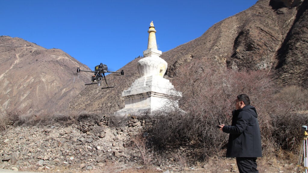
Case Study: CHCNAV X500 & AA15 in High-Altitude Powerline Survey
The Challenge
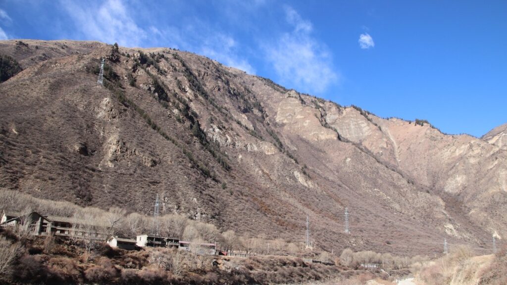
A 135 km, 220 kV powerline survey in the Sichuan Plateau presented extreme operational difficulties. The survey area featured elevation variations exceeding 1,476 meters, rugged landscapes with mountains and rivers, and temperatures dropping to -10°C. Additionally, the presence of high-voltage infrastructure required a system capable of acquiring precise data while maintaining flight stability in unpredictable conditions.
The Solution
The team deployed the CHCNAV X500 UAV, AA15 LiDAR, C5 orthographic camera, and CoPre and CoProcess software. The X500 facilitated long-endurance flights over varying altitudes, while the AA15 LiDAR ensured high-density point cloud acquisition through dense vegetation. The CoPre and CoProcess software optimized data processing, generating high-precision point clouds, DEMs, and contour lines for powerline analysis.
The Results
- Triple Efficiency – The X500 UAV and AA15 LiDAR collected 5-6 km of data per flight, achieving three times the efficiency of previous methods.
- High-Quality Data – The AA15’s 2 million pulses per second and 16-return capability ensured accurate ground elevation mapping with point cloud thickness under 5 cm.
- Precision Performance – Testing validated a vertical accuracy of 2.5 cm, ensuring compliance with stringent project specifications even in challenging conditions.
- Operational Reliability – The X500 performed consistently in high-altitude environments, with its smart battery system enabling continuous operations with minimal downtime.

Key Takeaways for UAV-LiDAR Aerial Mapping
Optimizing UAV-based mapping requires balancing data quality, operational reliability, and workflow efficiency. The CHCNAV X500 UAV and AA15 LiDAR exemplify this balance, offering extended endurance, high payload capacity, and precise LiDAR scanning.
This integrated approach ensures accurate data collection with minimal operational overhead, making it a cost-effective and high-performance solution for aerial surveying professionals.


