Textron Systems’ Imagery & Data Analysis is a leading developer of data analysis and image processing software for geospatial intelligence. Our solutions provide analysts with the ability to integrate and analyze multiple data sources, such as aerial imagery and video captured by UAVs (unmanned aerial vehicles).
Our geospatial analysis products are used by national agencies, local governments and militaries worldwide to provide enhanced situational awareness and actionable intelligence.
Optice™ – Geospatial analysis software
Real-time visualization and exploitation tool to enhance interactions with FMV & other data sources
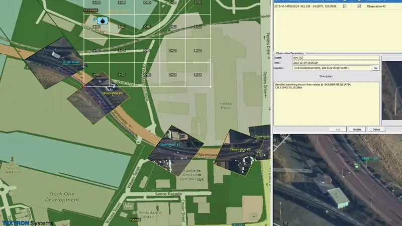
Optice™ is a user-friendly real-time visualization and exploitation tool purpose-built to enhance interactions with full motion video as well as other data sources. Optice delivers a series of advanced capabilities that enrich the data and help shorten the time from data acquisition to action. Optice allows your operators and analysts to focus on all operational support functions within one simple tool. There is no back-end system required, allowing you to increase capabilities while reducing costs.
Optice can integrate with any video capturing product such as unmanned and traditional aviation systems including drones, camera systems, security and surveillance systems and body cameras. This tool allows users to find, identify and assign attributes to any visible object in real-time. Optice creates custom data layers to visualize data sourced from different locations or sensors. Interact with live or historical data for real-time or forensic analysis. Create custom reports or generate an activity-based report for analysis. Optice can be integrated with existing GIS systems.
Applications:
First Responders, Energy, Utilities and Environmental
Geospatial analysis software delivering real-time data exploitation and collaboration tools
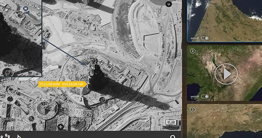
SeeGEO™ is a web-enabled platform with an architecture purpose built to solve problems across the spatial-temporal spectrum. Providing support for multi-modal data SeeGEO delivers a sophisticated toolset for exploitation packaged in a highly collaborative environment. With its user first design approach SeeGEO provides an experience that is unmatched in the industry that is coupled with best in class tools for visualizing and interacting with geospatial imagery and video.
User-generated workspaces and multi-user sharing allow efficient collaboration with features such as live editing, real-time chat, commenting and notifications. Workflow management functionality includes analyst tasking, reporting, and team management. SeeGEO provides intuitive unified search, discovery and cataloging of imagery, video and data from a variety of sources, including commercial imagery providers and live UAS camera feeds. Both live stream data from manned and unmanned assets as well as archived imagery and FMV data can be searched, visualized, exploited, and shared.
SeeGEO is fully platform-agnostic, providing compatibility with browsers on desktops, laptops or mobile devices.
SeeGEO™ is available in a variety of specialized deployment options, providing solutions for a range of mission requirements and dynamic environments:
SeeGEO Embedded
Designed for the tactical edge
Direct collection and interaction with UAS platforms
Real-time access
Enhanced situational awareness
SeeGEO Pathfinder
Purpose built for operation centers and onsite deployments
Expanded support for larger data collection and platform interactions
Enhanced collaboration tools for expanded mission support (chat, watch-boxes and workspaces)
Sophisticated tools for data sharing and exploitation
SeeGEO Enterprise
Cloud ready and designed to scale
Ability to process and disseminate big data sets across an enterprise
Built on industry and community standards enabling data sharing and interoperability
Extensible platform with a built-in analytic framework to deploy custom algorithms
Geospatial data analysis software for intelligence and mission planning
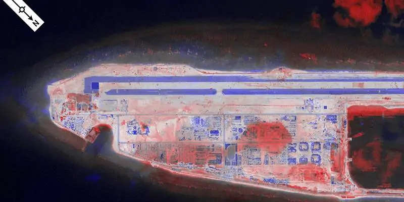
RemoteView™ Pro is our flagship imagery exploitation and analysis solution that provides state-of-the-art tools for high-performance mission planning and operational support. As the geospatial intelligence solution of choice, RemoteView has a long history of success across a broad range of users within the U.S. intelligence community, Department of Defense, and across analysis directorates in 27 countries.
Featuring cloud access and a streamlined, intuitive customizable user interface, RemoteView Pro provides a suite of capabilities for analysts, including multi-image analysis, terrain analysis and data conversion. The software can display and fully support data from hundreds of sensors including RGB and multispectral images, video, LiDAR and SAR data, as well as elevation information.
RemoteView™ Pro can be extended with a number of optional add-on modules to provide further powerful capabilities:
RVSAR™ – Allows users to enhance the clarity of synthetic aperture radar (SAR) imagery, with different filters that can be applied either on a single page or to multiple polarization images.
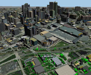
3D Pro™ – Allows analysts to incorporate the latest satellite and tactical imagery in near real-time to create mission scenarios with buildings, utility lines, vegetation and other features in 3D.
RVCloud™ – Provides a cloud-based streamlined version of RemoteView with an essential set of features for viewing and analyzing imagery in a user-friendly web application.
Virtual Mosaic™ – Streamlines the process of building terabyte-sized mosaics from numerous input images, with no preprocessing or conversion steps required.
GeoCatalog™ – On-demand access to and analysis of vast geospatial data resources for quick retrieval and overviews of imagery and FMV libraries to help expedite the PED process via a user-friendly web interface.
High-performance video encoding hardware solution blended with integrated software
Opmeta™ is a high-performance video encoding solution that blends high performance hardware with integrated software to provide a powerful solution to meet almost any video encoding requirement. Providing full support for popular codecs, including H.264 and H.265, Opmeta is capable of supporting data from legacy systems up to 4K.
Opmeta is part of the broader Textron Systems Geospatial Portfolio with integrated support for both SeeGEO for data archive, discovery and collaboration as well as Optice for highly intelligent, AI enabled visual workflows. Opmeta provides high quality solutions without compromising latency pass through and is programmable to support a variety of cameras.
GIS data analysis software with automatic feature extraction
Feature Analyst™ provides automated feature extraction from high-resolution UAV aerial imagery and satellite data. Built as an extension to the world’s leading GIS system, ArcGIS, Feature Analyst delivers high-precision spatial intelligence, including capture of hydrologic zones, buildings, roads, vegetation and more.
With a simple interface, customizable extraction process, and end-to-end workflow, Feature Analyst’s trainable algorithms provide increased accuracy and improved results. Resulting vector data can be improved with a variety of advanced post-processing and editing tools, and users can develop automated feature extraction (AFE) models for automatic batch processing of additional data sets.
All products generated from Feature Analyst™ can be directly imported into RemoteView™. Feature Analyst can also be utilized in conjunction with LIDAR Analyst to simultaneously extract actionable information from both imagery and LiDAR.
LiDAR data processing software with 3D object extraction
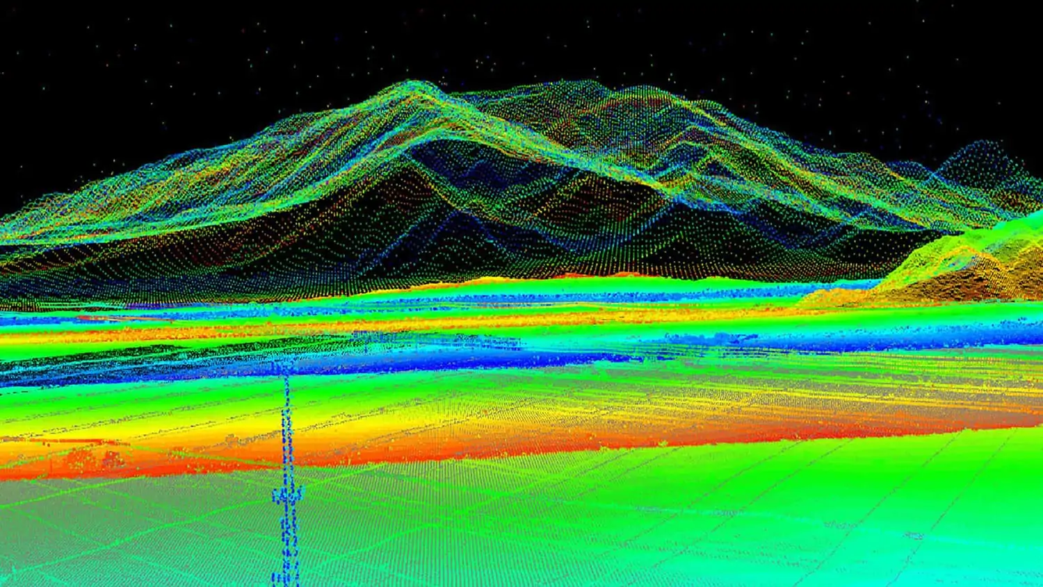
LIDAR Analyst™ provides an end-to-end solution for visualization, processing, and extracting mission-critical content from LiDAR data. Built as an extension to ArcGIS, LIDAR Analyst enables LiDAR data to be imported from any airborne LiDAR sensor, allowing extraction of 3D objects such as bare earth, trees and buildings for critical decision-making or mission planning and rehearsal.
Powerful analysis tools allow automated object inventory, 3D calculations and measurements, and generation of hill-shades, contour lines and slope images. A variety of elevation layers can be utilized for applications such as flood analysis.
LIDAR Analyst™ allows batch processing of data to run during off-peak hours or other convenient times. The workload can be spread across multiple processing nodes for maximum efficiency.
All products generated from LIDAR Analyst can be directly imported into RemoteView™. LIDAR Analyst can also be utilized in conjunction with Feature Analyst to simultaneously extract actionable information from both imagery and LiDAR.
When you submit this form, your personal data will be transferred to the company who will respond to you directly. See our Privacy Policy for details on how we process your data and your rights.