


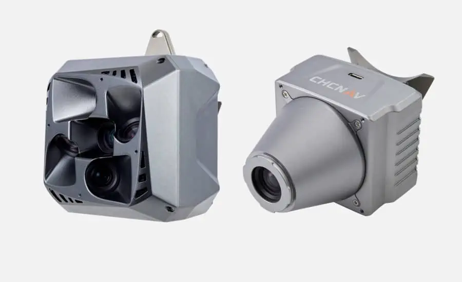
CHC Navigation (CHCNAV), a global leader in geospatial solutions, has introduced new aerial survey cameras for aerial photogrammetry with unparalleled precision and efficiency.
According to the company, the new C5 and C30 cameras offer seamless integration with UAVs and deliver exceptional image quality, enabling professionals to unlock the full potential of aerial surveying.
Unmatched Precision and Image Quality
The C5 and C30 offer unparalleled image quality, capturing highly detailed and accurate aerial images. Professionals can rely on the cameras’ advanced imaging technology to ensure that every pixel represents the area being surveyed with the utmost fidelity. This level of precision increases data accuracy and provides users with invaluable insights.
Seamless Integration and Versatile Applications
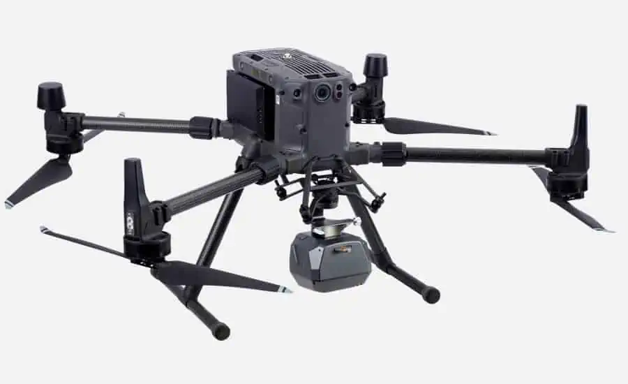
Designed for integration with UAVs, the C5 and C30 cameras adapt to existing platforms, allowing professionals to optimize their workflow and achieve exceptional results.
These versatile cameras are designed for use in a range of applications, including infrastructure planning, environmental monitoring, topographic mapping, and disaster management.
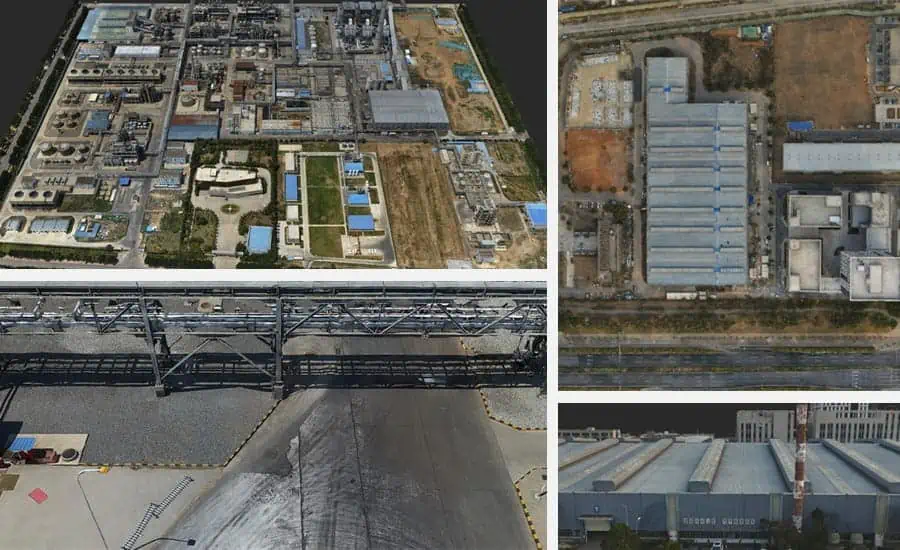
Increased Efficiency with Advanced Photogrammetry
With the C5 and C30 cameras, CHCNAV introduces advanced photogrammetry capabilities that streamline data collection and processing. Professionals can efficiently plan missions, capture georeferenced images, and use easy-to-use software solutions to convert raw data into actionable insights.


