


Autonomous Control Systems
Discover cutting-edge solutions from 6 leading global suppliers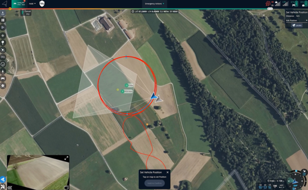
Auterion Mission Control expands its functionalities and allows it to efficiently execute ISR missions even in GPS-denied conditions.
In today’s world, flying Uncrewed Aerial Vehicles (UAVs) in GPS-denied conditions is crucial for the success of ISR missions. Auterion Mission Control equips operators with essential tools and capabilities to support them in achieving their mission objectives.
Thanks to continuous onboard health checks and the ongoing monitoring of GPS accuracy metrics and consistency with respect to other sensor inputs, AuterionOS can promptly detect GPS jamming and/or spoofing. In these conditions, the system stops relying on GPS data to estimate its position. Alternatively, the operator can manually stop GPS from being used by the UAV estimator if there is suspicion of jamming or spoofing.
In Auterion Mission Control, the operator can detect the occurrence of such conditions by observing a divergence between the vehicle’s estimated position, depicted by the blue UAV icon, and the raw GPS position of the vehicle, depicted by the gray UAV icon.
Once the UAV doesn’t rely on GPS to estimate its position, the accuracy of its location degrades over time and is highly influenced by weather conditions such as wind.
The UI in Auterion Mission Control depicts the position’s uncertainty through a blue circle around the UAV icon. The size of the circle directly correlates with the magnitude of the position uncertainty, with a larger circle indicating greater uncertainty.
If the operator recognizes any landmarks in the video feed, he has the option to reset the vehicle position by manually specifying the location observed by the camera. By re-initializing the vehicle position to a known point, the position error of the vehicle is minimized. This feature proves highly beneficial when operating without GPS for prolonged durations. Additionally, the vehicle position can be directly reset by indicating the estimated location of the vehicle on the map.
Auterion Mission Control equips operators with the capabilities to navigate GPS-denied environments, minimizing additional cognitive demands and ensuring precise mission execution.


