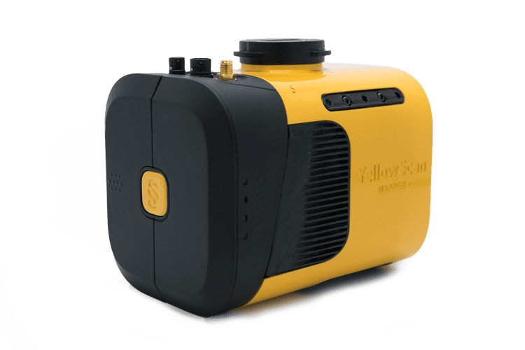
Teledyne Geospatial to Present LiDAR Survey & Mapping Solutions at Geo Week 2023

Visitors are encouraged to visit the company at Geo Week in Denver, February 13-15, for a first-hand look at the single-source mapping solutions and workflows available By Caroline Rees / 27 Jan 2023

Drone LiDAR

Discover cutting-edge solutions from 4 leading global suppliers
SUPPLIER SPOTLIGHT
Follow UST
as_galaxy

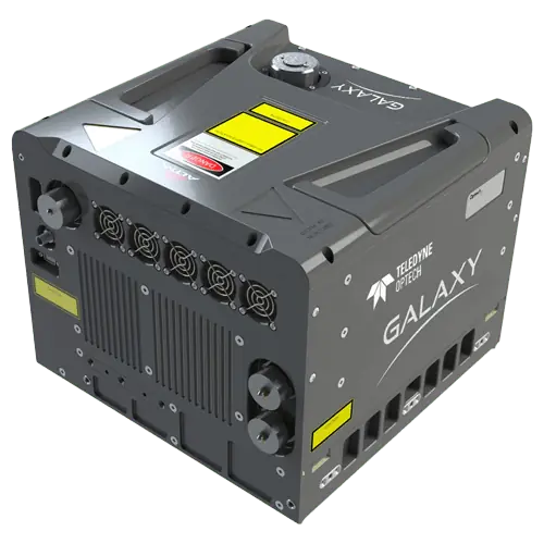
Teledyne Geospatial has confirmed it will exhibit its latest LiDAR survey and mapping hardware and software solutions at Geo Week, being held in Denver, CO, February 13-15, 2023.

Visitors are encouraged to stop by booth #721 for a first-hand look at the single-source mapping solutions and workflows available.

In addition to the smart-scanning 2 million points per second Galaxy T2000 and the density-doubling G2 Sensor System, visitors can find out more about Teledyne Geospatial’s new efficiencies in airborne mapping workflows which the company believes make the Galaxy line-up unmatched in productivity and ease of use.

Teledyne Geospatial will also be displaying Optech CLS-A, a new survey-grade UAV laser scanning payload that enables high quality surveying and inspection applications where the tight integration of a powerful, narrow beam divergence laser, high accuracy kinematic IMU, calibrated camera and powerful post-processing software that supports wide area operation at the maximum operating altitude of UAVs.

Find out more about the CZMIL SuperNova topo/bathy lidar system. Equipped with the most powerful green laser on the market, Supernova provides maximum depth penetration and superior coverage in turbid waters.

Teledyne Geospatial is joined this year by Teledyne FLIR who will showcase powerful camera systems including the newly launched Ladybug6 which delivers high quality and spatial accuracy in 360-degree spherical imaging.

Presentations by Teledyne:

  • On Feb 13, 10:45 AM – 11:00 AM in Room 708, Track 2, Malek Singer, Airborne Product Manager at Teledyne Geospatial presents Solutions Beyond the Sensor: Revolutionizing Airborne Workflow and Productivity
  • On Feb 13, 1:00 PM – 2:00 PM at the Exhibit Hall Theater catch the session On the Cutting Edge: Geospatial Advances. Malek Singer, Airborne Product Manager at Teledyne Geospatial, will present Introducing Geospatial Work, That Flows
  • On Feb 13, 4:00 PM – 5:30 PM in room 605 attend the session titled Advances in Topobathymetry and Coastal Mapping. Don Ventura, Product Manager at Teledyne Geospatial will present Hurdles and Holes: Considerations and Solutions in the Maturation of the Bathy Lidar Workflow
Posted by Caroline Rees Caroline co-founded Unmanned Systems Technology and has been at the forefront of the business ever since. With a Masters Degree in marketing Caroline has her finger on the pulse of all things unmanned and is committed to showcasing the very latest in unmanned technical innovation. Connect & Contact

Latest Articles

Most Read Articles on UST This Week

Here’s our round-up of the five most read articles on UnmannedSystemsTechnology.com this week

Jul 11, 2025
Vertiq Speed Firmware v0.1.1 Now Available with Bug Fixes

Vertiq has released firmware v0.1.1 to correct a parameter bug affecting telemetry and 3D mode settings on select G1 and G2 modules

Jul 11, 2025
The Role of ROVs in Unmanned Marine Operations

Oceanbotics has answered the most common questions about ROVs, covering how they work, where they're used, and key capabilities

Jul 11, 2025
LiveU File Transfer Speeds Up Drone Data Delivery for Critical Missions

LiveU’s File Transfer enables rapid transmission of large drone data files, reducing delays and supporting faster decision-making in public safety and infrastructure operations.

Jul 11, 2025
Exploring Differences Between M9PLUS & M9 GNSS Antennas

Discover the key upgrades in Maxtena’s new M9PLUS GNSS antenna, including improved performance, signal purity, and multipath mitigation over the original M9

Jul 11, 2025
USAF Uses Inertial Labs Drone Lidar for Tree Obstruction Survey

The US Air Force successfully used Inertial Labs drone Lidar and cloud software to quickly map tree obstructions at Joint Base Lewis-McChord (JBLM), improving airfield safety

Jul 11, 2025

Featured Content

USAF Uses Inertial Labs Drone Lidar for Tree Obstruction Survey

The US Air Force successfully used Inertial Labs drone Lidar and cloud software to quickly map tree obstructions at Joint Base Lewis-McChord (JBLM), improving airfield safety

Jul 11, 2025
New UAV to Combine Solar Hydrogen & Battery Power for Extended Flight

XSun and H3 Dynamics are developing the first UAV powered by solar, hydrogen, and batteries, aiming to deliver zero-emission, long-endurance unmanned flight

Jul 07, 2025
Enhancing Mangrove Restoration Through 3D Printed Drone Design

Explore how Inverto Earth, in collaboration with HP Additive, is using sustainable 3D printing and drone technology to drive large-scale mangrove restoration and protect vulnerable coastal ecosystems

Jul 03, 2025
Advancing Unmanned Systems Through Strategic Collaboration UST works with major OEMs to foster collaboration and increase engagement with SMEs, to accelerate innovation and drive unmanned systems capabilities forward.