FarSounder is advancing the development of unmanned and autonomous naval systems with its Argos series of 3D Forward-Looking Sonars (FLS), providing real-time awareness of the subsurface environment. Read more >>
As autonomous and minimally crewed vessels transition from experimental programs to core fleet assets, accurate underwater perception has become essential to operational reliability and integration within modern naval architectures.
Reliable situational awareness depends on networks of complementary sensors that convert environmental data into actionable intelligence. While radar, electro-optical/infrared (EO/IR), and vision-based systems deliver extensive surface coverage, the underwater domain presents persistent challenges. Navigational hazards, uncharted terrain, and limited communications bandwidth make subsurface sensing a critical factor for autonomy and mission safety.
Expanding Operational Capability
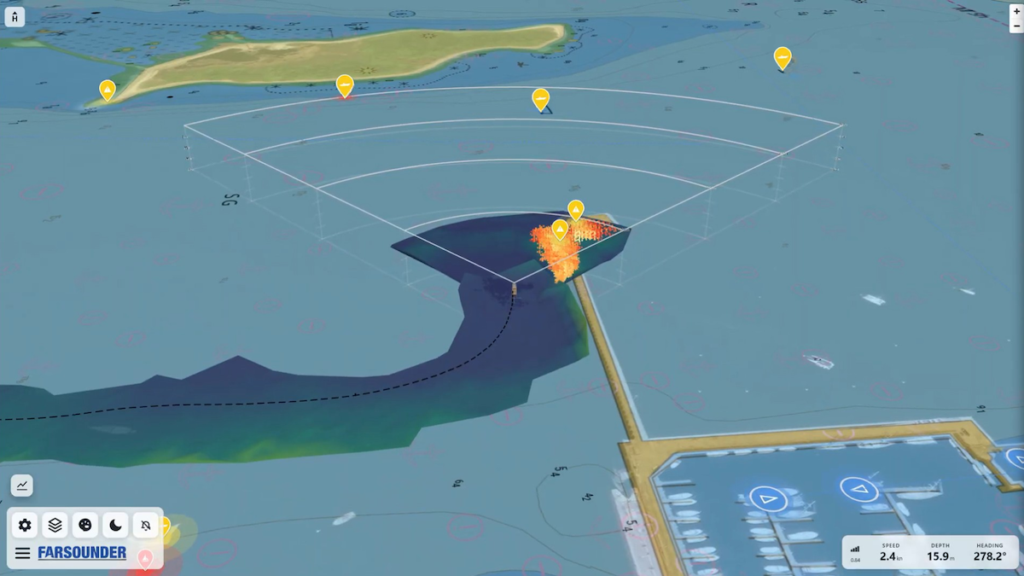
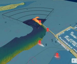
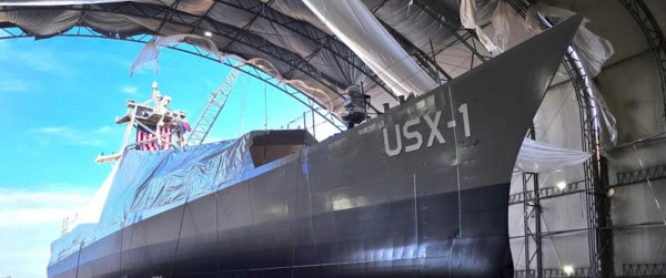
FarSounder’s Argos sonars are deployed across manned and unmanned vessels, including the DARPA NOMARS “Defiant” USV, providing a real-time, three-dimensional view of the seafloor and obstacles up to 1000 meters ahead. In addition to navigation safety, these systems generate an evolving map of the seabed that contributes to a persistent layer of environmental intelligence, shareable across connected platforms to enhance collective awareness.

DARPA’s NOMARS demonstration vessel “Defiant” Source: Serco North America
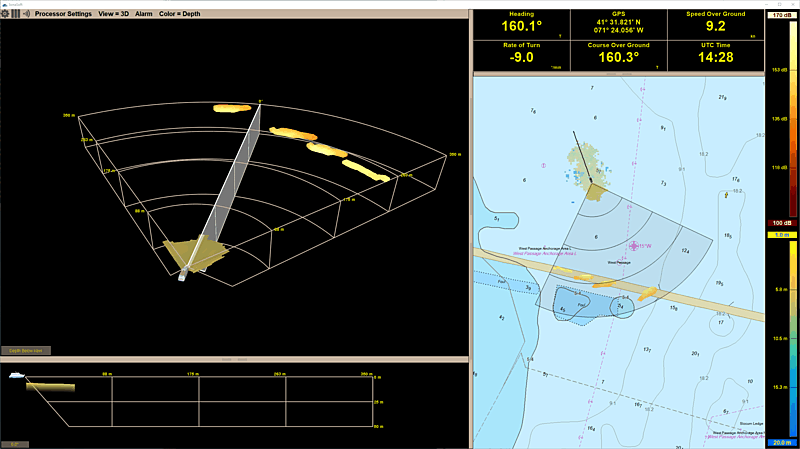
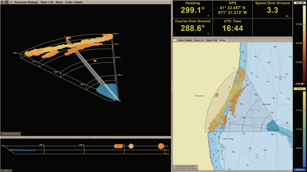
Argos 3D FLS supports the full range of operational modes, from operator-assisted missions to fully autonomous navigation. Processed sonar data is delivered via an Ethernet-based interface, providing vehicle control systems with information required for independent decision-making and real-time course adjustments. For human-in-the-loop operation, FarSounder’s display interface presents a clear, intuitive visualization of the environment ahead.
The company’s Local History Mapping™ function continuously builds and stores depth maps of all surveyed areas, allowing previously gathered bathymetric data to be recalled when a vessel revisits known locations. This information can also be securely shared across multiple vessels to support coordinated fleet activity.
Enhancing Domain Awareness
Unmanned surface vessels increasingly act as distributed sensors that extend the fleet’s situational reach. When operating ahead of or alongside crewed ships, they contribute to a layered surveillance network capable of providing early indication of underwater obstacles or potential threats. Integration of Argos 3D FLS strengthens this network by supplying real-time subsurface data, improving both navigational safety and tactical understanding.
Intelligence, Surveillance, and Reconnaissance (ISR)
For ISR missions, platforms equipped with Argos 3D FLS expand the scope of underwater intelligence available to command units. These vessels can conduct persistent patrols or area monitoring while crewed assets address higher-priority tasks, enabling concurrent mission execution. Real-time subsurface awareness enhances ISR coverage to include detection of underwater anomalies, infrastructure, and environmental changes relevant to mission objectives.
Seamless Integration Across Multi-Sensor Ecosystems
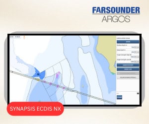
Integration flexibility is a key aspect of FarSounder’s system design. Argos sonar data can be combined with AIS, ARPA, and optical technologies such as SEA.AI, creating a consolidated operational picture. Through the SonaSoft™ software suite and accompanying Software Development Kit (SDK), sonar data can be incorporated into (W)ECDIS and other situational-awareness platforms.

Argos FLS data integrated into Anschütz SYNAPSIS (W)ECDIS NX Interface
This interoperability extends information sharing beyond the host vessel. Real-time and historical sonar data can be distributed and exchanged across command networks, providing operators and autonomous systems with a unified maritime view that supports timely, coordinated decision-making.
Operations in Uncharted Waters
Naval deployments often take place in uncharted or poorly surveyed regions where environmental uncertainty poses risks to both navigation and mission success. Equipping USVs with Argos 3D FLS enables safe reconnaissance and mapping of these areas without exposing crewed vessels to danger.
Each sonar maps the underwater environment out to at least eight times the depth below the sensor. In waters 50 meters deep, for example, a USV achieves seafloor visibility extending 400 meters ahead — significantly greater than that provided by traditional downward-facing sonar. Aggregating bathymetric data from multiple USVs allows naval commanders to build detailed terrain models and identify secure transit routes, supporting mission planning, logistics, and amphibious operations.
Supporting Mine Countermeasures
Mine Countermeasure (MCM) missions remain among the most hazardous naval tasks. Traditional towed-sensor systems provide valuable data but operate close to the seabed, introducing risk to equipment and mission continuity. A USV equipped with Argos 3D FLS can detect underwater features at navigationally significant distances, allowing remote operators or automated control systems to adjust course or towfish depth in time to prevent collision or sensor damage.
Enabling the Hybrid Fleet
As defense organizations evolve toward hybrid fleets combining manned, unmanned, and autonomous systems, reliable subsurface intelligence will be critical to operational success. FarSounder’s Argos 3D Forward-Looking Sonar contributes to this capability by delivering accurate underwater awareness that supports autonomous control, remote supervision, and fleet-wide data exchange.
Integrated within broader maritime information frameworks, the Argos series enhances navigation safety, ISR performance, and domain awareness, reinforcing the operational effectiveness of today’s increasingly autonomous naval forces.