


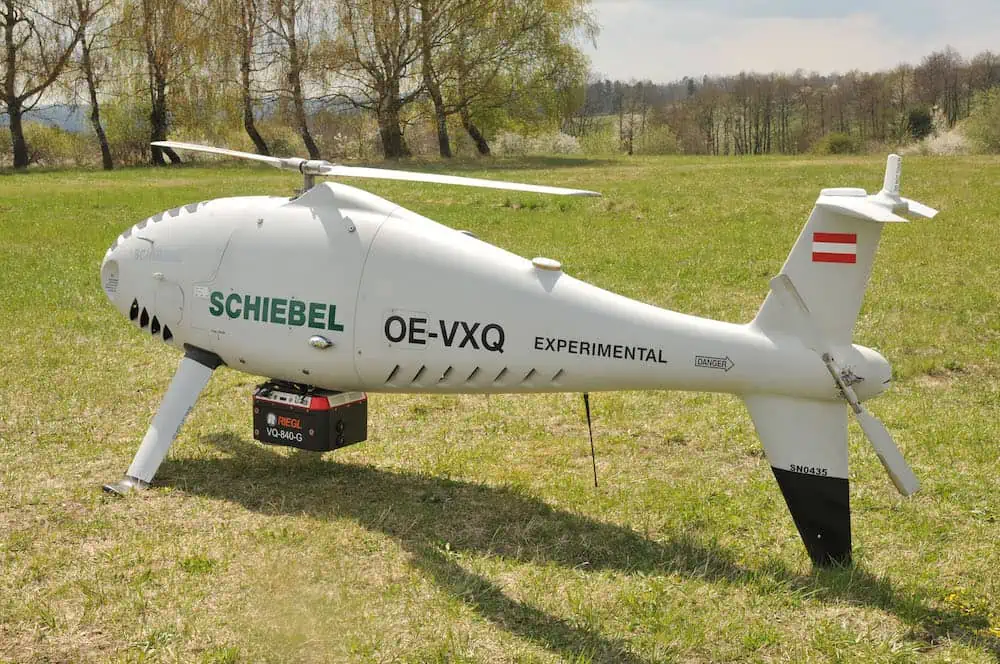
RIEGL has successfully integrated its RIEGL VQ-840-G topo-bathymetric LiDAR sensor on to the Schiebel CAMCOPTER S-100 Unmanned Aerial System (UAS).
According to the companies, operating a high-end laser scanning system remotely on a UAS requires a tailored solution going beyond what is currently available off-the-shelf. In order to maintain the broad operating range of the UAS, the weight of the sensor payload must be kept low. In addition, the effective execution of the survey mission requires full remote control of the payload instruments and real-time feedback to the operator via a data link.

RIEGL’s compact topo-bathymetric laser scanner was designed for use in a variety of maritime and hydrographic environments. The LiDAR sensor payload system is controlled remotely via a data link, which is crucial for the integration into the S100 system.
The scanner is controlled by using the onboard ‘RiACQUIRE-Embedded’ software via the available data link; data acquisition and laser safety are also monitored. Once the survey is completed, the raw data seamlessly integrates into the RIEGL data processing workflow.
The RIEGL VQ-840-G, combined with the outstanding technical specifications and performance of the CAMCOPTER S-100 UAS enables an efficient and secure way for surveying shallow waters, where monitoring from boats becomes a challenge. The applications of Airborne LiDAR Bathymetry (ALB) include the mapping of coastlines and river banks as well as the monitoring of natural habitats, water reservoirs and hydraulic engineering applications (such as canals, dams, bridges). In a single data acquisition mission, data below and above the water surface are covered.
Additionally, the topographic laser scanners RIEGL VUX-1UAV/-LR and VUX-12023 can be integrated in the front payload bay of the CAMCOPTER S-100.


