


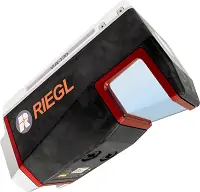
RIEGL has developed two new airborne LiDAR scanners developed specifically for use on UAVs (unmanned aerial vehicles). The new products will be presented at the company’s exhibition booth at the INTERGEO 2020 virtual trade show.
The system provides options for integrating IMU/GNSS systems and one of a variety of cameras, making it ideal for fixed-wing UAV corridor mapping. It uses an innovative NFB (Nadir/Forward/Backward) scanning pattern for optimal detection of even vertical targets such as high-voltage pylons, house facades or steep mountain slopes. The 100° wide field of view is scanned in alternating planes (strictly vertical down, +10° forward oblique, -10° backward oblique). This wide field of view enables users to fly parallel to the asset as opposed to directly over the target, significantly increasing safety for applications such as mapping of power line networks.
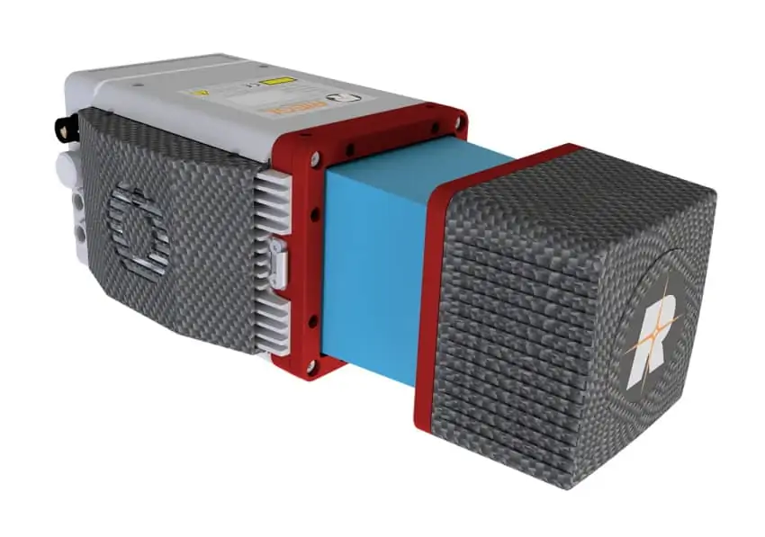
Like its sister models miniVUX-1UAV and -2UAV, the miniVUX-3UAV can be combined with various IMU/GNSS systems and camera options to optimally match the requirements of particular applications. It can also be used with RIEGL’s Integration Kit 600, a hardware extension that provides easy integration with multirotor drones.


