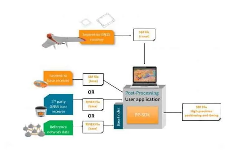
Septentrio, a developer of GNSS positioning technology for UAVs (unmanned aerial vehicles) and unmanned systems, has announced the release of a new upgrade for the company’s post-processing software. Both the GeoTagZ geotagging and GNSS data post-processing software and the PP-SDK PPK software now include the BaseFinder tool, which improves survey workflow efficiency by automatically obtaining the required reference data to augment GNSS logs for sub-centimeter accuracy.
The BaseFinder tool extracts the most suitable corrections from an online database of reference networks. The new capability is available as an app or via an API and can be incorporated into any existing software. Using this PPK functionality with drone surveys will allow high precision georeferencing without the need for a real-time base station link or ground control points (GCPs).
The software upgrade also adds support for the European Galileo and Chinese BeiDou GNSS constellations. Access to all signals from all GNSS constellations improves reference network compatibility and positioning availability in difficult environments, such as near tall structures or under foliage.
Danilo Sabbatini, Product Manager at Septentrio, said: “Surveying without a base station will allow users to reduce costs and set-up time. With this PPK upgrade we are improving the end-user experience as well as developer experience.”