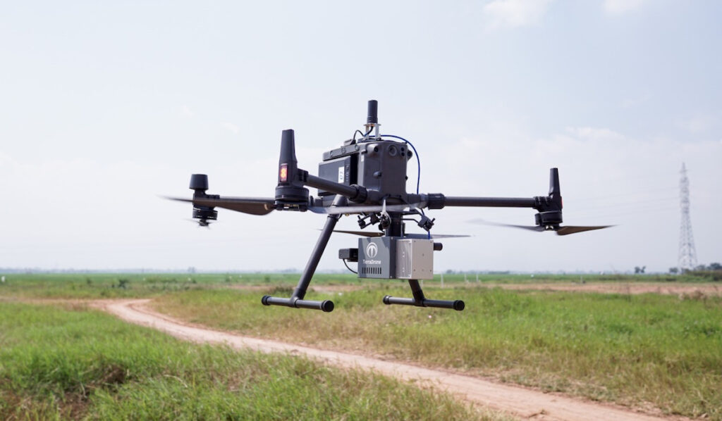
Terra Drone leveraged Trimble Applanix’s advanced DG (Direct Georeferencing) solutions, integrating the APX-15 UAV with POSPac® UAV Cloud Software, to develop the Terra LiDAR One.
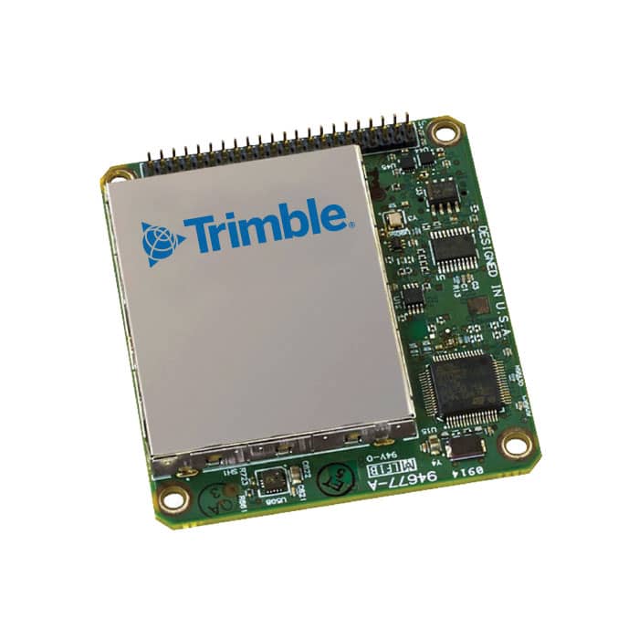
Trimble Applanix’s APX-15 UAV is a compact, low-power GNSS-inertial solution specifically designed for UAVs. Its data is processed using Applanix’s POSPac UAV Cloud post-processing software, which automatically generates the final, highest-accuracy trajectory (position and orientation) in the cloud.
The system also utilizes the POSPac LiDAR QC Tools module for automatic boresighting and trajectory adjustment based on LiDAR data.
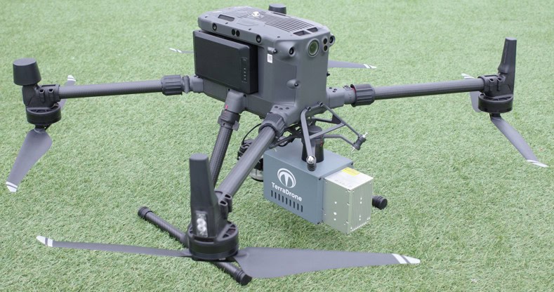
Terra LiDAR One
To provide optimal drone solutions tailored to each specific project and application, Terra Drone set out to develop a specialized payload for UAVs, incorporating a laser scanner and camera as part of its new, high-accuracy solution.

Terra LiDAR One
To ensure both accuracy and efficiency, Terra Drone required a DG solution that was both compact and lightweight enough for a UAV, yet still offered high precision and reliability, with automated processing.
Terra Drone turned to Trimble Applanix’s DG solutions for UAVs. By integrating the Trimble APX-15 UAV with Applanix POSPac UAV Cloud, the company developed a lightweight LiDAR and camera payload. This solution generates an accurate, georeferenced map of the surveyed area, ensuring that every piece of sensor data is geographically located to within centimeter-level precision.
The outcome was the Terra LiDAR One, a drone solution for high-accuracy mapping capable of operating in various environments, including areas with dense vegetation and challenging-to-reach locations. This system combines the payload, UAV, and cloud-based processing software to effortlessly generate the final map products.
Equipped with Trimble Applanix Direct Georeferencing, Terra LiDAR One is an intuitive, cost-effective, and highly accurate drone-based mapping solution designed to address the challenges posed by an aging workforce and the growing need to survey aging global infrastructure.
The Trimble APX-15 UAV, paired with POSPac UAV Cloud Software, provides a single board GNSS-Inertial Direct Georeferencing solution for UAVs, along with POSPac UAV Cloud post-processing offered as a service.
Advantages of Survey Drones
The adoption of drone technology for surveying and mapping has surged in recent years, driven by significant savings in cost and time, as well as its ease of use and convenience.
Survey drones offer the ability to quickly and easily generate high-resolution survey data, such as orthomosaic imagery, LiDAR point clouds, and detailed 3D models, for areas where data is either outdated or unavailable.
These high-accuracy maps and models are produced rapidly, even in complex or inaccessible environments. The costs associated with traditional ground or crewed aerial data collection methods are drastically reduced.